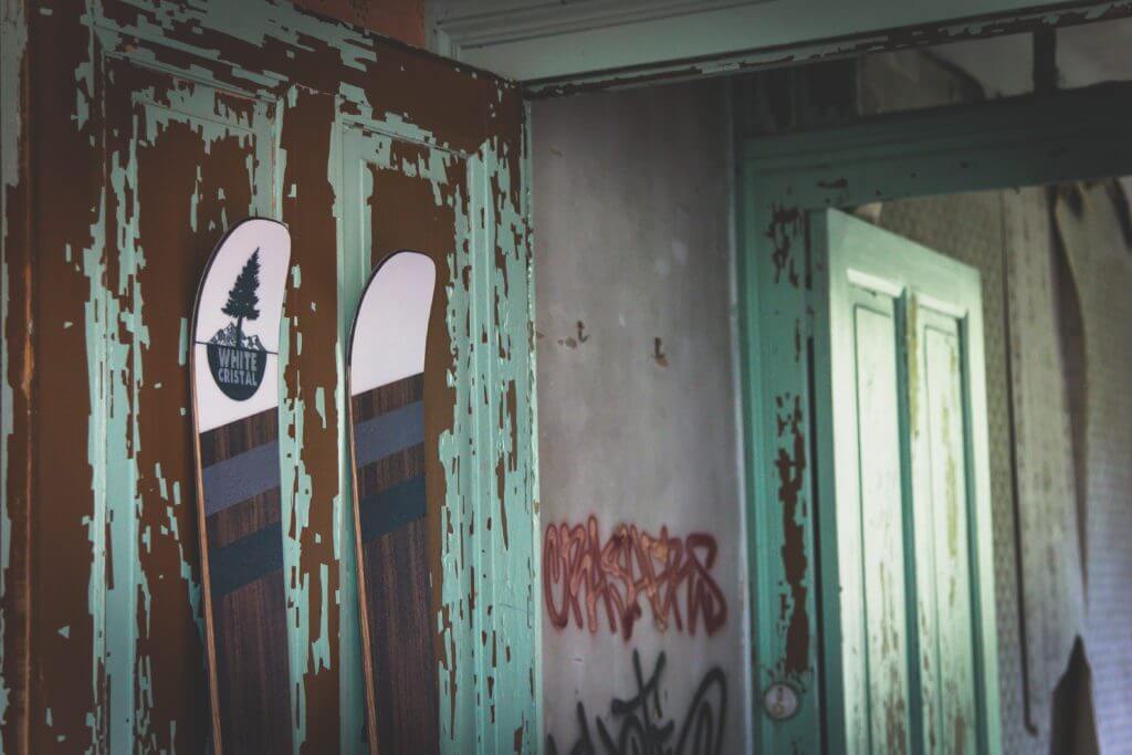
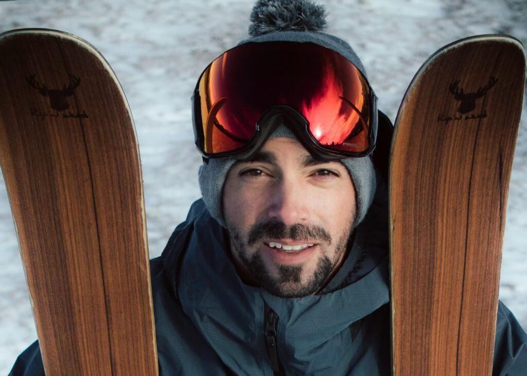
• Skip to main content
  • Skip to header left navigation
  • Skip to header right navigation
  • Skip to site footer
  • Home
    • Adventures
    • Places
    • Prophets
    • Apparatus
    • Sustainability
  • Explore
    • Your next adventure
    • Your guides
endorfeen

endorfeen

The Media For Sustainable Outdoors.

  • About us
  • Write/ share
  • endorfeen – instagram page
  • enforfeen Facebook page
  • endorfeen twitter page
  • Pinterest

Archives for March 2021

WhiteCristal Skis

March 30, 2021 by Thomas Viguier

WhiteCristal Skis

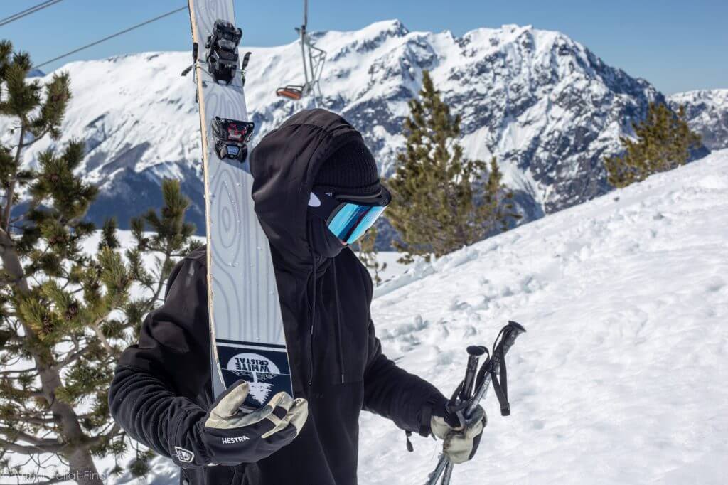
Free-ride skis designed by free-riders for the ones demanding performance

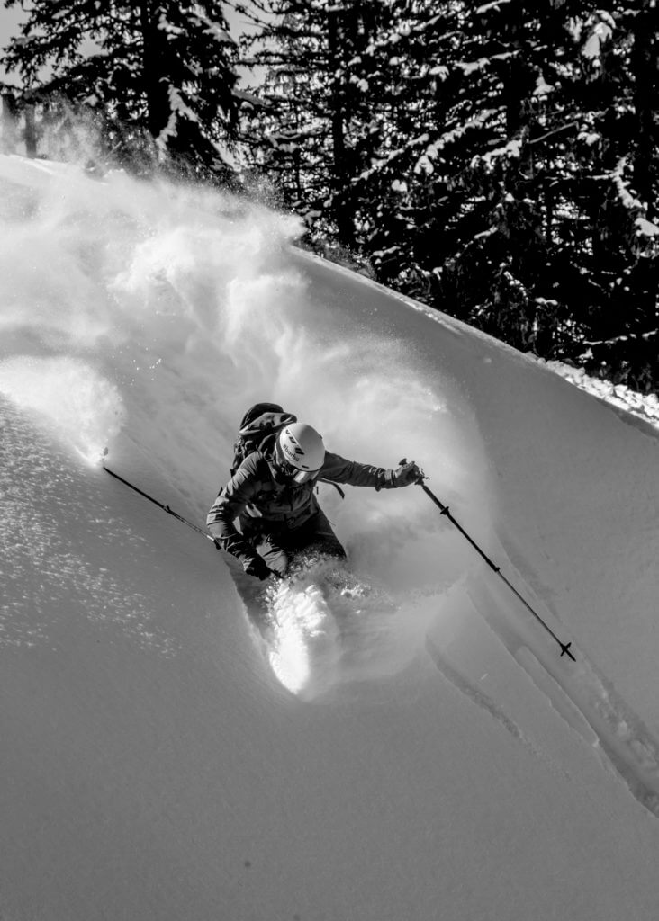
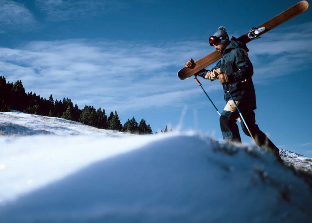
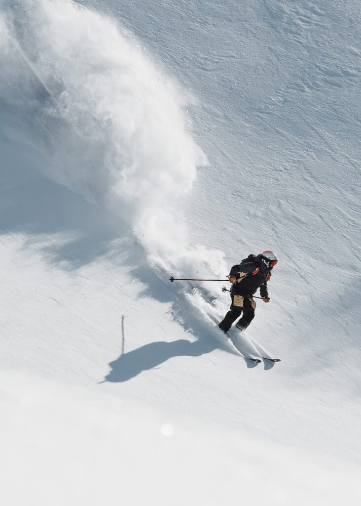
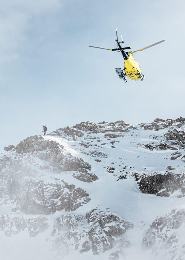
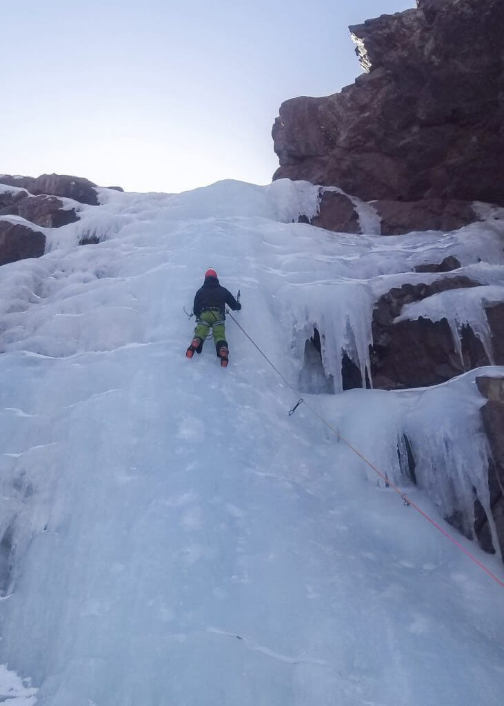
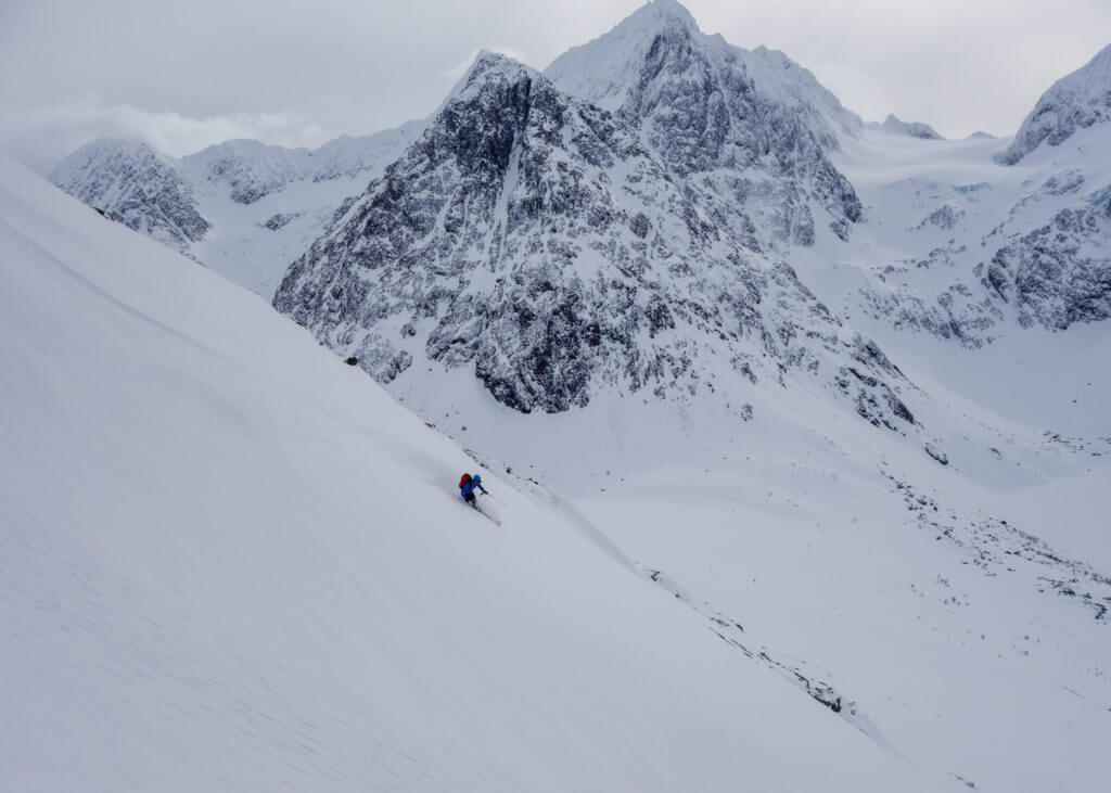
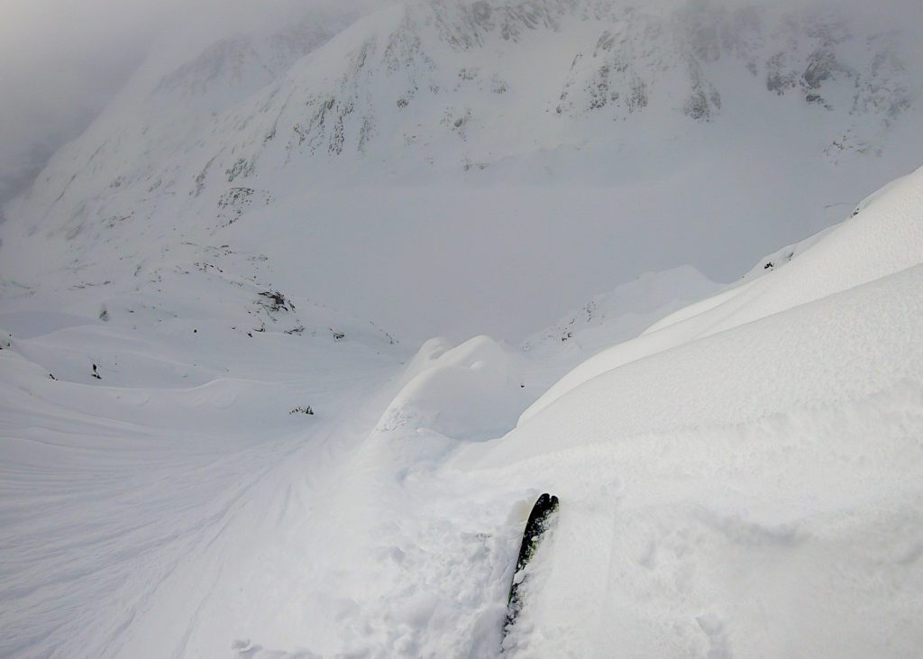
Freeride Performance

WhiteCristal Skis were born between France and Argentina. The company designs and manufactures state of the art freeride skis and splitboards for demanding riders.

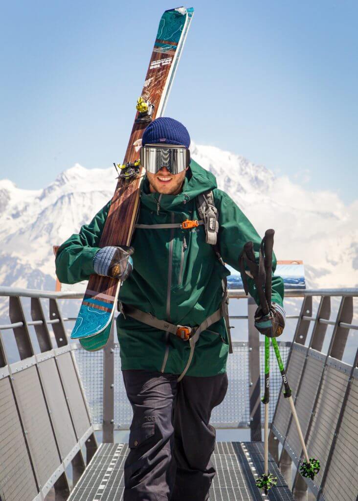
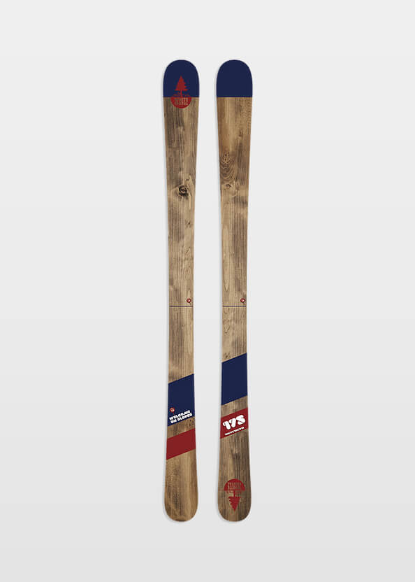
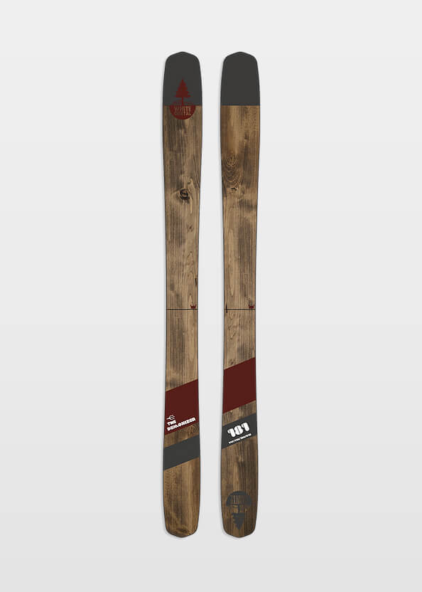
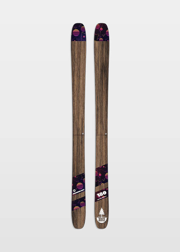
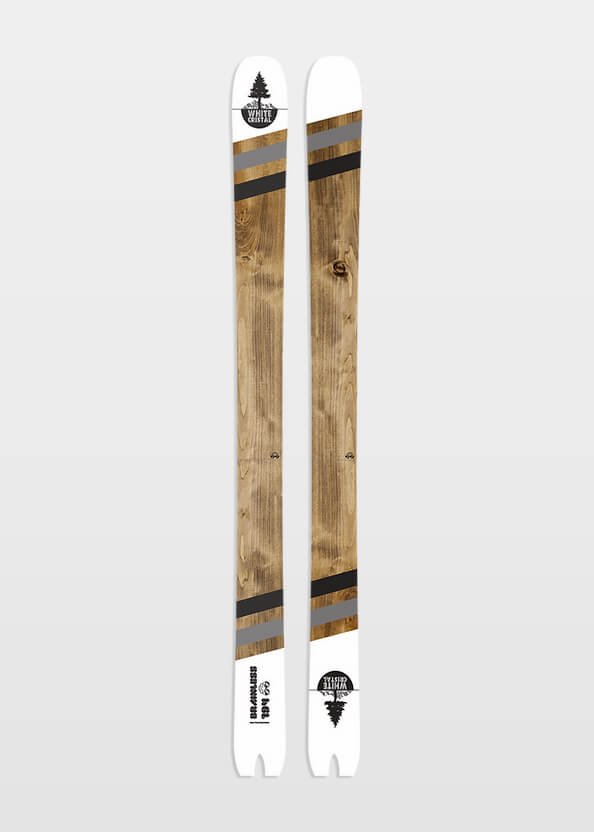
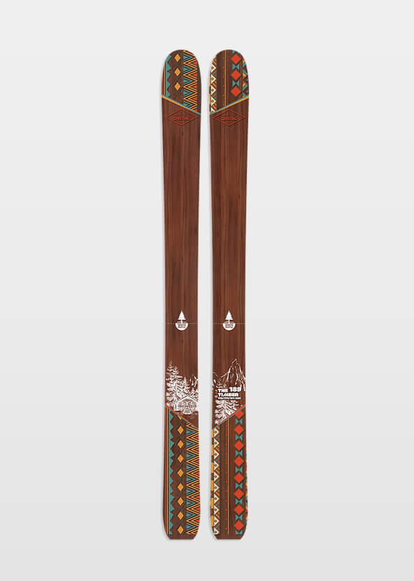
All skis can be custom made and are built using wood coming from sustainable forests.

WhiteCristal Skis’ unique freeride beasts


  • WhiteCristal - WOS
  • WhiteCristal - Brainless
  • WhiteCristal - Timber

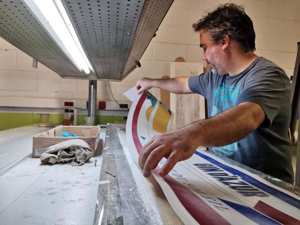
Designed in France, hand-made in Spain


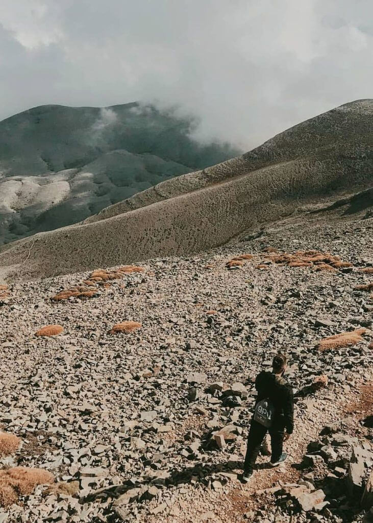
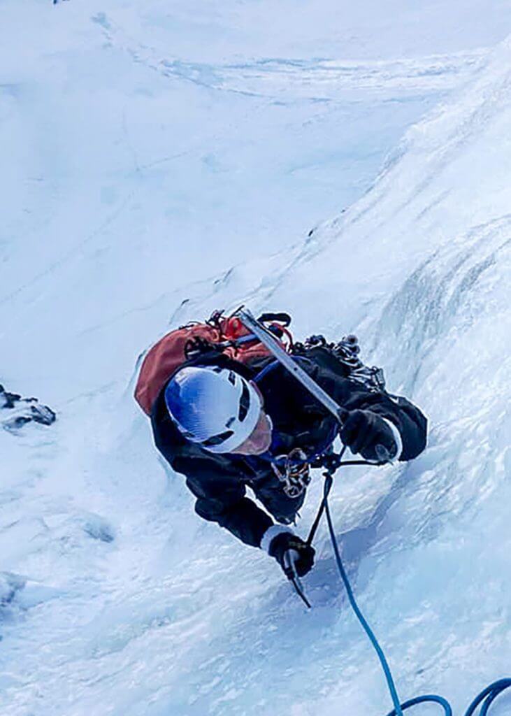
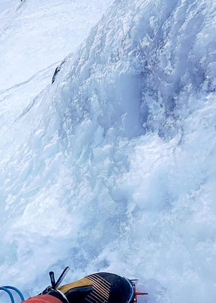
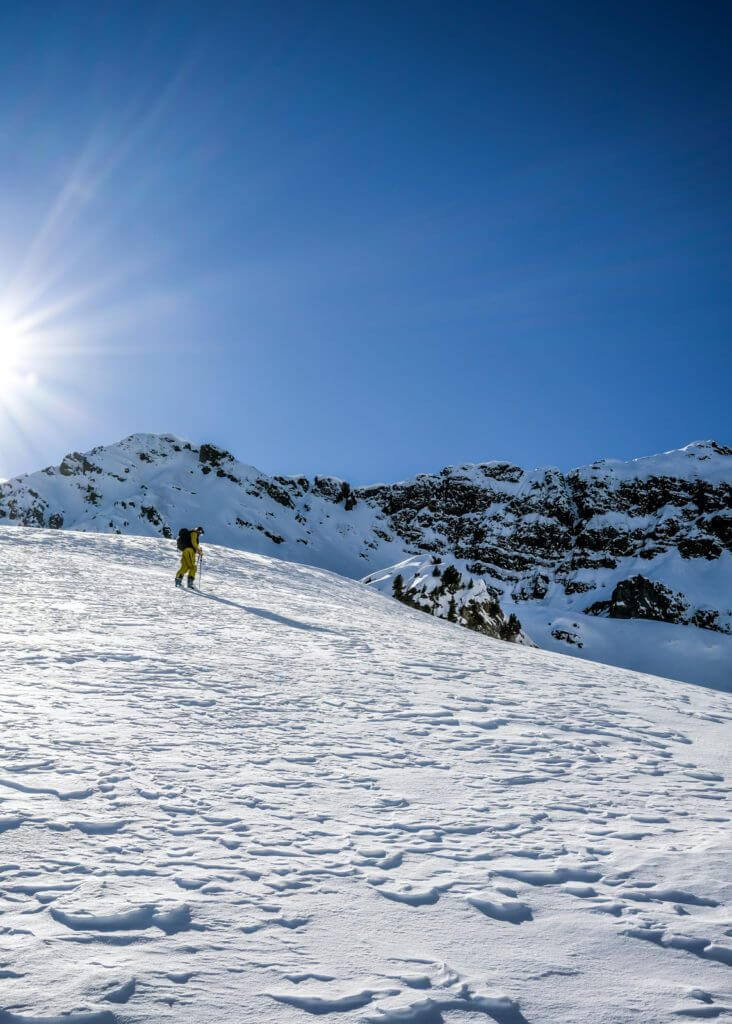
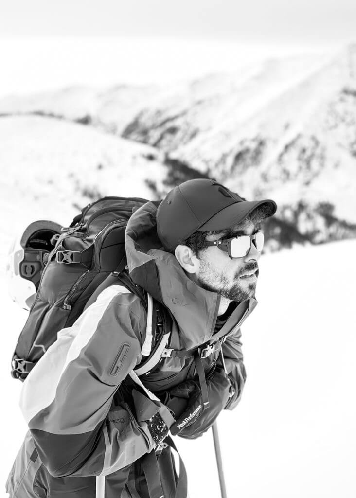
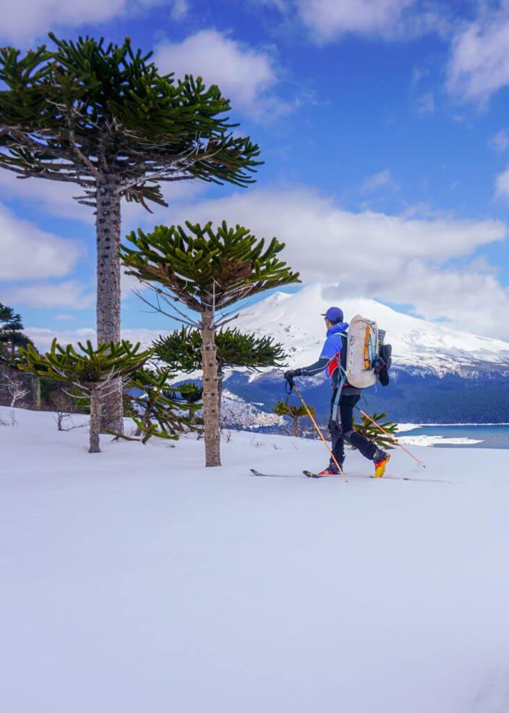
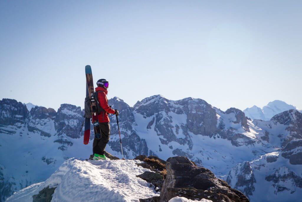
Local expertise for big adventure

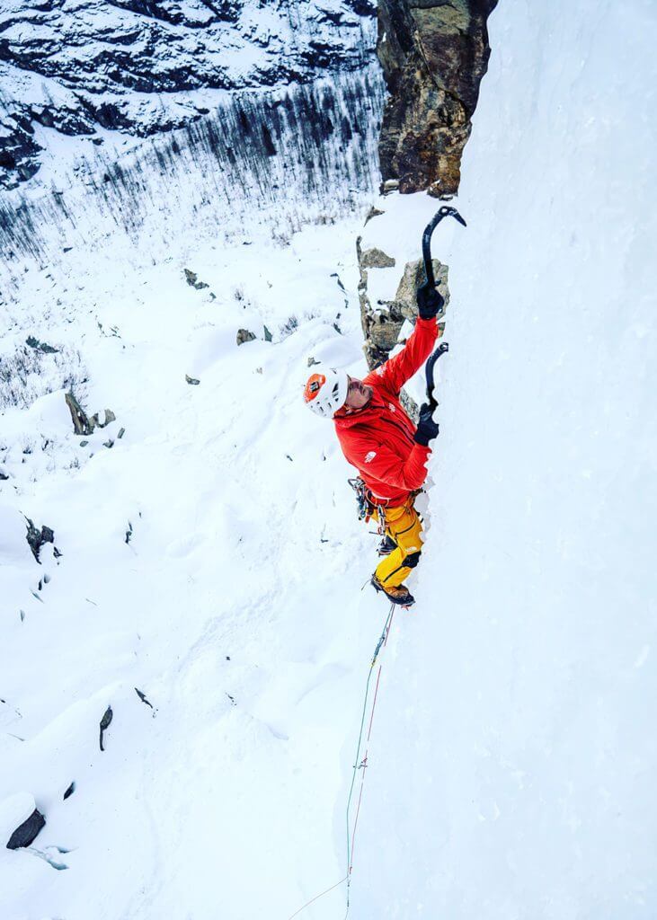
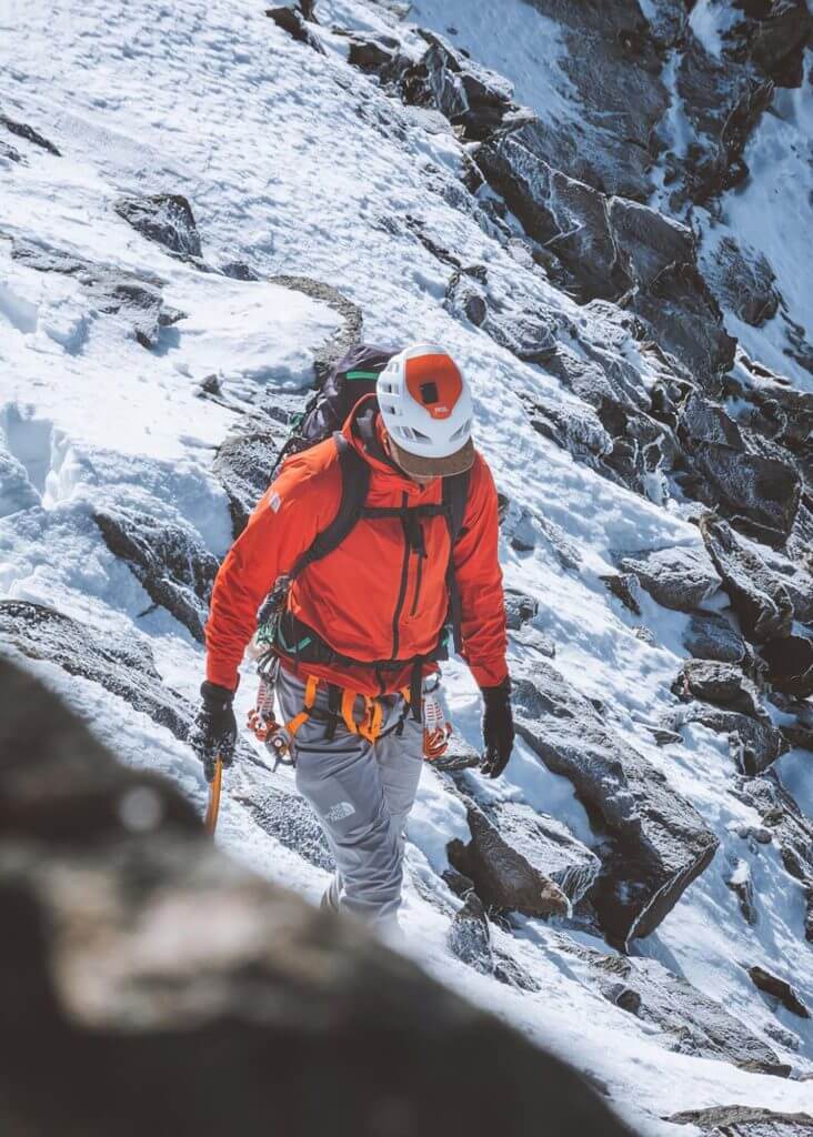
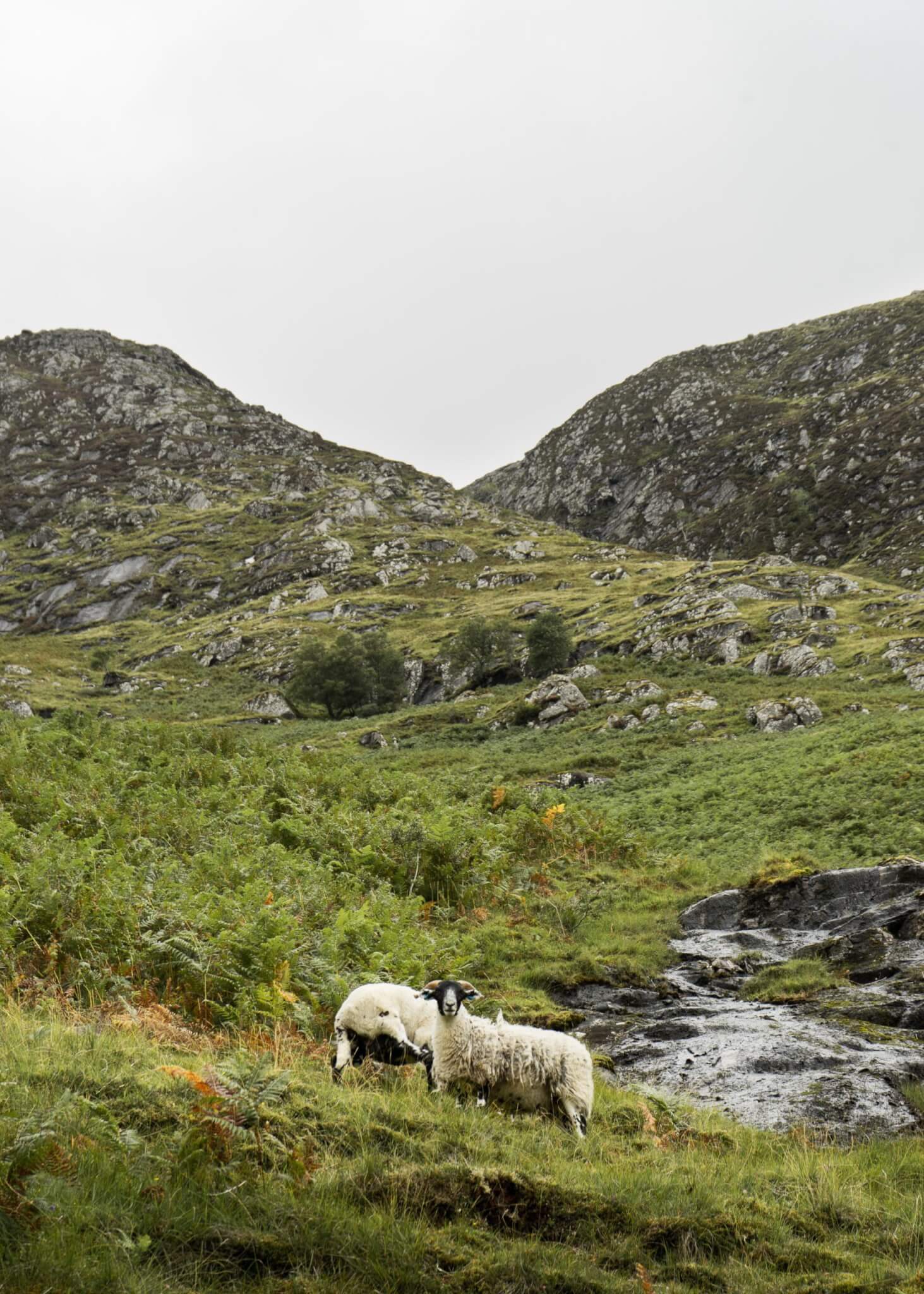
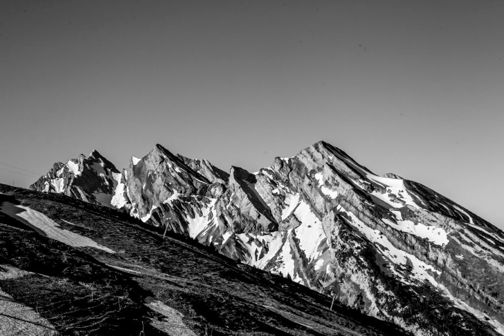
Taking its roots in the heart of the French Alps, WhiteCristal has this Adventure spirit built-in.

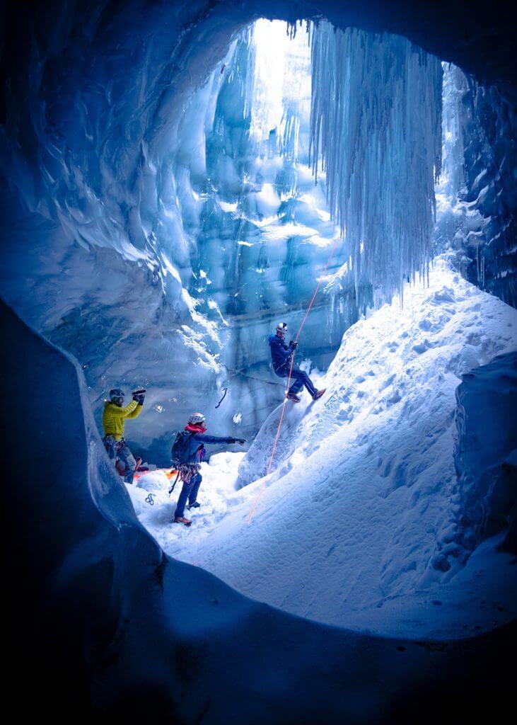
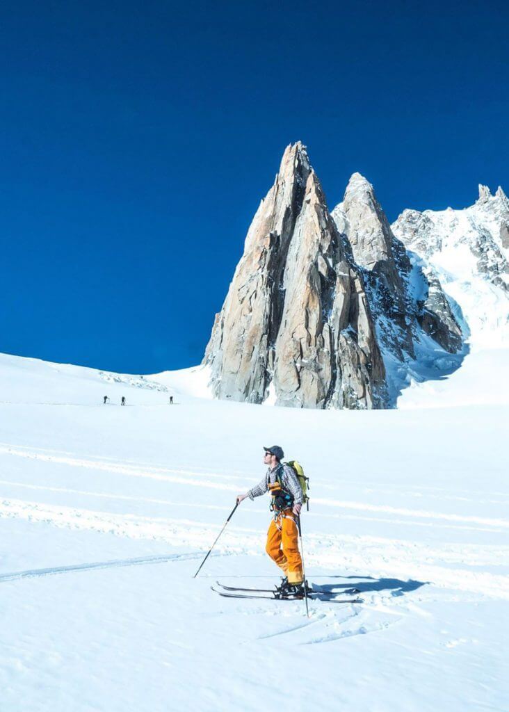
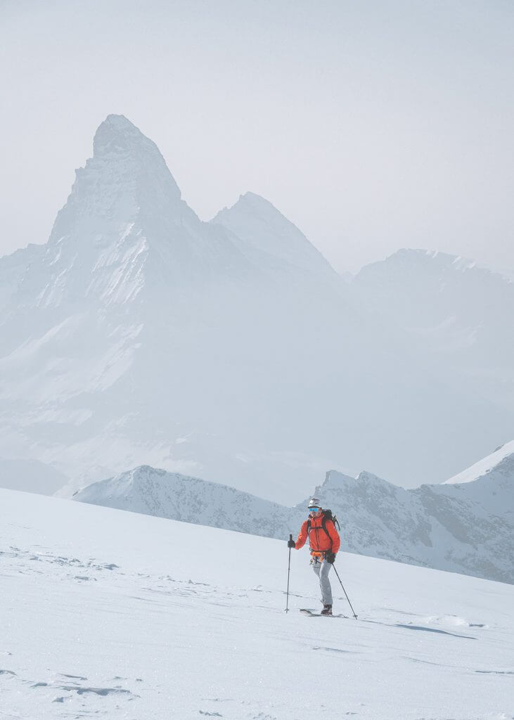
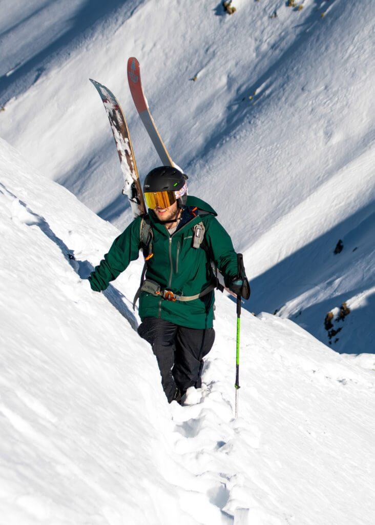
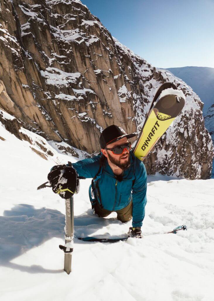
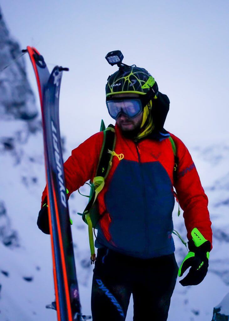
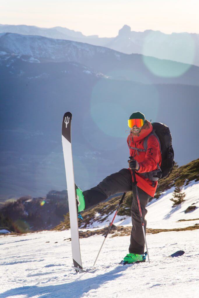
They are built for demanding riders who appreciate freedom and big mountain performance.

WhiteCristal’s souls come from the combination of Pilou Sassi’s past as a professional freerider and Pablo’s excellent wood craftsmanship.

Athletes and team

Trusted by some of the best young freeriders

WhiteCristal Skis’ history


2005 – 2006, the source

Pilou Sassi, French pro-rider skiing with Dynastar, crosses the American continent with Mamat.

They arrive in San Martin de Los Andes from Canada, where they meet two brothers, two amazing wood artisans.

They become friends and decide to put their expertise together and create their first skis.

WhiteCristal-Skis-MACQUEEN-Origins

2011, the birth of the brand

After years making skis for themselves and friends, WhiteCristal is born.

They make pure freeride and freestyle skis for demanding skiers.

From a small workshop in Argentina, the production is now based in Spain, in their factory.

Today

Victor de Haro, with the same spirit and vision, is now heading WhiteCristal.

The shaper manages the manufacturing process from the wood selection to the end and ensures extraordinary quality control.

Wood used in the making is selected from sustainable forests.

WhiteCristal-Skis-Shooting-Skis-custom

The highest mountain in Crete

March 25, 2021 by endorfeen

Wondering what the highest mountain in Crete is? The island can be the perfect combination of lazy days at the beach and outdoor actions. Mount Ida or Psiloritis can be an objective in itself. While not necessarily high for alpine standard, the ascent can be challenging.

In general, Crete is a very mountainous island and covered with six major mountain ranges that could be your next playground.

Psiloritis-@photo_peti
credits: @photo_peti
Psiloritis-highest-mountain-in-crete-@constantinos.k
credits: @constantinos.k

About mount Ida (Psiloritis), the highest mountain in Crete

Mount Ida is the highest mountain in Crete. It is 2,456m (8,058ft) high. It is also referred to as Psiloritis (in Greek: Ψηλορείτης, “the highest”), the name of the mountain range where Mount Ida is located.

The mountain dominates the Messara plain. There are several routes to make the ascension. The most interesting one and the wildest of all starts from Fourfouras, at the edge of the Amari valley.

Some of Crete’s highest mountain features are the Nida plateau and the Ruva forest in the Eastern part.

Mount Ida was once sacred. According to Greek mythology, Rhea gave birth to Zeus in one of the caves in Psiloritis. She gave him to the Naiades to protect him from his father Cronos, who used to eat his children.

The route to the summit/ hiking on Psiloritis

What to bring 

During the summer the temperature is always at least ten degrees celsius lower than sea level. It is not uncommon to need a jacket even in July, August when everyone is laying on a beach. Snow remains until the end of June, so plan your gears accordingly.

How to get to the summit of the highest mountain in Crete

The walk starts on the Nida plateau. It is the highest in Crete (average altitude of 1,400m / 4,593ft). You will take a dirt path going up going through Ideon Antron, where there is a fascinating cave. 

The European path E4 will lead you to Akolita, a lower plateau. From there, you will be able to see numerous Mitata. Shepherds used those stoned huts as protection against rain, cold or wind as well as storage for cheese and milk.

From Akolita, continue to the top, to a second couloir, right after the “tou sela digeni” mountain pass and the summit called “Mavri Korfi” (black summit). You will enjoy a particularly wild landscape and will finally have your eyes on the summit.

Once at the top, the view is breathtaking. You will be able to see the entire island: to the west, the White Mountains, to the east, the Dikti range, to the south, the Messara plain.

The descent will follow the European path E4 until Kalogrades, another plateau, right in front of Mount Kedros (1,777m / 5,830ft) where you will enjoy a fantastic view of the Paximadia islands. After this, you will take a dirt path (13km) that will lead you to Kouroutès, your final destination. 

E4 hiking trail

The European path E4 is a 10,450km (6,493mi) hiking trail that goes west to east. It starts in Spain, then goes through France, Switzerland, Germany, Austria, Hungary, Romania, Bulgaria, Greece (going through Crete), to Cyprus.

There is one large trekking or hiking route on the Greek Island of Crete, which is part of the E4 European Long Distance Path. The E4 trail covers the White Mountains (Lefki Ori), Mount Psiloritis (Mount Ida) and the Mount Dikti. The E4 Path is 320 km long.

The highest mountain ranges in Crete

Crete is a mountainous island and covered with relatively high mountains. Cretan mountains are mainly grouped into six main ranges: the Dikti range in Lassithi, the White Mountains (Lefka Ori) in Chania, the Idi (Psiloritis) range in central Crete, the Asterousia range (south), the Thrypti Range and Mount Kedros.

Dikti Range

The Dikti Range is located between Heraklion and Lassithi. The highest summit is Spathi at 2,148m (7,047ft). There are two more mountains higher than 2,000m (6,562ft).

The Lassithi plateau is the highest one in Crete. It is located in the heart of the mountain range at an altitude of 850m (2,789ft), surrounded by a series of smaller plateaus like Katharo, Limnakaro, Mari, Lapathos, Omalos, Erganos and Nisimos. A mountain hut was built on Limnakaro, from which hikers go up to Spathi.

The various gorges are the most exciting features in the area. Havgas and Kalamafka are the main ones but do not miss the small canyons like Sarakina, Adrianos, Ambelos, Roza and Kritsa.

The Dikti mountains are home to diverse flora and fauna. Olive trees, pines and carobs cover the lower parts. South-east, the Selakano forest is the largest pine forest in Crete.

credits: @manousos_ch

The White Mountains

The White Mountains or Lefka Ori cover a large part of the centre of Western Crete. They are the essential feature of the region. They take their name from the fact that snow covers them until the end of spring. In the summer, the summits appear white as rocks are mostly limestone.

The highest summit of the range is Pachnes at 2,453m (8,048ft). It is the 2nd-highest summit in Crete after Mount Ida, which is only 3m (10ft) higher.

More than 30 summits, called sori (amas), are over 2,000m (6,562ft). There are also some 50 gorges, the most famous one being Samaria.

The high plateaus in the middle of the mountains are a crucial characteristic of this range. The most popular one is the plateau of Omalos. It is a circular plain surrounded by mountains, at an altitude of 1,100m (3,609ft).

There are only a couple of routes up to the White Mountains: the road going towards Omalos and the one going towards Chora Sfakion through the plateau of Askifou.

There are also some dirt paths higher up in the mountains. The only way to have a real experience of this mountain range is by walking.

The central and southern parts of the mountain range are technically a desert. It creates a unique lunar-like landscape at 1,800m (5,906ft).

The Idi range (Psiloritis)

The chapel of Timios Stavros marks the highest summit of the island at 2,456m (8,058ft). This mountain range’s raw beauty is striking: magnificent caves, impressive kast formations, deep gorges, small plateaus, woods, little villages hanging above precipices.

Psiloritis was the sacred mountain for the Minoans. Many myths are attached or related to the peak. The education of the god, Zeus, was associated with the Ideon cave. In the past, Psiloritis was covered with dense forests.

There are many caves on Psiloritis. The two main ones, opened to the public are Sfendoni near Zoniana and Gerontospilios around Melidoni. 

Psiloritis is an immense water reservoir feeding several water sources and lakes. Among them, the Zaros lake, the Faneromeni dam and the Almiros sources in Ellinoperamata.

It is also possible to explore a few gorges like Vorizia, Zoniana, Keri, Kroussonas, Vromonero, Asites and Platania. The most beautiful one is the gorge of Gafaris in Rouvas. 

The Asterousia range

The rocks and the steep and impressive cliffs falling in the sea gives a mysterious ambience to the Asterousia range.

The Asterousia range is located in Southern Crete and separates the Messara Plain from the Libyan Sea. It is bordered by the seaside village of Tsoutsouras, to the east, and by cape Lithino, to the west.

The Asterousia range is not exceptionally high: Kofinas, the highest mountain, is 1,231m (4,039ft). However, because of the rough terrain, the canyons and the steep ravines, it is quite challenging to explore.

High temperatures, dry landscapes and low vegetation characterise the area. Goats almost immediately eat the few trees that struggle to grow on those drylands.

Thrypti Range/ Sitia mountains

The Thrypti Range (or Sitia mountains) is the fifth most extensive mountain range in Crete. It is also called Aori. The highest peak of the group of mountains is Stavromenos (1,476m / 4,843ft).

The range is located in Lasithi in eastern Crete. It stretches between Ierapetra in the southwest and Sitia in the northeast. 

A beautiful pine forest covers the entire range. Unfortunately, it has shrunk over the years due to human presence and several fires.

Near the Plateau of Thrypti start the imposing wild gorges of Ha and Mesonas. On the southern slopes of these mountains, there are some of the most scenic villages in Crete, such as the lush Orino village, and the seaside resort of Makrygialos. There are also the fantastic green gorges of Pefki, Mylonas and Orino.

Because of the rugged morphology and the ideal climatic conditions, the area of Thripti hosts several endemic species of flora such as arhontoxylo, aladania, the Cretan white anemone and the Cretan cyclamen. Lastly, the canyons’ walls, especially the unreachable Ha Gorge, shelter threatened birds of prey like the endangered bearded vulture and the golden eagle.

credits: @juergen.hoenack

Mount Kedros

The Kedros range is located in the central part of Crete, south-east of Psiloritis, by Amari. It took its name from “the cedar”. In antiquity, the mountain range was covered by a forest of cedars, which slowly disappeared because of exploitation and fires.

The mountain range is composed of 3 main mounts: Samitos (north) the smallest one (1,014m / 3,327ft), Mount Kedros (1,776m / 5,827ft) and Asiderotos (1,179m / 3,868ft) near the sea.

Mount Kedros is known for its abundant water sources (“101 sources”). Every year, at the end of the winter, numerous waterfalls appear as a result of the melting snow.

The mountain benefits from extraordinary biodiversity and belongs to the Natura 2000 network.

Frequently asked questions about Mount Ida (Psiloritis), the highest mountain in crete

Does Crete have mountains?

Crete is a Greek mountainous Greek island. It is mainly covered with mountains that can be grouped into six major mountain ranges:

  • the Dikti range in Lassithi
  • the White Mountains (Lefka Ori) in Chania
  • the Idi (Psiloritis) range in central Crete
  • the Asterousia range (south)
  • the Thrypti Range
  • Mount Kedros

How tall is Mount Ida?

Mount Ida or Psiloritis is the highest mountain in Crete. It is located in central Crete and is 2,456m (8,058ft) high.

Charley Radcliffe, the British Mountaineer

March 23, 2021 by Thomas Viguier

Charley Radcliffe is a British mountaineer based in Chamonix, France.

He did not come from a family of mountaineers. On the contrary, he discovered the mountains fairly late in life. Before he transitioned to a more outdoorsy life, Charley was an entrepreneur in London.

He lived a life-changing moment while climbing Mont-Blanc, where he understood that a pure urban life wasn’t going to make him happy. Step by step, Charley transformed his life and reinvented himself.

His learning curve is impressive.

Follow Charley Radcliffe on

Instagram

Charley Radcliffe wasn’t a mountaineer

When did you discover the world of mountaineering?

I discovered everything quite late. When I was 27, I was dating a girl who was into climbing. She mentioned that she wanted to climb Mont-Blanc, so I decided to tag along. My mountaineering journey started with this.

Did you do any mountain related sports?

I was starting with indoor climbing, but not so actively. I snowboarded in the resort through “classic” ski holidays – a few days a year but not much.

Did you climb Mont-Blanc?

Yes, I followed a 5-6 day training and climb Mont-Blanc. It was a revelation. It opened an entirely new world I didn’t know existed; it was a real life-changing moment for me.

Is it when you moved to Chamonix?

No, not quite, but I remember that I told myself, “I’m going to live here one day” after my first trip to Chamonix. At the time, I had a web agency in London, so my life was in the UK.

Did you keep a foot in the mountaineering world?

Yes, our guide on Mont-Blanc needed a website, so I offered him an exchange: a website against mountaineering lessons, so I made a few trips. It allowed me to learn the “basics” quite quickly.

Charley Radcliffe - Glacier Plaine
Charley Radcliffe by Tim Howell - Ice-Climbing
credits: Tim Howell

He became one

When did you move to Chamonix?

It had been a process. I knew I wanted to live in Chamonix but had to go through my process.

I had a startup in London. I went through the whole raising funds/ the trying to grow fast process, which means I was focused on work. But after 1.5 years of trying hard, the venture did not work out, and we had to stop.

After this, I was pretty exhausted, so I decided to take a break. I came to Chamonix, and I made a few climbing partners.

After that break, I went back to the UK and took a job, but I remember realising that this life wasn’t for me anymore. I had that ambition to “make some money” and then come and live in Chamonix. That dream was actually already possible, with less.

Quite quickly, I took my leap of faith. I quit my job in May 2014 and came to Chamonix “for a season”. I, then, stayed for another one, then another one, until now (laugh).

What did you do when you got to Chamonix?

Well, it was another “adjustment”/ “change” process. First, I passed the qualification to become a personal trainer. It was a way for me to work with athletes and guides in town.

At the same time, I had started to work a little with the North Face and they offered me a job as a community manager.

The trick in Chamonix is that you need to have three or four jobs AND you need to have enough time to spend in the mountains; at least that is my objective – I wouldn’t be here if I couldn’t be out there often. I also with the application Fatmap.

In parallel to all of that, I work in production management for films. It means that when people want to come to the area and shoot a movie, I help them with all the logistical aspects.

Charley Radcliffe - Ski
Charley Radcliffe by Jordan Manoukian - Rimpfishorn
credits: Jordan Manoukian

The “Charley Radcliffe” learning recipe

How did you learn how to be autonomous in the mountains?

When I arrived in Chamonix, I became a “Yes” man. I was up for everything and eager to learn and learn fast.
I tried to meet as many people as I could. It was a matter of being present.

To give you an example. I was running an event, and Liv Sansoz came along; we talked a little about her current project of climbing all the 4,000m in the Alps. I got the chance to connect with her there.

The next day, after that event, I received a text message from her saying, “do you want to ski Mont-Blanc with me?”. You don’t understand – she is an icon to me (smile)!

Thanks to this event, I had the chance to spend two days with Liv in the mountains. I learnt so much from this; it was incredible.

In the end, learning in alpinism is really about how you build relationships with people. It’s not just about doing scary and dangerous things.

How did you learn skiing?

I “properly” learnt how to ski following a bet with a friend. The goal was to ski 100 days in the season. The one who loses pays for dinner. I had never skied that much in my entire life (laugh)!

I managed to do it and realised one thing. Learning is also about volume. People couldn’t believe how much I had improved between day 1 and day 100. When you put this into perspective, it would take an average person, going to the mountains one week a year, 14 years to ski 100 days!

I essentially did 14 years worth of skiing in one season!

Any other tips?

In addition to people and volume, there is also consistency.

For instance, with a friend, I climbed Matterhorn in 7.5 hours, which was a huge step for me. It was all the result of consistent training and work over the summer. I knew exactly when to drink, when to eat, or what layers to wear etc.

Charley Radcliffe by Jordan Manoukian - Rimpfishorn 2
credits: Jordan Manoukian

Next steps

Do you have any personal projects?

Yes, I would like to climb the 82 4,000 of the Alps.

Anything else?

I would like to become a mountain guide in Chamonix, with the aim of going to the ENSA. I hope to start this whole process next year.

Becoming a mountain guide would be a huge accomplishment for me.

Other than that, I’d love to go to Nepal and be able to climb summits in a “single push”. I quite like that mountaineering style of being fast in the mountains.

How do you find Chamonix?

Chamonix has a collegiate and friendly spirit. People may say it’s quite competitive (and it can be from time to time), people are generally benevolent.

It took a long time to integrate, create a group of friends, a network. Once you are in, it’s very much about sharing moments and insights. It’s like a big international family.

What do your friends from your “previous” life think?

First, nobody followed me (laugh). Everybody is in London. They are happy for me. They can see that I found my way.

Ben Nevis, the roof of the UK

March 18, 2021 by endorfeen

At 3,239m (10,627ft), the highest mountain in the UK is, officially, Mount Hope in the British Antarctic Territory. That said, we will focus our attention on mountains that are on the mainland. You will quickly realise (if you did not know this already) that most of the UK’s highest peaks are located in Scotland (192 of the highest 200 mountains in the UK can be found in Scotland).

At 1,345m (4,409ft), the highest mountain in the United Kingdom is Ben Nevis. It is not high for alpine standards but can be a reasonably challenging summit to ascend, so as some of its neighbouring peaks.

Ben Nevis - Highest Mountain in the UK - liam-riby-F6I3xUuIViA-unsplash
credits: Liam Riby

What Is the Highest Mountain in the UK?

Ben Nevis is the highest mountain in the United Kingdom. At 1,344m (4,409ft), it is also the highest Munro. A Munro is a mountain in Scotland that’s at least 3,000ft tall or 914m – there’s 277 of them in all. Ben Nevis is most precisely located in the Grampian Mountain Range and attract some 150,000 visitors every year.

Although Scotland is such a mountainous country, nine of the top peaks are concentrated within two regions – Fort William and the Cairngorm National Park. The tenth highest peak, Ben Lawers, falls just south of the Cairngorm National Park and is, therefore, the highest mountain in the southern part of the Highlands.

The ascent starts at sea level. There are two main routes to the summit. An “easy” one on the south-western face, which uses an artificial path. A more technical way goes through the rocky north-western face, which is recommended for more advanced mountaineers.

Climbing the highest mountain in the UK will give you a gratifying feeling. Even if the summit or part of the climb can be cloudy, you will never forget the breathtaking views of the valleys, the lakes and neighbouring towns.

Some recommendations

When to go?

For beginners, it is strongly recommended to attempt the ascent during the summer months. The temperature will substantially fall as you climb. It will be close to 0 degrees at the summit, even if you had warm conditions at the base. Even in the middle of the summer, it is highly likely that you will have snow at the top.

During winter, you may find extreme cold temperatures at the summit. Even if you are not scared of a little snow, it can quickly become a danger. Snow makes it harder to see the path. You could get lost and walk into some hidden risks.

Finally, attempting the climb in the summer means other people will likely surround you. It will make the walk much safer (harder to get lost). You should always check the weather forecasts before you go to ensure excellent visibility once you reach the summit.

What sort of equipment?

You will most likely get some rain and find cold temperatures. Your equipment for the ascent should allow you to face those weather conditions.

First, take appropriate clothing: good walking shoes, windproof and waterproof jacket, and pants are the strict minima. You should also pack suitable gloves, a cap, and functional layers to keep you warm (use layering for more efficiency), as the temperature at the summit won’t be higher than 2 degrees.

Second, pack enough water and food for the hike. Dehydration can happen quickly. You pass by some small rivers and water sources, but it is not recommended to drink from those because of the sheep pasturing in the surroundings.

Finally, grab a map with the exact itinerary as well as a compass. They could become handy if you get lost.

General recommendations for the climb

Ben Nevis is close to the city of Fort William. It is accessible by road from Glasgow (65km / 40mi) or from Inverness (40km / 25mi). Fort William is also easily accessible by rail.

Ben Nevis - highest mountain in the UK - climbing 1
credits: mckeevermountainguiding
Ben Nevis - highest mountain in the UK - climbing 2
credits: mckeevermountainguiding

The main routes to the summit

The botanist James Robertson was the first to ascent Ben Nevis on August 17, 1771. Robertson wrote just three sentences on his expedition: “I ascended Ben Nevis which is reckoned the highest mountain in Britain. A third part of the hill towards the top is entirely naked, resembling a heap of stones thrown together confusedly. The summit far overtops the surrounding hills.”

The Mountain Track

The Mountain Track to the summit (also known as the Ben Path, the Pony Track or the Tourist Route) remains the simplest and most popular route of ascent. It begins at Achintee on the east side of Glen Nevis about 2 km (1.5 miles) from Fort William town centre, at around 20 metres above sea level.

The track climbs steeply via several small zig-zags to the saddle by Lochan Meall an T-Suidhe (known as the halfway lochan) at 570m, then ascends the remaining 700 metres up the stony west flank of Ben Nevis in a series of larger but less steep, zig-zags that criss-cross the face of the mountain’s western side.

The walk is 16.6km (10.3mi) and will roughly 6 hours.

Carn Mor Dearg Arête route

The Scramble over the Carn Mor Dearg Arete is one of the classic mountain walks. It’s not a route for hill walking novices. You’ll need a serious hill walking experience to complete this safely.

Carn Mor Dearg may be one of Britain’s highest mountains, but Ben Nevis completely overshadows it. It is the perfect viewpoint from which to admire the Ben’s magnificent North Face. Its graceful peak crowns a beautiful ridge – joined to its great neighbour by the famous Carn Mor Dearg arete.

All good mountains should have a proper ridge. Ben Nevis is no exception to this rule and is home to several excellent ridge routes; Carn Mor Dearg Arête is one of the most famous ones. British mountaineers so well know that it is often abbreviated to just the ‘CMD Arête’ or sometimes simply “The Ridge”. The route that traverses its knife-edge crest between The Ben and its smaller neighbour Carn Mor Dearg is one of Britain’s classic mountain routes,

The climb starts from Torlundy “North Face” Car Park. It is roughly 19km long and will take you around 8-9 hours. The Carn Mor Dearg Arete is somewhat exposed but not technically challenging, provided you have a good head for heights.

The next top 5 highest mountains in the UK

Only summits with a prominence above 600 m (1,969 ft) are listed below.

Ben Macdui

Location: Scotland
Elevation: 1,309m / 4,320ft
Prominence: 950m / 3,135ft

At 1,309m, Ben Macdui is the second-highest mountain in the UK, after Ben Nevis. It is located in Cairngorms National Park. Ben Macdui lies on the southern edge of the Cairn Gorm plateau, on the boundary between Aberdeenshire and Banffshire’s historic counties (currently on the border between the Aberdeenshire and Moray council areas).

Braeriach

Location: Scotland
Elevation: 1,296m / 4,277ft
Prominence: 461m / 1,521ft

At 1,296m (4,227ft), Braeriach is the third-highest peak in the UK, after Ben Nevis and Ben Macdhui. It is the highest summit in the Cairngorms National Park. It has a crescent-shaped summit.

Ben Lawers

Location: Scotland
Elevation: 1,214m / 4,006ft
Prominence: 915m / 3,020ft

Ben Lawers is the highest mountain in the central highlands, at 1,214m / 4,006ft. It is the 10th highest Munro. It has the most celebrated collection of rare arctic-alpine plants in Britain and over 600 different types of lichen.

Carn Eige

Location: Scotland
Elevation: 1,183m / 3,904ft
Prominence: 1,147m / 3,785fr

Carn Eige is located in the north of Scotland. At an elevation of 1,183 metres (3,881 ft), it is the highest mountain in northern Scotland (north of the Great Glen), the twelfth-highest summit above sea level in the British Isles. In terms of relative height (topographic prominence), it is the second-tallest mountain in the British Isles after Ben Nevis.

Ben More

Location: Scotland
Elevation: 1,174m / 3,874ft
Prominence: 986m / 3,254ft

Ben More is a mountain in the Southern Highlands of Scotland, near Crianlarich. It is the highest of the so-called Crianlarich Hills to the south-east of the village, and there is no higher land in the British Isles south of Ben More.

Frequently asked questions while searching for the highest mountain in the UK:

What is the highest mountain in the UK called?

Ben Nevis is the highest mountain in the UK, on the mainland. It is located in Scotland and has an altitude of 1,344m (4,409ft).

Generally, Mount Hope, in the British Antarctic Territory, is considered to be the highest mountain in the UK, with an altitude of 3,239m (10,627ft).

Which is higher, Snowdon or Ben Nevis?

At 1,344m (4,409ft), Ben Nevis is higher than Snowdon. At 1,085m, Snowdon is the highest mountain in Wales.

Victor de Haro, the skier behind WhiteCristal Skis

March 16, 2021 by Thomas Viguier

Victor De Haro is the General Manager of WhiteCristal Skis, but he is first and foremost a French free-skiers whose love for the sport has driven his entire life.

Immersed in a free-ride culture very young, he also showed a strong entrepreneurial mindset when, in 2019, he took over the management of WhiteCristal Skis, one of the underground free-ride ski brands nested in the French Alps.

If you are wondering how you end up leading a ski brand, read up.

Follow Victor de Haro on

Instagram | WhiteCristal Skis

Victor de Haro’s background as a free-skiers

Can you give us a quick introduction? What’s your background as a skier?

I was born in Montélimar, France. I started skiing very young. Luckily, my uncle, who loved skiing, took me with him and showed me everything when I was around 12.

My second passion is photography. I’m particularly drawn by technique and film photography.

Fifteen years ago, my family moved around St Etienne. It was when I realised I didn’t have an academic mindset. Let’s put it this way – I wasn’t the first in the class (laugh).

Around that time, I met Thomas, who has become one of my best friends. He skied and skis exceptionally well. His parents had a truck, so we were travelling in their van around the mountains, skiing a lot!

While in high school, I got interested in video. In parallel to high school, I decided to go and study video making at a school in Lyon, FR. It also meant I was skiing every weekend.

Around 2012, we formed “Crew-Ton”. It’s essentially a group of friends, free-riders, including Thomas, Luc, Margerie (former Freeride champion). We were all very close to that brand WhiteCristal and seeing Pilou as some sort of a mentor.

How did you get acquainted with WhiteCristal skis, which is now the brand you run?

In 2013, I met Pilou. He was the original creator of WhiteCristal Skis. He was much older than us and a true ski legend.

I was looking for some sponsorship, so the first thing I did was get in touch with Pilou. It didn’t go as smoothly as I had planned (laugh). After insisting a bit, he said yes.

Victor de Haro - WhiteCristal 4
Victor de Haro - WhiteCristal 3

How his relationship with WhiteCristal evolved over time

How did you end up running the show?

In 2019, Pilou called me and said that he wanted to stop WhiteCristal and asked me if I was interested in taking over.

I said, yes!

What is the spirit of the brand?

Now, WhiteCristal is a freeride ski brand that is run by skiers for skiers. We don’t carry many types of skis. We only have four, and we make custom ones too. It’s relatively “niche” in some way; we target people who know what they want.

What’s the story behind WhiteCristal?

It started when Pilou was skiing for another ski brand. He went for a project in Canada and had the idea to go down to Chili. When he arrived in Argentina, he had broken all the skis he had.

There, he met two brothers. Their father had a workshop where they could fix their skis. That is the period when he got the idea to make some.

Back in France, they started WhiteCristal. They were designing everything in France, and the skis were manufactured in Argentina, in Bariloche.

At some point, one of the two Argentinians wanted to stop making skis. Seizing the opportunity, the other one decided to come to Europe and continue the production. He created a new workshop in Sierra Nevada, in Spain.

Victor de Haro - WhiteCristal 1
Victor de Haro - WhiteCristal 2

The highest mountain in New Zealand and others prone to adventure

March 11, 2021 by Thomas Viguier

The highest mountain in New Zealand is Mount Cook. It rises 3,724m (12,218 feet) above the sea. While it is not extremely high it is not an easy summit.

It’s generally easy to only focus on the highest mountain; New Zealand has much more to offer. From easy beach walks to technical climbs or 60-day treks, the country is truly a land of adventure and will please both beginners and more advanced mountaineers.

credits: @andrewlewthwaite
credits: @jamessyoung

Mount Cook, the highest mountain in New Zealand

Not so high, but not so easy

Mount Cook is the highest mountain in New Zealand. Located in the Southern Alps, it belongs to the mountain range extending along much of New Zealand’s South Island length. The Southern Alps reach its greatest heights near the range’s western side.

The Aoraki/Mount Cook national park (700km2) offers an exceptional setting to discover the country’s nature.

Mount Cook or Aoraki is 3,724 meters (12,218 feet), following 2014 measurements by researchers from the University of Otago. Analysis of high accuracy GPS data obtained during the Otago-led climbing expedition in November 2013 revealed that it is actually 3,724m tall at its highest point (and not 3,754m).

Latest 1991 readings (estimated from aerial photography) were made immediately following a massive rock-ice collapse. The relatively thick remaining ice cap, at the top, had been subject to erosion.

While Mount Cook/ Aoraki is a relatively low summit, it is a technical climb often underestimated by amateur mountaineers. There are no “non-technical” routes. It is a serious undertaking. It would be best if you did not attempt this climb without good glacier travel skills, crevasse rescue, protective systems, steep snow climbing, and ice climbing. The weather is also fairly unstable.

Let’s not forget that the highest mountain in New Zealand was Sir Edmund Hillary’s training ground. While he became notoriously famous for his first ascent of Mount Everest in 1953. In 1948, the ascent of Mount Cook’s difficult south ridge was one of Hillary’s first great mountaineering achievements.

Routes to the summit of the highest mountain in New Zealand

It is regarded as more difficult than Liberty Ridge on Mount Rainier and is similar in length and difficulty to Aguille Verte in Chamonix (France) and Mount Huntington in Alaska.

The highest mountain in New Zealand is an impressive peak with five sides, six faces and seven main ridges. It was first summited on Christmas Day, in 1894, by Tom Fyfe, Jack Clarke and George Graham.

Emmeline Freda Du Faur, the Australian mountaineer, was the first woman to ascent Mount Cook, in December 1910. 

There are multiple routes to the summit (more than 40 different ones). Technically, the Linda Glacier is considered to be the easiest route. It is an arduous and of average difficulty climb but fairly exposed to ice falls. It was first opened by Hugh Chambers, Jack Clarke, Jim Murphy and Hugh Wright in February 1912. 

The first part of the ascent is relatively low-angled, while the last 50-100m is pitched-climbing with a 40-50° ice up to the base of the summit rocks.

If you are a more experienced mountaineer, you may want to consider other itineraries like Zurbriggins Ridge, the East Ridge, and a Grand Traverse across Low Peak, Middle Peak, and High Peak.

Aoraki-the-Maori-legend-of-the-highest-mountain-in-New-Zealand-@carmenhuter
credits: @carmenhuter

The Maori legend of the highest mountain in New Zealand

Mount Cook draws its name from James Cook, the first European explorer to claim the discovery of New Zealand. It also has another name: Aoraki, from the Maori “cloud in the sky”.

According to the legend, Aoraki was one of the three sons of the creator. 

One day, they went on earth but did not manage to return to the sky and changed into rocks. The oldest of the brothers, Aoraki, naturally became the highest mountain. 

Other noticeable peaks after the highest mountain in New Zealand

Most mountains are easily accessible from major tourist areas such as Wanaka, Taupo, Tekapo and Queenstown, so it’s never too difficult/ too far to go and see one of those beautiful mountains.

Mount Taranaki

Mount Egmont or Mount Taranaki (Maori) is an active canonical volcano (or stratovolcano). Due to its perfect cone shape, it is very often compared to Mount Fuji (Japan). The movie “The Last Samurai” with Tom Cruise was shot there. The last eruption was in 1854. 

The 2,518m high mount is on the west coast of New Zealand’s North Island, near New Plymouth, facing the Tasmanian sea.

Mount Taranaki and Egmont national park represent the perfect playground for hikers. Like in most of New Zealand, you will be able to find numerous trails and hikes in this area (more than 300km of walking tracks surrounding the mountain).

Mount Tasman

Mount Tasma is the second highest mountain in New Zealand, after Mount Cook/ Aoraki at 3,497m (11,473ft). It lies in the Southern Alps not far away from Mount Cook.

It is a serious climb and an estimated 6-day expedition. All guides routes are snow and ice. They feature steep faces and exposed ridges. With its proximity to the highest peak in the country, the views are unforgettable. 

Jack Clarke, Matthias Zurbriggen and E. A. Fitzgerald were the first to ascent in 1895.

Mount Ngauruhoe

You may recognise Mount Tasman from the Lord of the Rings’ Mount Doom. It is located in the Tongariro World Heritage Park (North Island). The hike to the top would take you around 5-7 hours for a round trip of 17km (from Mangatepopo).

Mount Ngauruhoe is the youngest of the group of 3 volcanoes in the area. It is 2,287m. John C. Bidwill, an English botanist was the first to ascend in March 1839.

The Remarkables

The Remarkables are the mountain range located near the adventure town of Queenstown. In the winter, they turn into the paradise for skiers and snowboarders in the area. With Coronet Peak, Cardrona and Treble Cone, the Remarkables allow you to ski while admiring the marvellous landscapes of the South Island. Imagine skiing with a view on the lake Wakatipu.

Mount Aspiring / Tititea

Mount Aspiring / Tititea is one of the highest mountains in New Zealand. It has a height of  3,033m (9,951 feet).

It’s the highest mountain in the country outside the Aoraki/ Mount Cook region. With a pyramidal shape, it is often called the Matterhorn of the South, in comparison with the peak in the Alps (Matterhorn/ Cervino).

Bernard Head, Jack Clarke and Alec Graham were the first to ascend Mount Aspiring/ Tititea in November 1909.

Mitre Peak

Mitre Peak is a fairly low mountain (with a height of 1,692 meters / 5,560 feet) but represents a fairly technical and difficult climb.

It’s one of the most iconic mountains of the magnificent Milford Sound.

Mount Maunganui

Mount Maunganui is an extinct volcano, by the ocean. It is extremely low (232 meters). This is not a climb but rather a 30/40min stroll (3.5/4.0km) that will allow you to benefit from the amazing views on the 

The British army used to use it as a military base camp during the colonial period.

Mount Ruapehu

Mount Ruapehu is the highest mountain in the North Island. It is a volcano and is 2,797 meters high. It is where you can find the largest glaciers and longest ski slopes of the Island.

The winds from the west bring important snowfalls in the mountains. The local alpine weather conditions allow permanent snows at the top as well as small glaciers around the crater.

G. Beetham and J. P. Maxwell were the first to ascend Mount Ruapehu in 1879. The easiest route being the one from Whakapapa.

Several ski resorts are located there, like Whakapapa, Turoa and Tukino.

You will also be able to recognise the mountain in different shots in Peter Jackson’s Lord of the Rings.

Mount-Ruapehu-ryan_domenico
credits: ryan_domenico
Mount-Ruapehu-outthere.kiwi_
credits: @outthere.kiwi

Whakaari / White Island

White Island is a small volcanic island located north of the North Island. Uninhabited, Cook discovered it in 1789. It is the most active volcano system in New Zealand and has been active for the past 150,000 years. The 2019 eruption killed 21 of the 47 tourists who were on the island at the time.

70% of the volcanic structure is under the sea level. The 2 canonical volcanoes are 321 meters high. A lake of acid is at the centre of the island.

Day hikes you should consider

Tongariro Alpine Crossing

The Tongariro Alpine Crossing is a 20km hike that would take you 6 to 9 hours. Located in Tongariro National Park, this hike will take you around 2 volcanoes and breathtaking landscapes on the North Island.

This is not a loop so you may need to get organised for transports. Some tours would allow you to book your transport ahead ($30 from National Park and c.$65 from Taupo).

The hike is best between November and May. Between June and October, you should highly consider hiring a guide. Snow, ice, and sub-zero temperature make it much more difficult and demand strong alpine skills.

Mount Robert Circuit, Nelson

This 10km hike of average difficulty is located in Kahurangi national park. It will take you approximately 5 hours to complete (round trip).

The Mount Robert Circuit is a trail that makes a loop in front of the North face of Mount Robert (1,421m high). You will enjoy a spectacular view of Lake Rotoiti.

The park is home of the rarest birds, the oldest rocks and most peculiar plants in the country.

Fox Glacier Te Moeka o Tuawe Valley Walk, Westland

This 2.6km walk on Fox glacier will take you approximately 45min to 1hour

It may be short, but you will discover old glaciers with spectacular scenery. This path is sometimes closed due to snowfalls, floods or rock falls.

Kaikoura Shoreline Walk

Kaikoura Shoreline Walk is a short one that starts at Point Kean. It will take you, for 4.4km (2.7mi), to see amazing wildlife. You will then enjoy an incredible view of the Southern Alps, near the Kaikoura littoral. 

Following the cliffs to the bay, you will have the chance to observe fur seals and colonies of birds. A bit further in, you will pass some limestone outcrops and underwater caves before reaching South Bay in the city.

Mount Stokes Track, Marlborough Sounds

Mount Stokes Track starts on the Kenepuru road, on Queen Charlotte Drive. It takes hikers to Mount Stokes, the highest peaks of the Marlborough Sounds (1,203m / 3,947ft).

It is going through a forest of Podocarpaceae before reaching the subapline summit, where you will benefit from a breathtaking view on the North Island, Picton, the Sounds and Nelson.

Some longer hikes and climbs

In addition to the numerous peaks and mountains, we mentioned earlier, here are a few recommended hikes and climbs for more serious hikers and mountaineers.

In general, the Southern Alps (South Island) with peaks reaching 3,000 meters and above, will constitute the perfect spots for avid climbers.

Mueller Hut Route, Mount Cook National Park, South Island

The Mueller Hut Route is a 2-day hike that would take you to the Mueller Hut, one of the most popular in the country at 1,800 meters. You will spend one night there (c.$40). The first Mueller Hut was built in 1914. The current one is the 5th one and was built in 2003.

The walk there is fairly short (5.2km / 3.2mi) but the positive elevation is strong. At the top, you will have an absolutely amazing view on the glaciers and Mount Cook. It can be done in 1 day but you will miss out on the views.

On your way back, you will take the same path as on your way up. The walk is difficult because of the elevation, the bad terrain and the wind at the top (prepare some warm clothes).

Mueller-Hut-on-Mount-Cook-highest-mountain-in-New-Zealand
credits: @wscunningham

Abel Tasman Coast Track, Abel Tasman National Park, South Island

The Abel Tasman Coast Track is a 60km hike along the littoral. It usually takes 3 to 5 days to complete. It belongs to the 9 great walks in New Zealand.

In the heart of Abel Tasman National Park, this famous hike will take you between the sea and lush forest. Views are astonishing: orange-sanded beaches, lagoons, turquoise waters and incredible rock formations will leave you with lifetime memories.

Te Araroa, Cape Reinga to Bluff

This is just the longest hike. 3,054! The number of kilometres (1,898mi) you will need to walk to complete that hike.

It goes from Cap Reinga to Bluff. In itself, it would be the reason for an entire long trip to New Zealand (a website dedicated to it – where you can find additional information).

Kepler Track, Fiordland National Park, South Island

The Kepler Track is a 60km-long hike. It can be done in 3-4 days. This hike belongs to the “Great Walks” of New Zealand. You will start walking through a forest that would lead you to a magnificent alpine range. 

You will stay in huts/ refuges along the way.

Milford Track, Fiordland National Park, South Island

The Milford Track is one of the best-known hikes in New Zealand. As the hut/ refuge is your only way to sleep and rest (it is forbidden to camp), you will need to book your place months in advance if you intend to do it in high season.

It will take you around 4 days (3 nights).

Enric Rabert, freerider from Catalunia

March 9, 2021 by Thomas Viguier

Enric Rabert is a Spanish freeskier riding on Rip’n Wud. He started skiing at a very young age, first competing in Alpine racing.

He now competes on the Freeride World Qualifier. Enric started freeriding to reconnect with nature and free himself from the rules that go with Alpine racing.

Supported by Rip’n Wud, Peak Performance, Desperados, Skiz1700, Purenees Poles and Ozona Crossfit, he is a driven athlete. Skiing is a passion, not a job.

Follow Enric Rabert on

Instagram


Enric Rabert - Freeskier 3
Enric Rabert - Freeskier 4
What is your background as a skier?

I come from a small town near Barcelona, in Catalonia. I started skiing very early, on short plastic skis.

Around eight years old, I started competing in Alpine Ski races and ended in FIS competitions until I turned 20.

Unfortunately, when I went to university, I had to stop competing as I did not have sufficient time to train, but don’t get me wrong, I’m glad I studied (laugh).

I kept skiing quite a lot – every weekend.

What did you do when you stopped competing? Where did you ski?

I left alpine skiing, and I started free-skiing. I liked racing, but it came with too many rules. For me, it was a bit of a disconnect with the environment, the mountains and nature.

Spain is not the snowiest country in Europe. If you think of “mountains” and “snow”, you do not think of Spain. Of course, I skied in Spain, but I was and still am travelling a lot. I go to Switzerland, France, Italy, or Andorra, for instance.

Enric Rabert - Freeskier 2
Enric Rabert - downhill
@speedypx whith @montpackers
We saw you ski with Rip’n Wud; it’s a small brand, based in France, how did you discover it?

One of the first skis I had after FIS racing got lost after a couple of turns in the Mont Gelé (Verbier, Switzerland).

Then came a time where I had to get deep into testing, so I tried all sorts of skis. Nothing worked for me. Coming from Alpine skiing, I looked for something “stiffer” than the lightweight skis that we get to see nowadays in Freeride, and I couldn’t find the right fit where I could feel comfortable.

After many trials, I found Rip’n Wud. I reached out to the owner of the brand. He explained their vision. I bought into it straight away and bought my first pair without even trying it.

The skis were exactly what I was looking for. It was a perfect match. After 6 years of using them, I was quite lucky to sign a pro deal with them.

Do you have any other sponsors?

Yes, I do, Peak Performance, Purenees Poles and Skiz 1700 are sponsoring me. They give me equipment, but I don’t think I would go to the next step to get paid to race. I ski because I love it. I wouldn’t want skiing to become my job, it wouldn’t feel right to me.

My current situation is perfect; I get fantastic pieces of equipment but keep my “freedom”. I do also count with the support of Desperados beer who has helped me to develop a few projects that I have had in my mind for many years!

Enric Rabert
@speedypx whith @montpackers
Does your family ski a lot too?

Yes, my parents were skiers, but my mother stopped a few years ago after my little sister had an accident and almost ended in a wheelchair.

But my dad, uncle, and cousins still ski a lot! (when COVID wasn’t there).

It looks like you may have faced some traumatic experience, how do you cope with it?

Well, yes in some way. Some friends of mine passed away while skiing. And also I’ve seen too many accidents unfortunately.

It makes you stay on your feet and think twice before doing something. But I guess that It gives me extra motivation to ski; it’s my own way to honour them while doing something we enjoyed as much as we did together.

Also, to prevent injuries and minimize the risks, I train every day. I go to the gym in a Crossfit centre where I plan all my training, combining Crossfit with regular gym exercises to skiers. I, obviously, ski as much as I can. All the training helps to build confidence and improve every season.

Faiçal Bourkiba, the Moroccan climber

March 4, 2021 by Thomas Viguier

Faiçal Bourkiba

Faiçal Bourkiba is a Moroccan climber and alpinist. He is also an instructor at the French Alpine Club in Casablanca.

Faiçal belongs to this small group of young Moroccans promoting climbing and mountaineering in a country covered with mountains but where people are not originally climbers.

Equipment and infrastructure are still lacking, but nothing seems to be able to stop him. Driven by true passion and his generous heart, Faiçal is one of the modern Moroccan climbing scenes’ engines.

Follow Faiçal Bourkiba on

Instagram

Faiçal Bourkiba - Climbing Morocco - Morocks 6

Morocco is slowly becoming a climbing playground

Can you give us a bit of background?

I come from Casablanca. I do not come from a sporty family; nobody in my family practices any sport; I’m the only one.

Everything for me started relatively recently. In 2009, my brother offered me a camera. The thing is, in Casablanca, for permit reasons, it’s forbidden to take pictures. Because of this, I started travelling around the country to use my camera (laugh)!

I started hiking, then moved to some more challenging activities (climbing, mountaineering), and finally got hooked. Mountains were and are my passion.

Everything moved very quickly. In 2014, I had already touched the different 4,000 summits in the Atlas mountains.

In 2018, I became involved with the French Alpine Club in Casablanca. I’ve been teaching rock climbing and taking groups for mountaineering excursions.

In 2020, I contacted the Italian brand Grivel. I was looking for a partner to help me develop the climbing culture in Morocco. They responded positively to my request, and we’ve produced one movie so far, “Morocks”.

My goal is to develop 2 to 3 projects per year, as I also work full-time as an international logistic manager.

Faiçal Bourkiba - Ice Climbing in Morocco
How are the mountains in Morocco?

Mountaineering and climbing in Morocco are much wilder than in the Alps in some respect. You do not have many Refuge/ hut here, only three! When you decide to go out, it requires a bit more logistics as, most of the time, you are going out there for a couple of days. The day excursion is rare.

One other thing is that you do not have a rescue service. If you have a problem in the mountains, you are on your own. We don’t have the same infrastructure in Morocco as in France or Italy, for instance.

Usually, you would put your “base camp” in the closest village. If you have a problem, it’s the nearest village that will try to rescue you. I think you need to be extra careful when you plan to go to the mountains.

Did you have any bad/ scary moments in the mountains?

Yes, a couple. I can give you one example. Once, in 2015, I was coming down a couloir and had broken one of my crampons, so it was quite challenging. I slipped and did a 60m fall – I was alone, which was a major mistake.

When I managed to put myself together, it was already night time. I was supposed to get back to the village at around 2 pm and got there at 1 am! And after this, I drove back to Casablanca, arrived at 6h20 and went to the office at 8 am (laugh).

Faiçal Bourkiba - Climbing Morocco - Morocks 5
Faiçal Bourkiba - Climbing Morocco - Morocks 3

Faiçal belongs to that group of Moroccans pushing the discipline

What is Morocks? What did you discover?

Morocks is the first project I did with Grivel. Morocco does not come to mind when you think about mountaineering or climbing. In some way, it’s weird because the mountains surround us, and they are not low. At the same time, Moroccans do not have a past in climbing.

With Morocks, I wanted to show the world that Morocco could be an excellent mountaineering destination.

I discovered that people in the mountains were climbing to go and save their goats. Climbing wasn’t a sport. They didn’t have any equipment whatsoever. They were climbing in sandals! So it was only an activity you would do by pure extreme necessity.

How big is the climbing community now? What has changed?

Everything started with the French, who came for sport climbing. Around 2000, 2004, mountains became a bit more popular amongst young locals. Development is slow as we lack infrastructure and access to equipment.

We need to go abroad to buy equipment. Generally, when one of us go, he/she goes with a shopping list (laugh).

Do you have a big group of people you are going out with?

Well, not so big. Fortunately, my girlfriend is into climbing too (laugh). Otherwise, I generally hang out with a core group of 4 or 5 main partners.

Where would you recommend someone who is coming for a climbing trip to go first?

It’s a tough question! You have so many places you can go to! You can go to Imlil, no too far from Marrakesh. You also have Azilal, which is a very wild region, extremely beautiful.

Do you have any specific projects outside Morocco?

The 82 4,000-meter summits in the Alps is something I’d love to do. I have proposed that project to Grivel, so fingers crossed (laugh).

I’d like to climb Mount Ararat, in Turkey, a volcano that is 5,000+.

Finn Kristoffer Hovem, the adventure skier

March 2, 2021 by Thomas Viguier

Finn Kristoffer Hovem

Finn Kristoffer Hovem is a driven adventure skier.

While he did not come from a family that pushed him towards the mountains or grew up in a mountainous area, even though Norwegian, Finn is passionate about skiing and mountaineering in its purest form.

He will strike you with his humility. He belongs to this small group of Norwegian freeskiers, connecting with the mountains, opening new routes and pushing the discipline’s boundaries.

Follow Finn Kristoffer Hovem on

Instagram | Website

Skiing in norway - adventure skiing
credits: @mountainspiritphoto
Adventure skier - Is this steep enough?

Not such a straight line to become an adventure skier for a Norwegian

Can you give us a quick introduction?

I was born in Norway. My father is Norwegian, but my mother is actually from the US, from Colorado. I started cross-country skiing with my family. I wasn’t skiing much when I was younger.

When I turned 8, my family moved to Texas. My Dad was working for an oil company, and he had found a job there, so the entire family moved with him. As you can imagine, this meant no mountains nearby, so no skiing whatsoever except for cross-country skiing during the holidays. It’s also around that time that I understood that city life wasn’t for me. I didn’t like the whole “city” / “suburb” thing.

After a while, my father got another job in Azerbaijan when I was 17. Because of the lack of schools there, I finished high school in Switzerland. This was when my life as a skier began. I didn’t know so much about ski-touring then, but I liked the idea of it, so I started telemark skiing right from the beginning. I was hooked immediately. I couldn’t understand why everybody wasn’t skiing as much as possible.

What did you do after high school?

When I finished high school, I went to University in Colorado. I was “studying” engineering, but really, I was skiing four days a week. My grades took a hit (smile). At the time, studying wasn’t really for me, so I decided to drop out of Uni. I went to work for a ski shop and had a blast. I was working, but I had a lot of time to ski (I was still Telemark skiing).

After a couple of seasons in Colorado, I was missing Europe, so I moved back to Switzerland. I was backcountry skiing a bit when I was in Colorado. It’s when I got back to the Alps that I started ski-touring more and more, even though I was still on the telemark gear.

When did you get back to Norway?

I hadn’t got back to Norway for quite some time. One year, a Scottish friend called me and invited me to go on a trip with him… in Norway. We went to Lyngen together. It was snowing almost the whole time, so we didn’t have the chance to ski a lot of the lines we were hoping too. We got pretty much stuck in a cabin. While we did not spend a lot of time outside, it was a revelation for me; I needed to live here if I was going to have the chance to ski these mountains in the right conditions.

In 2015, I moved to Tromsø and went back to university. I studied risk management, which I find fascinating, particularly in parallel to my passion for mountains and skiing.

That year, significant changes for me as I gave up my telemark obsession in exchange for carbon boots and the touring efficiency of tech bindings.

I played REM’s losing my religion when I remounted my skis! (Laughs)

Did you ever compete in skiing?

I got interested in skimo racing, but I wasn’t a very “competitive” person. For me, competitions were just a fun way to get in better shape for ski touring. I wasn’t skiing to improve and win competitions; it was the other way around.

Equipment was becoming better and better, which allowed skiers (and me) to go to more technical and steeper terrains.

Did you follow any specific training to learn how to evolve and behave in the mountains?

When I finished my studies, I trained at the centre for avalanche research in Tromsø. Apart from this, nothing in particular. I started guiding part-time. Around the same time, I participated in the “Patrouille des glaciers” and went to New Zealand for their ski season – this was in 2018.

Instead of doing my Masters, I started ski guiding fulltime in the winter and going on my trips for the rest of the year. I spent the summer climbing in the Alps and Northern Norway. I went to Chile, in the fall, for a ski-touring trip. We did many multi-day ski traverses, exploring volcanoes with everything we needed in our 20kg backpacks.

Going up a face - chasing the line - adventure skier
credits: @nikolaischirmer
Ski touring Norway

What it means to be an Adventure Skier

How would you define your style?

I would define myself as an adventure skier. I´ve always been inspired by freeriding as well as more technical steep skiing. My style is somewhere in between.

I love that sport/ activity because we (“human beings”) do not dictate the rules; Nature does. It’s not like other sports where rules are set/ created. Take tennis, for example; we invented the lines, we developed a scoring system etc. With freeskiing, Nature is the rule, and it always changes – you need to be humble and understanding. There is also its share of uncertainty.

Do you have some sort of objective?

My objective is to be in the mountains as much as I can – I like being out there! My goal is to build up experience in the mountains. The more I’m outside, the more I learn, and the more I understand the environment.

You learn about the environment for sure, and you also learn a lot about yourself: your physical AND mental capabilities. After a certain point, your body is not the limit. The limit is your mind.
The more I am in the mountains, the more it creates the perfect symbiosis.

Would you say you need to be a risk taker?

It’s a matter of perspective. Most people see skiing steep lines or narrow couloirs as risky. I take my share of risk, but it is important to me not to be reckless. There is always uncertainty in everything we do, but the goal is also to minimise this. I always assess the avalanche danger, my physical shape, the weather, the line etc.

But the uncertainty is part of the adventure. We can’t remove all the unknowns from our lives; it’s just deciding which risks we want to embrace and what others we want to avoid.

We would imagine that your discipline is pretty niche. How is the community in Norway?

Indeed, there aren’t as many people who are steep skiing in Norway as people who are cross-country skiing, but it’s growing. There is a small community already in Norway.

Do you have you group of people you usually ski with?

Yes, but it also depends on the occasion. I’m pretty flexible in my style. You can only ski with people who share the same style, have the same equipment and use the same tactics. I’m happy to take my tiny lightweight skis and jump turn, take the freeride skis and ski fast, or just cruise some mellow slopes in beautiful places with beautiful people. 🙂

The question of skiing in a group vs alone also depends on the line. Sometimes, skiing with a group is more dangerous than being alone. When you ski in a group, you assume that the others will be able to rescue you if you have an accident. Now, what if you are in a very steep rocky couloir, where a fall would mean death? It’s useless to have someone around to rescue you. This person would mean an additional risk of triggering an avalanche, a fall etc.

That said, don’t get me wrong, I prefer to ski with other people (laugh)!

Do you have any sponsorship?

Yes, I’m currently supported by Dynafit and Camp.

Finn Kristoffer Hovem
credits: @kyrre.buxrud
Finn Kristoffer Hovem - skiing norway
credits: @fjellfanten_

Adventure skiing, finding the right lines

As an adventure skier, you are “chasing” lines, how do you spot a new line?

Each time I see a mountain, I will start thinking about skiing it. It’s a very subjective thing, but I will look at the aesthetic of the line. It’s somewhat related to the technical difficulty and challenge, but not necessarily. A great line does not have to be extremely steep, for example.

Can you tell us about Felix Couloir?

I drove past the wall many, many, many times before. It’s next to one of the most Instagrammed places in Norway, the mountain lake – Blåisvatnet. I was the 3rd one to ski Felix Couloir. I came after Andreas Fransson and Kilian Jornet!

When did you decide to ski it?

It had been a process. In 2017, I skied a couloir next to it. In 2018 I skied another, not too far from Felix couloir. The same year, we climbed 2/3 of the couloir and almost got killed by an avalanche. The conditions were not optimal, but we got lucky. We were roped up and tied to the wall/rock. If it had been 5 minutes earlier or later, we would have died – 100%.

And this avalanche did not dissuade you?

No, not at all. It made me realise that we did not read the signal correctly at the time. It was a lesson!

After the event, I took pictures of the face. I skied the approach, which might be a first descent (north-west face). After some time, I don’t think anyone had spent more time on that mountain than me. (laugh). Choosing the right moment to go is never easy.

On the one hand, you are looking for good, soft snow, but this means a greater risk of avalanche. On the other hand, while harder snow means less risky, it’s much less pleasant. Planning, visualising, and deciding when to go is 90 % of the adventure. I can’t count the number of hours I´ve spent thinking about lines that I will probably never ski. But one day… who knows 🙂

Social media

Instagram
Pinterest
Facebook
Twitter

Categories

Adventures
Apparatus
Places
Prophets

Information

About us
Contact us

Contributors

Login

Subscribe to the Natural Dispatch, great adventures come to those receiving our news
loader

Copyright © 2023 endorfeen · Privacy Policy · Contact Us

  • Facebook
  • Twitter
  • Instagram
  • English
    • Français (French)