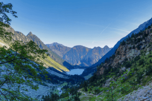
Hiking in Cauterets means enjoying a natural gem nestled in the heart of the High Pyrenees.
Indeed, this dazzling destination invites you to discover a landscape of breathtaking beauty, characterized by its shimmering lakes, majestic waterfalls, vertiginous peaks, and breathtaking panoramas. The hikes in Cauterets are undeniably among the most stunning within the Pyrenean massif. Whether in summer or winter, Cauterets offers a variety of trails suitable for all levels, from tranquil strolls to experienced hiking adventures, allowing visitors to encounter marmots and chamois within the national park. Cauterets, located in the Hautes-Pyrénées, is an emblematic destination that attracts both winter sports enthusiasts and spa-goers.
However, it is also the perfect gateway to explore the majestic peaks of the Pyrenees in any season. By staying in Cauterets, you will have easy access to a multitude of trails, allowing you to discover the best of this mountainous region.
Exploring Cauterets: Nature and Heritage in the High Pyrenees
Situated in a narrow valley of the Hautes-Pyrénées, just 30 kilometres south of Lourdes, the small town of Cauterets takes its name from the Latin “valley of hot baths” due to its thermal springs. Since the end of the 19th century, several establishments have been exploiting the naturally sulfuric springs that abound in the region. Nowadays, Cauterets continues to charm visitors with its rich architectural heritage, typical of the Pyrenean mountains, and its culinary delights, including the famous berlingots of Cauterets.
Furthermore, the city offers easy access to high mountains, hiking trails in the summer and ski slopes in the winter, making it a prime destination for mountain enthusiasts. The surrounding landscapes, including the Lys Circus, the Vignemale massif (dominating the French Pyrenees at a height of 3,298 meters) and the Pyrénées National Park, also delight nature lovers and fans of panoramic beauty.
We should also note that Cauterets is surrounded by the lengthy course of the Cauterets gave, a mountain torrent that originates from the Jéret and Marcadau gaves, as well as in their tributaries, the Lutour gave and the Gaube gave.
Thus, this configuration offers an ideal starting point for numerous hikes to popular natural sites, such as Péguère, Lake Gaube, Petit Vignemale (rising to 3,032 meters), the bridge of Spain, a picturesque village by the mountainside crossed by a waterfall, as well as the small massif of Fruitière.
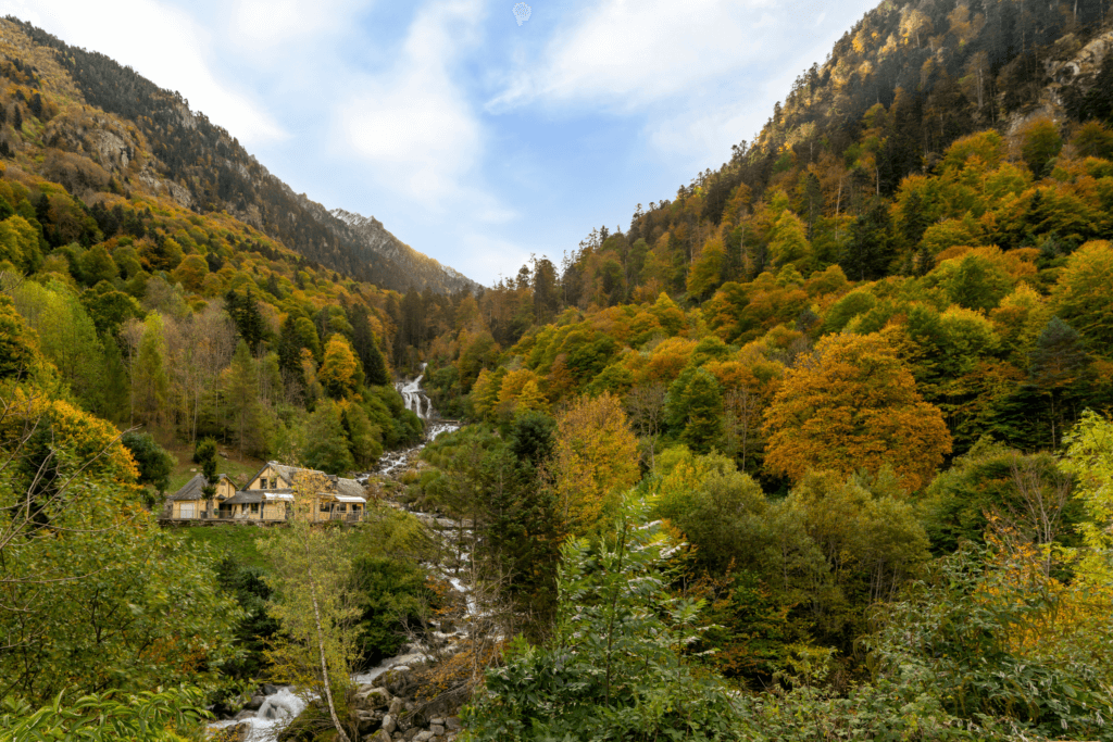
Hiking in Cauterets: A Paradise for Nature Lovers
Located in the heart of the Pyrenees National Park, the village of Cauterets offers many hiking trails, whether family strolls, leisurely walks, or more athletic expeditions with the possibility of bivouacking, suited to all preferences. Here is a selection of the most well-known and most appreciated hikes in Cauterets.
Hiking in Cauterets: Discover the trail of Pont d’Espagne and Lake Gaube
The path of the Pont d’Espagne nicknamed the “Path of Waterfalls”, is a must-visit for a hike in Cauterets, leading you to the splendid Lake Gaube, surrounded by majestic mountains, ideal in summer as well as in winter.
It borders the Gave de Marcadau, offering a shaded walk with magnificent waterfalls:
- Mauhourat Waterfall, near the hot spring water source.
- Cascade of Escane-Gat, hidden behind the trees.
- Ceriset Waterfall, before the path towards Péguère.
- Pouey Bacou waterfall, nestled between the rocks.
- Cascade of Bear’s Pass, near the bridge of the same name.
- Boussès Waterfall, after Sarah Bernhardt Island.
After just a 1.5-hour walk from La Raillère, you reach the Pont d’Espagne, classified among the Great Sites of Occitanie, perfect for families.
Continue on the GR® 10 towards Lake Gaube, offering one of the most beautiful panoramas in the region at the foot of the Vignemale massif, at the Oulettes Refuge.
Thus, to reach the lake, start from the Pont d’Espagne on a short and comfortable trail… However, it is quite busy in the summer. Indeed, the path is accessible most of the year, but it can get crowded in the summer. In winter, it can be accessed with snowshoes, but be aware of the icy conditions.
After admiring Gaube Lake, continue along the trail on the left bank towards the Gaube Valley. Enjoy the view of the Vignemale and the Esplumousse waterfall. This waterfall is the 3rd stop before reaching the Oulettes refuge at the foot of the Vignemale, offering a magnificent view of the mountain’s northern face.
Hiking to Ilhéou Lake: The Blue Treasure of the Pyrenees near Cauterets
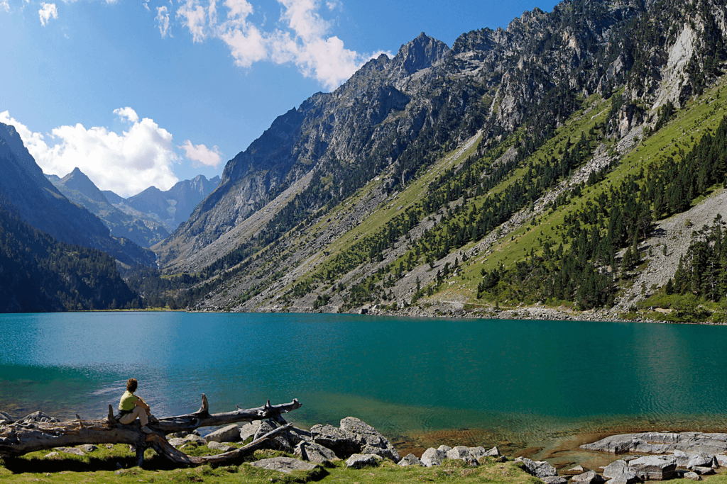
The surroundings of Cauterets are home to beautiful lakes, but the “Blue Lake” of Ilhéou stands out. Indeed, this large lake with its turquoise waters extends majestically between the Pyrenean peaks, creating a magical landscape. This hike, a bit demanding with an elevation of about 700 meters, offers breathtaking mountain panoramas and immersion in the Pyrenees National Park. The cherry on the cake it reveals a lake with crystal-clear waters, perfect for a brave swim.
The starting point is located at Cambasque, only a 15-minute drive from Cauterets. To reach the “Blue Lake”, follow a wide track along the Ilhéou stream, a creek that snakes through a wild and mineral valley. You will pass by an elegant waterfall, perfect for photographers.
Return to the trail, and the black lake reveals itself before you reach Lake Ilhéou, nestled at the foot of the high Pyrenean peaks. For a breathtaking view of the lake, climb up to the Refuge d’Ilhéou, where you can savour crepes or cheese (open from May to October, reservations possible). A trail will allow you to tour the lake, offering a landscape dotted with snow patches in spring.
For the more adventurous, extending the walk to the summit of Nets Peak for a magnificent panorama is possible. During winter, climbing to the lake can be an incredible experience, provided you are well-prepared. Those less accustomed to such exertions can take the cable car up and enjoy the walk down.
Finally, to access the trail from Cauterets, take the Cambasque road, which quickly ascends via several switchbacks to the Cambasque plateau. You can also follow the route on foot from Green Nipple Avenue through the forest. From the Cambasque car park, follow the trail that runs along the valley above the road towards the Ilhéou valley, circumventing the Lys peaks. This broad trail leads in 20 minutes to the Sahucs Waterfall. Then, the trail gradually ascends westwards to a promontory in 1h30. This promontory is crossed in several switchbacks, leading to Black Lake.
Hiking from Cauterets to La Fruitière: a pleasant trail in the Pyrenees
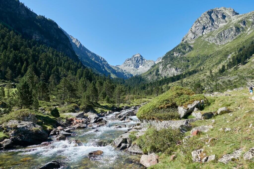
Located just 6 kilometres from Cauterets, La Fruitière is a well-known starting point for numerous hikes in the Lutour valley. But La Fruitière is much more than that: it is also a restaurant that delights hikers seeking a gourmet break after a day of exertion.
La Fruitière restaurant offers delicious local cuisine featuring products from the region. You can enjoy a hearty and tasty meal accompanied by a refreshing drink. It’s the perfect place to refresh and recharge your energies before you continue your mountain adventures.
Thus, the hike from Cauterets to La Fruitière is an enjoyable experience, leading you along the Gave de Lutour, where you can observe local wildlife, notably marmots and chamois, who watch visitors from afar. The trail, well-maintained but occasionally narrow, is accessible and offers magnificent views of the surrounding nature.
If you still have energy to spare, we invite you to continue your hike towards the famous Lake Estom, another exciting adventure in the Pyrenees.
Hiking from Cauterets to Lake Estom: A Pyrenean Treasure
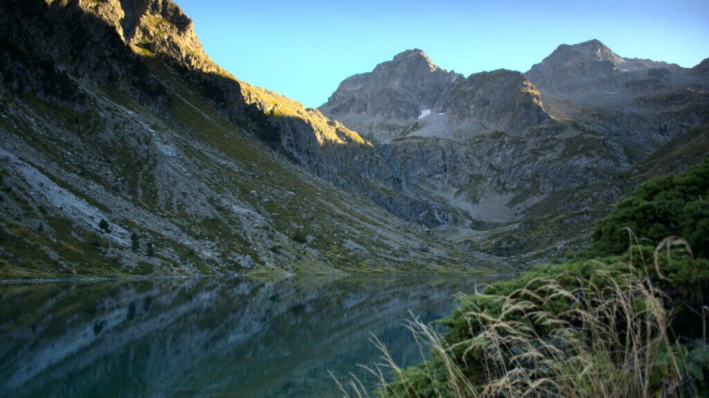
This demanding hike, rewarded by exceptional beauty, leads you to Lake Estom, perched at 1,804 meters above sea level. The slopes of Cestrède, Estom Soubiran, and Labas peaks plunge into its turquoise waters, creating a breathtaking natural spectacle. If the wind is not part of the picture, you can admire a magnificent shimmering panorama on the lake’s surface before descending towards La Fruitière and Cauterets.
This route between lakes and rivers provides a unique experience, featuring beautiful landscapes throughout the walk. At the end of the trail, after a steeper stretch, you will reach the magnificent Lake Estom. The more adventurous can even take a dip in it.
So you would understand this hike is magical as it completely immerses you in unspoiled nature.
To access this hiking trail in Cauterets, you can follow the same route that leads to La Fruitière and continue from there.
From the parking lot, follow the path that crosses the bridge over the Gave du Lutour. The trail, easy and well-marked, ascends steadily along the river, allowing you to discover the magnificent Lutour Valley. The trail passes through the Pourtau de Limouras, then continues to the Pouey Caut cabin and the fork in the trail leading to the Refuge Russel, which you will find after approximately 1 hour of walking (indicated by a sign).
Finally, continue on the main trail until you reach a footbridge, from which the path crosses the Gave River and continues south, steadily ascending to the Estom Lake and refuge, which you will reach after about 2 hours of walking from the start.
Hiking to the Pic du Cabaliros: A Majestic Viewpoint in Cauterets
There are a multitude of options for hiking in Cauterets, whether you’re looking for a peaceful stroll or a long adventure. Whatever your choice, you’ll be rewarded with breathtaking landscapes and the chance to discover majestic lakes.
Among the best hikes in Cauterets, we suggest you explore the Pic du Cabaliros. This ascent from Cauterets, via its south face, is a demanding hike, with a significant elevation gain and substantial distance. The numerous switchbacks of the trail will put your calves to the test.
The Pic du Cabaliros is a secondary peak, but its location makes it an ideal viewpoint, offering a magnificent view of numerous peaks in the Hautes-Pyrenees. The climb from Cauterets is a bit long, but the 360° panoramic view makes it worthwhile. An orientation table at the peak will help you identify the surrounding summits.
During the hike, you will traverse through forests, verdant pastures, and ridges. You will also pass by several streams and observe typical stone barns. Finally, at the summit, you’ll enjoy a breathtaking panorama. Those with the highest motivation may detour to the charming Anapéou Lake before descending.
To reach the starting point of the Cauterets hike, head towards the city centre. Pass by the town hall square, then continue on the main avenue until you reach the Mamelon Vert Avenue on your right. Follow the signs indicating “Aoumède Viewpoint”. You will arrive at the starting point of the hike at the end of this street.
Thus, from the starting point, take the path that climbs through the woods to Aoumède farm, which you will reach after about 30 minutes of walking. Follow the signs indicating Cabaliros and take the track on the left. This track climbs in wide bends through the Aoumède woods.
At the summit, you will find three antennas and an orientation table to enjoy the panoramic view. The panorama extends from the Val d’Azun (Balaïtous, Palas…) to the valleys of Cauterets (Vignemale, Monné, Ardiden…) and up to the valleys of Barèges (Néouvielle, Pic Long, Pic du Midi de Bigorre…).
The Cardinquère Lakes Circuit: A breathtaking hike from Cauterets.
The Cardinquère Lakes circuit is a long hike, but the exceptional landscapes it offers will quickly make you forget the efforts made. Here is a guide for this adventure from Cauterets.
For a departure from Cauterets towards La Raillère (D920), park at the Pountas parking lot. Follow the path to the Clot plateau, cross the bridge over the gave, and walk to the Cayan Bridge. From there, turn left and walk towards the Estalounqué Bridge. Continue along the gave to the Wallon Refuge (approximately 2 hours of walking).
From the Wallon Refuge, ascend northward via a steep, winding path. Disregard the trail of the Cambalès lakes. The highest point is Lake Nère, then descend towards the Embarrat lakes.
After exploring these lakes, follow the narrow trail that descends through the vegetation and forest to the Cayan bridge. Walk along the left bank of the Gave River to return to the Clot plateau and then to the Pountas parking lot, your starting point. This hike offers a varied experience in the heart of the Pyrenees from Cauterets.
Hiking to Cambalès and Opale Lakes from the Wallon-Marcadau Refuge
Explore the majesty of the Pyrenees with this breathtaking hike that will take you to the Lakes of Cambalès and Opale, offering breathtaking panoramas. The journey starts from the Wallon-Marcadau refuge, an ideal getaway for mountain lovers. A route that will take you through diverse landscapes, from forests to rocky peaks… A memorable experience awaits you in the heart of the preserved Pyrenean nature.
This hiking route in Cauterets typically begins at the Pont d’Espagne (Pountas car park), passing through the Marcadau valley. And just like the Circuit des Lacs de la Cardinquère, you need to climb through the forest, except that at the intersection, you turn left, towards the path that winds upwards towards Cambalès. It crosses a first stream and continues in switchbacks, bypassing a rocky spur on the right to reach the first lake after 1 hour and 15 minutes of walking. The trail then continues west across the circus, offering a view of the various surrounding lakes.
Note that the continuation of the route takes place off the trail. Therefore, leave the main trail and head south to bypass the lake towards a small pass, reached by climbing through the rocks. You will enjoy a sumptuous view of the Opal lakes with their remarkable turquoise blue. Then, follow towards the southeast along the slope through the rocks to reach the bottom of the valley between the two lakes, which takes about 3 hours from the start.
Walk along the small lake from the south through the scree, then meet the Cambalès stream that you cross and follow on the hillside through the stones on the left bank. You will find the path that you took to climb to the lakes of Cambalès after about 3 hours and 30 minutes of walking, then Wallon’s refuge after about 4 hours of walking from the start. A demanding hike but rewarded with extraordinary views of these Pyrenean lakes.
Snowshoe Hiking in Cauterets: The Enchanting Pyrenean Nature in Winter.
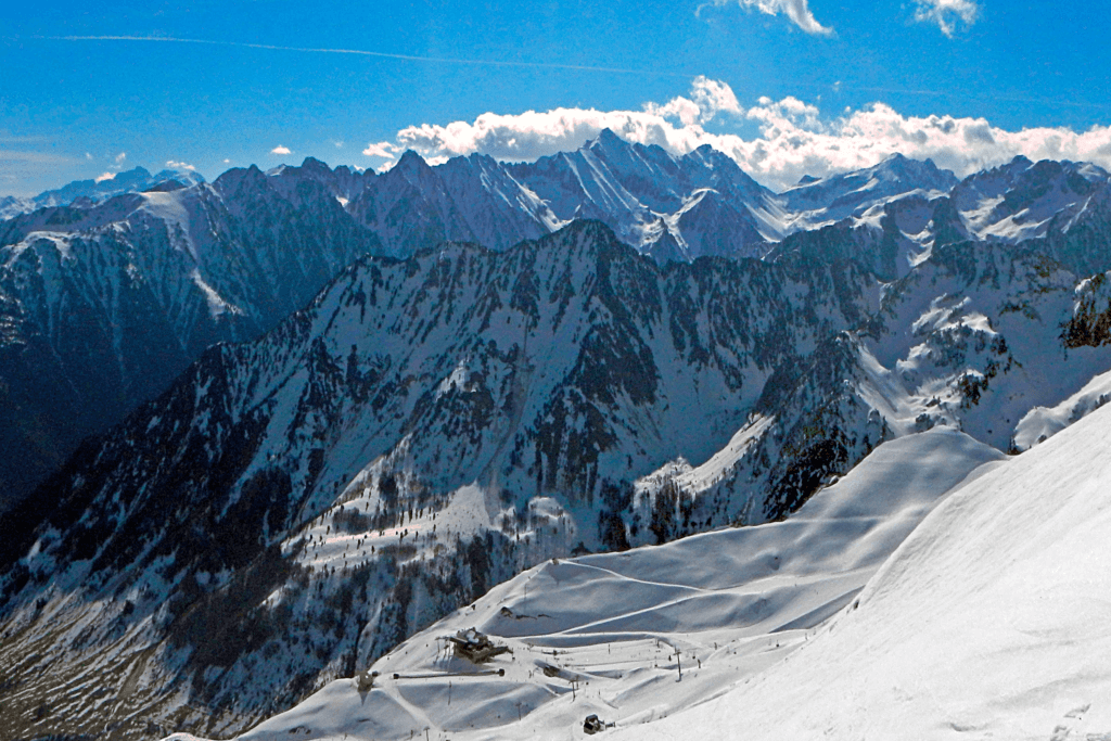
If Cauterets is a popular destination for its ski slopes in winter, it does not leave snowshoe hiking enthusiasts behind. Indeed, when the snow covers the trails of the Gaube and Lutour valleys, these landscapes transform into true white paradises, ready to amaze all visitors. Strap on your snowshoes because it’s time to explore these magnificent winter routes!
Perhaps you remember Gaube Lake and the Spain Bridge? Picture them under a snowy blanket, with their frozen waterfalls and lakes, offering panoramas worthy of a postcard. These paths, popular among summer hikers, turn into a playground for snowshoeing enthusiasts in Cauterets. Similarly, La Fruitière, with its refuge open on winter weekends, is a must-visit for hikers looking for a good hot chocolate to recharge.
Nevertheless, keep in mind that it is essential to stay informed about the snow conditions and the practicability of the snowshoeing trails in Cauterets during the winter. Do not hesitate to contact the Cauterets Tourist Office to get the most recent information, and consult the local webcams to get a real-time overview of the weather conditions. Get ready for an unforgettable winter experience in the heart of the Pyrenees!
Bivouacking Around Cauterets: Sleeping Under the Stars in the Heart of the Pyrenees
Mountain enthusiasts know it well: a single day of hiking in Cauterets is not enough to satisfy their thirst for adventure. They dream of dawn at the Pyrenean peaks, bivouacking under the stars, and communing with nature. Here are a few good addresses for those who wish to spend a night bivouacking around Cauterets.
Among the enchanting routes, don’t miss the hike from Cauterets to the Estibe Aute lakes, where bivouacking is possible. The start of the route is similar to that of the Estom Lake (at 1,804 meters altitude), but this time, you will divert to two small lakes perched a bit higher, at 2,328 meters altitude. It is an unforgettable experience to enjoy the misty and mystical atmosphere of the Estibe Aute lakes at sunrise.
If you favour the valleys of Gaube and Marcadau, we recommend the hiking route from the Pont d’Espagne to a stunning collection of mountain lakes, including those of Embarrat (at 2,078 meters above sea level), the Pourtet Lake (at 2,420 meters), and the Nère Lake (at 2,241 meters). A night spent camping can promise unforgettable memories. However, if you’re seeking a bit more comfort, consider the Wallon Refuge, a more comfortable option (with reservation necessary).
Finally, more adventurous people can extend their hike from Cauterets to Lake Gaube to challenge themselves against Petit Vignemale (at 3,032 meters). Beware, this route requires good physical condition, with a considerable distance and elevation gain, but the view from the top justifies a few calf cramps.
Finally, don’t forget to familiarize yourself with the bivouacking rules in the Pyrenees National Park in order to preserve the biodiversity and delicate balance of this exceptional environment. Enjoy this unique experience in the heart of the Pyrenees nature!
Hiking at Cauterets: Your Gateway to Adventure in the Great Outdoors
In conclusion, as you can understand, Cauterets offers you a variety of outdoor activities. Hiking, snowshoeing in winter, bivouac near mountain lakes, and much more. La Fruitière welcomes you for memorable hiking departures. However, always be aware of the weather conditions and respect the bivouac rules of the Pyrenees National Park to preserve this precious natural environment.
Be prepared for breathtaking adventures during your hike in Cauterets!

