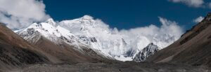
The vast terrains of the United States showcase a spectacular tapestry of landscapes. Among these, the towering mountains of North America stand as a testament to the continent’s geological grandeur. While the country boasts an array of mountain ranges, from the rugged Appalachian to the soaring Rockies, Alaska reigns supreme in terms of altitude.
Alaska, often referred to as the “Last Frontier”, houses a majority of the highest peaks in the nation. Out of the top 30 towering giants, ten are cradled within its vast wilderness. These mountains, although remotely situated, epitomise Alaska’s geography, standing as sentinel landmarks that are seldom visited but perpetually revered.
Furthermore, this northern state is encompassed by fourteen major mountain ranges. However, the lion’s share of America’s 15 loftiest summits resides within just three: the Alaska Range, the Saint Elias Mountains, and the Wrangell Mountains. While Alaska dominates the list, the Sierra Nevada range in California also makes its mark with the notable inclusion of Mount Whitney. States like Colorado, too, contribute to the high-altitude tapestry with their majestic peaks.
1. Denali: The Towering Jewel of North America
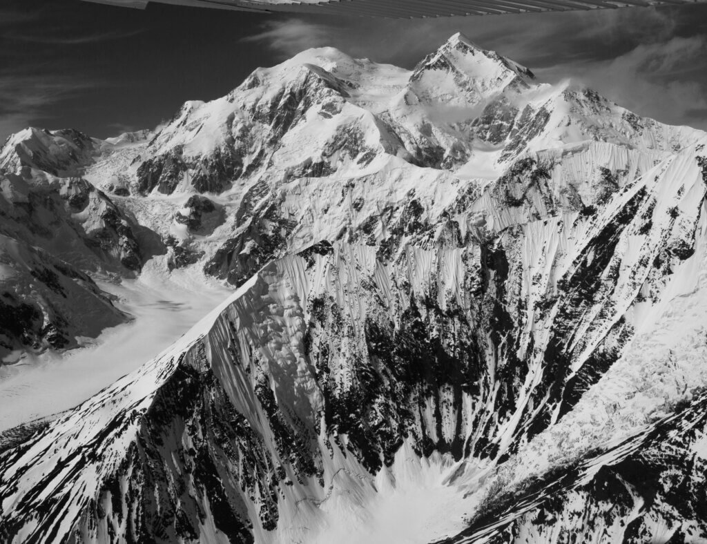
Standing at an imposing height of 20,310 feet (6,190 meters), Denali proudly claims the title of the tallest mountain in the United States. It is also the pinnacle of North America. It comes in third place among the Seven Summits, behind only Mount Everest and Aconcagua.
The origin of Denali, nestled within the Alaska Range, traces back to the convergence of the Pacific and North American tectonic plates. This formidable tectonic activity doesn’t merely belong to the past. It continues its role, contributing incrementally to Denali’s elevation each year. This persistent rise has gifted Denali with one of the most significant base-to-peak vertical gains globally. To put it into perspective, it boasts an ascent of approximately 18,000 feet (5,500 meters) from its base. This outpaces even the revered Mount Everest in this aspect.
Previously known as Mount McKinley, in honour of the 25th President of the United States, William McKinley, Denali is the native name endowed by the indigenous people of Alaska, meaning “the high one” in the Athabaskan language. This moniker was officially reinstated in 2015 by President Obama. Situated in Denali National Park, this colossal mountain attracts the bravest climbers. This includes about 1,200 of them daring to conquer its peak annually. However, the climb is anything but easy. The bone-chilling temperatures, persistent snow and ice cover, and challenging terrain make Denali a formidable adversary. Of the over 32,000 aspirants who have sought its summit, only a select few have tasted success.
Although widely recognised for its reputation and altitude, the exact elevation of Denali remains a subject of debate. This is because some surveys hint it might be loftier than the widely accepted 20,310 feet.
2. Mount Saint Elias: The Glacier-Crowned Titan of Alaska Yukon
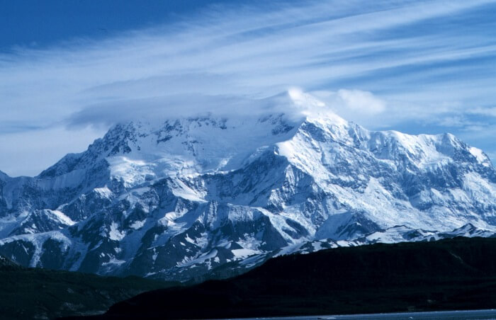
Situated at the cusp of Alaska and Canada, Mount Saint Elias stands as a towering sentinel in the Saint Elias Mountain Range, reaching a remarkable altitude of 18,009 feet (5,489 meters). Notably, it takes the honour of being the second-tallest peak in both the United States and Canada, surpassed only by Mount Logan.
The Saint Elias Mountains, of which Mount Saint Elias is a prominent part, are a distinct subrange of the Pacific Coast Ranges. This vast expanse of mountainous terrain stretches from southeastern Alaska and traverses the Yukon. It also extends into the northern reaches of British Columbia. Nestled on the Alaskan side of the border, Mount Saint Elias forms an integral part of the Wrangell-St. Elias National Park and Preserve. This park, distinguished as the largest in the United States, boasts nine of the country’s 16 loftiest summits.
Adjacent to this towering range lies Glacier Bay, renowned for its dense concentration of glaciers and icefields. The mountain holds cultural significance, too. The indigenous Yakutat Tlingit people, who have made this region their home for millennia, refer to Mount Saint Elias as Yaséitʼaa Shaa or Shaa Tlein. Delving into its exploration history, the peak witnessed its inaugural recorded ascent in 1897, achieved by an Italian expedition team. Guided by Prince Luigi Amedeo, Duke of the Abruzzi, this team, including American climbers, successfully summited on July 31 of that year.
Enveloping Mount Saint Elias in an expansive tapestry of history are ice fields and glaciers, among the most extensive in North America. Its name traces back to the 18th century when Russian explorer Vitus Bering christened it after the biblical prophet Elias.
3. Mount Foraker: Denali’s Majestic Neighbour in the Alaska Range
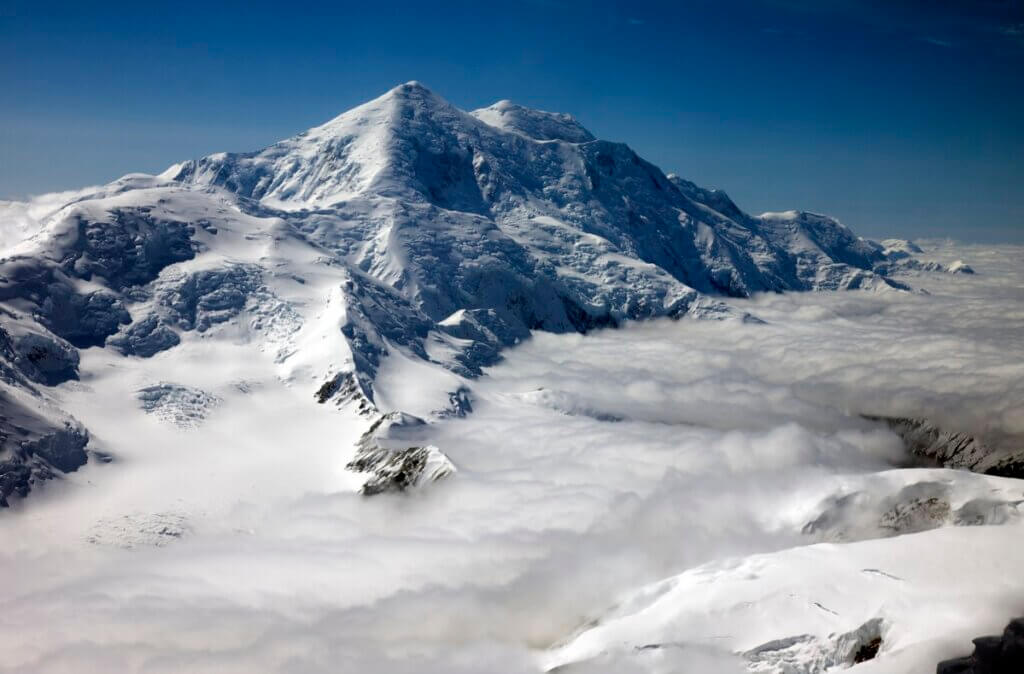
Nestled in the heart of the Alaska Range, Mount Foraker stands as the third-highest mountain peak in the United States, boasting an elevation of 17,400 feet (5,304 meters). On days with unobstructed views, you can observe this majestic peak alongside Denali, its more renowned counterpart. It is located just 14 miles (23 km) southwest of Denali within the boundaries of Denali National Park and Preserve. Mount Foraker is also often referred to as Denali’s sister peak.
Apart from its sheer height, the mountain’s geographical location adds another feather to its cap. Mount Foraker is strategically situated on a fork of the Kahiltna Glacier. It is the longest glacier gracing the Alaska Range, offering a mesmerising backdrop alongside Denali and Mount Hunter. This setting, with its rugged terrain, imposing peaks, and intricate climbing routes, makes Mount Foraker a sought-after destination for seasoned climbers.
The mountain is steeped in history and culture, bearing indigenous Dena’ina names. This includes names such as Sultana, translated as “the woman,” and Menlale, implying Denali’s wife, a testament to its closeness to Denali. Its ascent records date back to 1934, when Charles Houston, T. Graham Brown, and Chychele Waterston became the first to summit both its north and south peaks successfully. Additionally, its naming carries political significance, as it was christened in honour of Joseph B. Foraker, an Ohio senator who championed the establishment of Mount McKinley National Park.
4. Mount Bona: Alaska’s Majestic Volcanic Giant
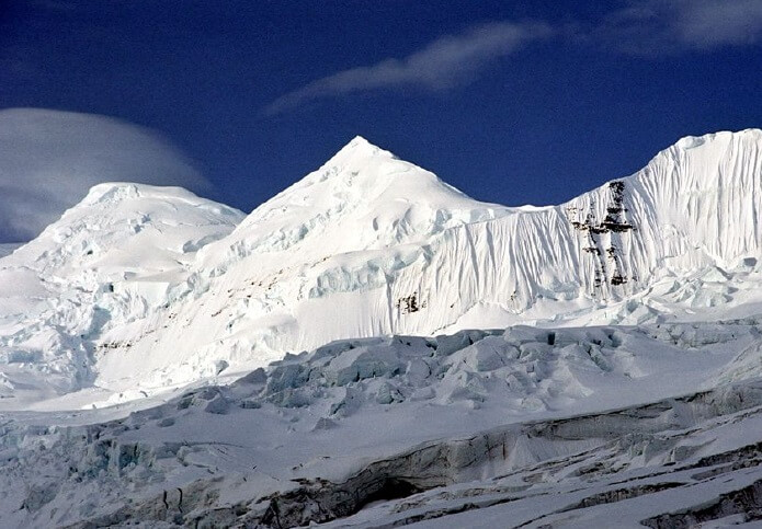
Nestled in the Saint Elias Mountains, Mount Bona stands tall within the eastern Alaska Range, majestically claiming its space within the expansive boundaries of Wrangell-St. Elias National Park and Preserve. It is the highest volcano in the United States, reaching 16,550 feet (5,040 meters). Additionally, it ranks as the fourth-highest peak in the US.
Its formidable stature is further enhanced by its geological significance. Accumulating layers of volcanic ash, lava, and rock crafted this dormant stratovolcano over time, making it considered an active volcano. The mountain’s foundations contain gems surpassing 300 million years of age, a testament to its ancient origins.
Mount Bona’s vast icefields accentuate its beauty, with the prominent Russell Glacier to the north and the University Range icefield gracing its western flanks. The Klutlan Glacier, flowing seamlessly into Canada’s Yukon Territory, plays a pivotal role in the Russell Glacier complex.
Its strategic location brings it close to fellow giants such as Mount Blackburn, Mount Sanford, and Mount Wrangell. This makes it part of Wrangell-St. Elias National Park is a coveted destination for mountaineers keen to conquer multiple towering peaks in a single expedition. The mountain’s history saw its summit first dominated by the determined trio of Allen Carpe, Terris Moore, and Andrew Taylor in 1930.
Apart from its geological and mountaineering appeal, Mount Bona carries a touch of maritime history. It received its name from the Duke of Abruzzi. He was inspired to name the peak after his cherished racing yacht during his ascent of Mount Saint Elias. With a remarkable base diameter stretching 25 miles and spanning an area of over 7,000 square miles, Mount Bona’s grandeur is undeniably awe-inspiring.
5. Mount Blackburn: Glacier-Crowned Titan of Wrangell-St. Elias
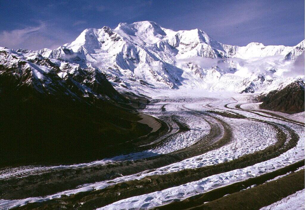
Nestled within the vast expanse of Wrangell-St. Elias National Park, Mount Blackburn, stands as an imposing eroded shield volcano, reaching an impressive altitude of 16,390 feet (4,996 meters). As the second-highest volcano and the fifth-highest mountain in the United States, its prominence within the country’s rugged landscape is undeniable.
Encircled by a plethora of glaciers, this giant contributes significantly to the icy landscapes of the region. The western side of the mountain feeds the extensive Kennicott Glacier, stretching over 20 miles and leading curious adventurers towards the remnants of the mining ghost town, Kennecott. The mountain’s northern face gives rise to the Nabesna Glacier, while the Kuskulana Glacier also benefits from its icy reserves. One of the mountain’s most awe-inspiring features is the mammoth icefall descending from its summit, regarded as one of the largest in North America.
The historical significance of Mount Blackburn isn’t limited to its natural wonders. In 1958, a brave team comprising Bruce Gilbert, Dick Wahlstrom, Hans Gmoser, Adolf Bitterlich, and Leon Blumer conquered its peak, marking the first successful ascent. Adding to its rich tapestry of stories, the mountain owes its name to Joseph Clay Stiles Blackburn. He was the Kentucky senator who passionately championed the establishment of the park.
6. Alaska’s Majestic Mount Sanford: A Dormant Giant with a Storied Past
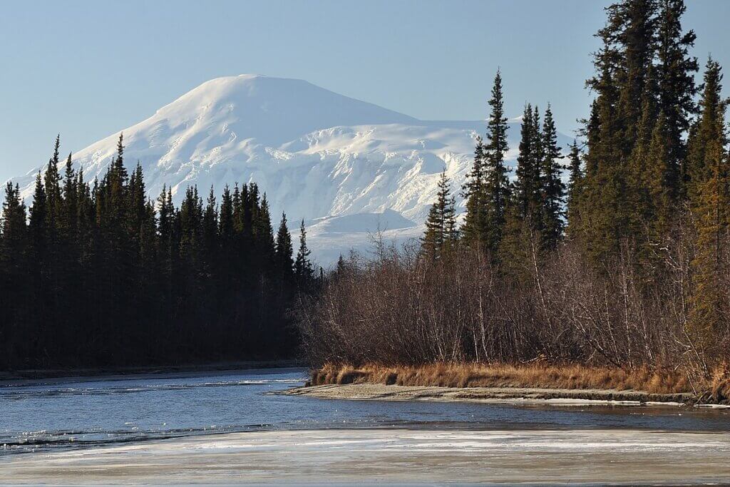
Mount Sanford, towering at 16,237 feet (4,949 meters), holds the distinction of being the third-highest volcano in the United States and the sixth-highest peak overall. It is nestled within the picturesque backdrop of the Wrangell Mountains. Additionally, this dormant shield volcano is an integral part of the Wrangell Volcanic Field in eastern Alaska. Notably, it lies within the expansive confines of the Wrangell-St. Elias National Park and Preserve.
The mountain’s geology is captivating, particularly its expansive caldera, spanning over 6 miles in diameter. This unique feature hints at the tremendous volcanic activities of aeons past. Yet, since the 1700s, Mount Sanford has remained inactive. Nonetheless, sporadic vapour, rock, and ice fall near its summit giving the illusion of smoke or ash. It is as if the mountain gently reminds visitors of its fiery history.
Adjacent to Mount Sanford is the Sanford Glacier, aptly named given the ice’s source from the mountain itself. The mountain’s name pays homage to the Sanford family, a dedication made by Lieutenant Henry T. Allen of the US Army back in 1885.
The allure of Mount Sanford isn’t just in its beauty or geology but also in its mountaineering history. In 1938, the peak witnessed its first successful ascent, undertaken by mountaineers Wilfred H. Babcock, H. Adams Carter, Elton Thayer, Terris Moore, and Bradford Washburn. Today, the mountain is a sought-after destination for mountaineers, offering challenging and unmatched vistas.
7. Mount Fairweather: A Majestic Peak Bridging Alaska and British Columbia
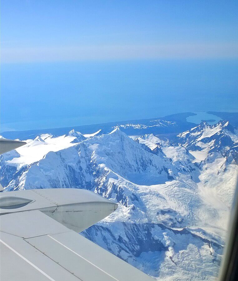
Located at the heart of the captivating Glacier Bay, Mount Fairweather stands impressively at 15,325 feet (4,671 meters). It serves as a beacon for millions of tourists who flock to Alaska to witness the beauty of tidewater glaciers and diverse wildlife. This majestic peak has rich cultural significance. Indigenous Alaskans refer to Mount Fairweather as Tsalxhaan or Tanaku in the Tlingit language.
Adventurers Allen Carpé, Terris Moore, and Andrew Taylor achieved the first documented ascent of Mount Fairweather in 1931, a testament to the mountain’s allure. The mountain uniquely straddles the border between Alaska and British Columbia. Despite a portion of its expanse being within Alaskan territory, it holds the title of the tallest peak in British Columbia. Remarkably, its summit is a mere 20 km from the vast expanse of the Pacific Ocean.
The mountain’s poetic name has historical maritime roots. In 1778, during an apparent spell of “fair weather,” Captain James Cook bestowed upon the peak its current name, captivated by its symmetry and grandeur.
8. Mount Hubbard: A Pinnacle of Challenge and Scientific Exploration
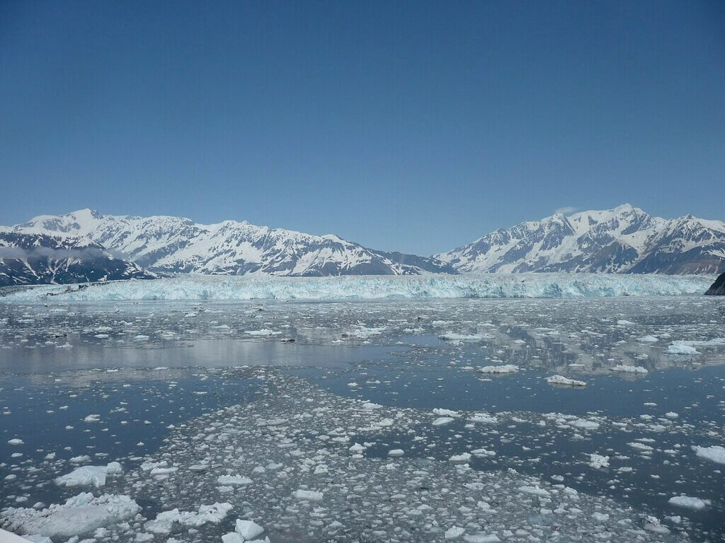
Strategically positioned in the Saint Elias Range, Mount Hubbard is a natural sentinel, defining the border between Alaska and the Yukon. Towering at an imposing height of 14,951 feet (4,557 meters), this mountain is not just a geographical marvel. It is also a significant nod to history. It was christened in 1890 in honour of Gardiner Hubbard, the pioneering President of the National Geographic Society. He was also instrumental in funding the Russell Expedition to explore its environs.
Mount Hubbard isn’t just a solitary peak but boasts three distinct summits. While Mount Hubbard is the highest, its siblings, Mount Alverstone and Mount Kennedy, add to its grandeur. It was on July 6, 1951, when Walter Wood, Bob Bates, and Bill Hackett marked history by making the first successful ascent of this challenging peak.
Though a natural wonder, the mountain isn’t just about its aesthetic appeal. Due to its position and structure, it’s acknowledged as one of North America’s most challenging ascents. This is because climbers often grapple with its sheer inclines and erratic weather. Beyond mountaineering, Mount Hubbard has also served as a significant field for scientific enquiry. Researchers have embarked on multiple studies here, delving into glaciology and the ever-pertinent subject of climate change.
9. Mount Bear: Alaska’s Overlooked Giant
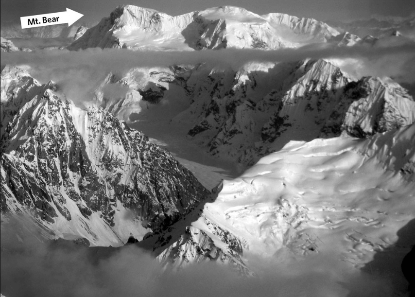
Standing at a formidable height of 14,831 feet (4520 meters), Mount Bear graces the Wrangell-Saint Elias Mountains in Alaska. Its proximity to the Canadian border is four rugged miles, underscoring its strategic location. Notably, the mountain is at the confluence of three significant mountain ranges, which bestows upon it a distinctive appearance.
Though Mount Bear boasts grandeur, it remains somewhat of an enigma in mountaineering circles. The shadows of the renowned Mount Logan, Mount Bona, and Mount Lucania often eclipse its majesty, making it a less-frequented peak. However, this giant has its own tales of conquest. It witnessed its first successful ascent in 1959 under the leadership of Fred Beckey. A joint team of American and Canadian climbers accompanied him.
Beyond its altitude and mountaineering allure, Mount Bear plays a vital role in the region’s glaciology. It feeds ice into the significant Barnard Glacier and Klutlan Glacier complexes. Among its icy treasures is the Bear Glacier, recognised as one of North America’s largest glaciers.
10. Mount Hunter: Alaska’s Ice-Climbing Jewel
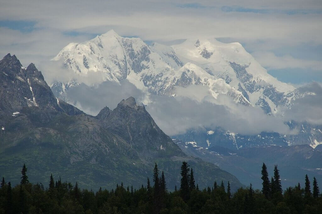
Within the vast expanse of Denali National Park, Mount Hunter rises to a formidable height of 14,573 feet. Just eight miles from the iconic Denali, this peak holds a special place in the hearts of the Dena’ina people, who christened it “Begguya” – translating to “child of Denali”. While the North Summit is acknowledged as the primary summit, its South counterpart is dubbed Mount Stevens in honour of a past Alaskan state senator.
This majestic peak is the third loftiest in the Alaska Range, overshadowed only by Denali and Mount Foraker. Its challenging terrains, especially the renowned West Ridge, have cemented its reputation in the mountaineering community. These routes, with their steep vertical reliefs, beckon climbers eager to test their mettle on ice and mixed terrains. Such demanding ascents require not just advanced technical prowess but also a deep passion for the craft. This is because the West Ridge is considered among North America’s most arduous climbs.
The history of Mount Hunter traces back to 1903 when it was named in tribute to Robert Hunter, an intrepid explorer of the region. The mountain’s allure proved irresistible, leading to its first successful ascent in 1954 by a dedicated team of four, notably featuring Bradford Washburn. Washburn’s exploits on this climb began his illustrious journey as a distinguished mountaineer and photographer.
11. Mount Whitney: The Sierra Nevada’s Majestic Summit
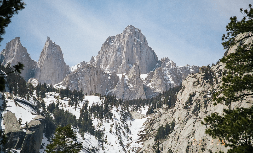
Nestled in the Sierra Nevada mountains of California, Mount Whitney stands tall at 14,505 feet (4,421 meters), claiming the title of the highest peak in the contiguous United States. Surpassing all other peaks in elevation within the continental US, it stands as the 11th-highest peak in the USA. Given its prominence, it’s no surprise that this majestic mountain is a prime destination for both day hikers and long-haul backpackers journeying along the Pacific Crest Trail.
The indigenous Paiute community reveres the mountain and knows it as Too-man-i-goo-yah. This magnificent peak straddles the edge of Sequoia National Park, and its trails often intertwine with the iconic John Muir Trail. The mountain’s legacy dates back to 1873, when Charles Begole, A. H. Johnson, and John Lucas, a trio of intrepid American climbers, ascended its heights.
Over the years, Mount Whitney has attracted adventurers from across the globe. Many of them commence their trek at the Whitney Portal near the quaint town of Lone Pine. This peak proudly bears the name of Josiah Whitney, California’s state geologist. It sits majestically within the protective boundaries of the John Muir Wilderness area.
12. Alaska’s Border Sentinel: Mount Alverstone’s Splendour
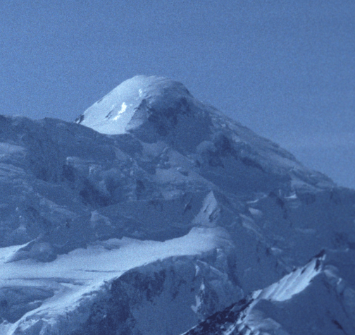
Mount Alverstone, a commanding feature in the Saint Elias Mountains, holds the distinction of being the 12th tallest peak in the USA. It stands proudly on the border between Alaska and Canada. Part of its prominence arises from its position as the pinnacle of the Alaska-British Columbia boundary. Adding to its geographical significance, Mount Alverstone is enveloped by the expansive Bagley Icefield. It is a staggering ice field that stretches across more than 1270 square miles. It is also acclaimed as the world’s largest non-polar ice expanse.
Its nomenclature bears historical weight. In 1908, the peak was christened in honour of Lord Richard Everard Webster Alverstone; it was previously named for Charles James Stewart, the Anglican Bishop of Victoria, known colloquially as Alverstone. In the annals of mountaineering, 1906 marks a significant year for Mount Alverstone. During this year, the peak saw its first successful ascent, achieved by a dedicated team of four under the leadership of the renowned American alpinist and philanthropist Dora Keen.
This formidable mountain isn’t a solitary wonder in its region. It forms a significant massif, with the eminent Mount Hubbard to its south and the marginally less elevated Mount Kennedy to its east. A salient feature of its topography is the pronounced shift in the Alaska/Canada border from its summit, tracing south towards the Alaska panhandle and pivoting west toward Mount Saint Elias.
13. University Peak: A Rugged Marvel in the Saint Elias Range
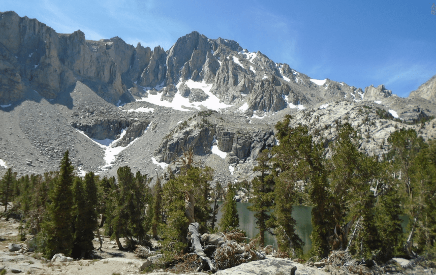
Nestled in the heart of the Saint Elias Mountains of Alaska, University Peak is a testament to nature’s grandeur. A neighbour to Mount Bona, this imposing summit is characterised by its dramatic landscape featuring precipitous cliffs and sweeping valleys. Unlike Bona, University Peak possesses a much steeper facade, presenting climbers with a unique set of challenges.
The mountain’s distinctive moniker was bestowed upon it by Terris Moore, the then-president of the University of Alaska. During an expedition near Mount Bona, Moore discerned two previously unnamed peaks. Eager to leave a lasting legacy, he promptly designated one in honour of his academic institution, marking it as “University Peak”.
This rugged mountain peak caught the attention of adventurers worldwide. In 1955, Keith Hart, a seasoned American mountaineer, successfully led a team to its summit. Today, University Peak proudly ranks among Alaska’s twenty loftiest summits and holds a commendable position within the fifty highest peaks of the United States.
14. Mount Elbert: The Gentle Giant of the Rockies
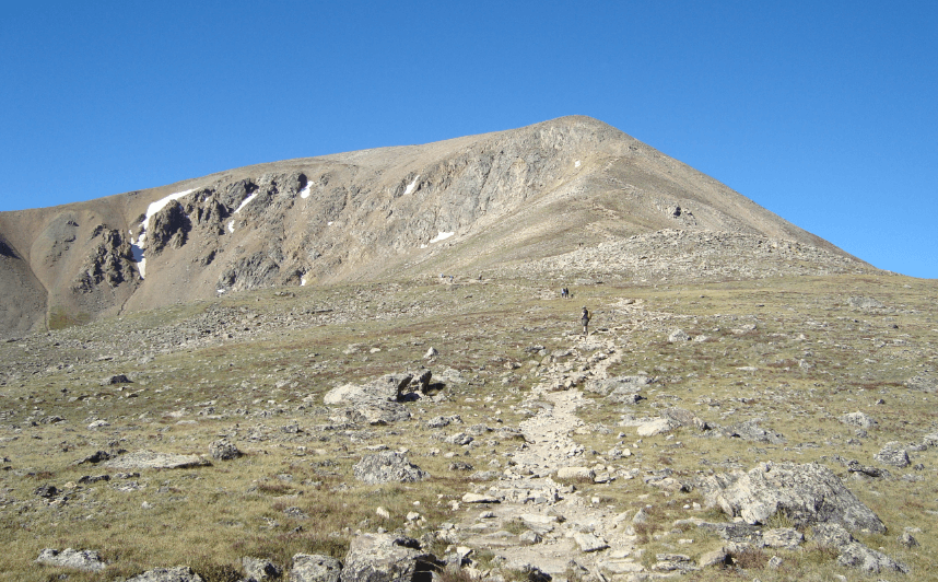
Situated in the heart of the Sawatch Range in central Colorado, Mount Elbert stands as the pinnacle of the Rocky Mountains. Towering at an impressive elevation of 14,440 feet (4,401.2 m), it not only claims the title of the tallest summit in the Rockies but also boasts the distinction of being the apex in the US State of Colorado. Beyond this, it is the second loftiest peak in the contiguous United States, surpassed only by Mount Whitney.
Nestled near Leadville, this magnificent mountain is adorned with glacial cirques, remnants of the last Ice Age. These naturally sculpted bowl-shaped depressions etched into the mountain’s flanks brim with snow and ice throughout the year, serving as a testament to nature’s grandeur and the passage of time.
In homage to Samuel Hitt Elbert, a pivotal statesman during Colorado’s nascent days and the territory’s governor from 1873 to 1874, the mountain proudly bears his name. Though it was officially christened in his honour in 1873, its majesty was no secret to Native Americans and intrepid explorers who revered it long before this formal recognition.
Beyond its impressive stature and rich history, Mount Elbert is also a significant geographical landmark. As the highest peak in the Sawatch Range, it determines the ultimate point in the vast Mississippi River drainage basin. Moreover, its location in the San Isabel National Forest, a mere 12.1 miles (19.4 km) southwest of Leadville in Lake County, makes it an accessible and sought-after destination for many.
15. Mount Massive: Colorado’s Sprawling Summit
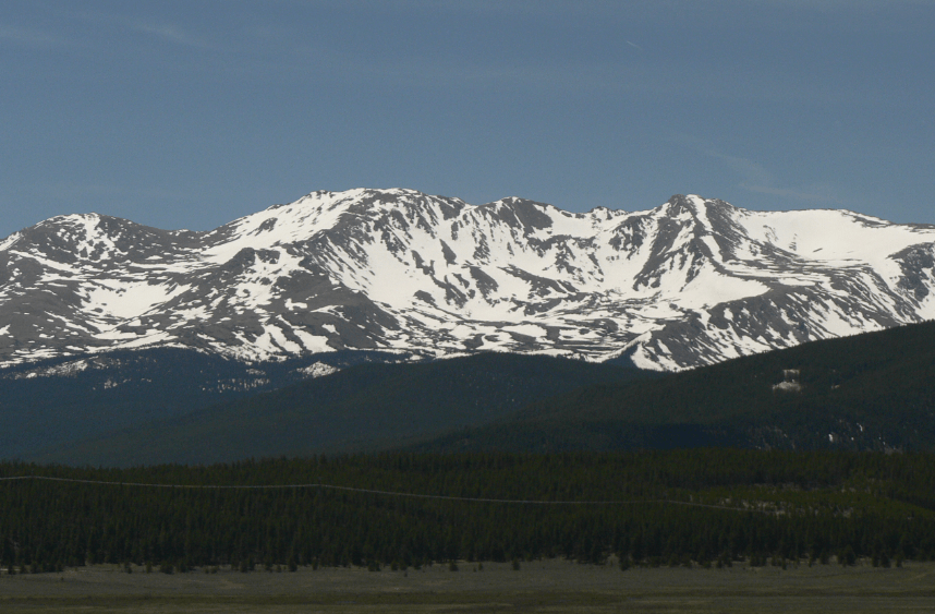
Boasting an impressive size that covers an expanse of over 340 square miles, Mount Massive stands as a testament to its name. Situated in the Sawatch Range, this peak proudly holds the title of the second-highest summit in the Rocky Mountains and the third-highest in the contiguous United States. At an elevation of 14,428 feet (4,398 m), it narrowly surpasses Mount Harvard by 7 feet (2.1 m) yet lags behind Mount Elbert by a mere 12 feet (3.7 m).
The peak’s summit plateau alone spans approximately 5 square miles, and it serves as home to several grand glaciers. Notably, the Massive Glacier, residing within the peak, is the most expansive in the Sawatch Range.
Historically, Mount Massive holds tales of exploration and discovery. The mountain first caught the attention of American frontiersman John C. Fremont in 1845. Its significant prominence led early miners to bestow upon it the name “Mount Massive”, mistakenly believing it to be the area’s highest peak. Presently, the mountain is nestled within the protective boundaries of the Mount Massive Wilderness in San Isabel National Forest. It’s located a convenient 10.6 miles (17.1 km) west-southwest of the City of Leadville in Lake County, Colorado.
16. Mount Harvard: Colorado’s Hidden Gem of the Rockies
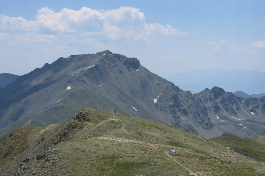
Situated in the heart of the Collegiate Peaks Wilderness, Mount Harvard proudly stands as the third loftiest summit. It is located in the Rocky Mountains of North America. With a striking elevation of 14,421 feet (4395.6 m), it reigns as the pinnacle of the Collegiate Peaks. Moreover, it claims the title of the fourth-highest summit within the contiguous United States.
Nestled in the San Isabel National Forest, this majestic mountain is positioned roughly 11.7 miles (18.9 km) in a north-westerly direction from the town of Buena Vista in Chaffee County, Colorado. Its peak towers above any point in the US east of its longitude. It also marks the zenith of Chaffee County. As a nod to one of the world’s premier educational institutions, the mountain is a tribute to Harvard University.
While some of its counterparts, like Mounts Princeton, Antero, Yale, and Columbia, can be easily spotted from the main roads weaving through the Arkansas River Valley, Mount Harvard offers a more elusive allure. Those with a keen spirit of adventure, looking to witness Mount Harvard’s full splendour, must venture to the trailhead. It is a hike that promises both challenge and reward. As one undertakes the ascent via the most accessible route, the journey will lead through the serene Horn Fork Basin. It commences from the North Cottonwood Creek Trailhead. However, the final stretch demands more tenacity, involving a scramble through rugged terrains to conquer the summit finally.
17. Mount Rainier: Majestic Volcano of the Pacific Northwest
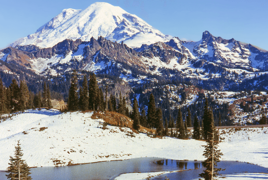
Mount Rainier, often referred to as Tahoma, stands as a significant active stratovolcano within the Cascade Range of the Pacific Northwest. Situated approximately 95 km south-southeast of Seattle, this mountain graces the expanse of Mount Rainier National Park. With its peak reaching an impressive 4,392 metres, Rainier holds the distinction of being the highest pinnacle in Washington and the Cascade Range. It is also the most topographically pronounced in the entire contiguous US and the loftiest within the Cascade Volcanic Arc.
Regarded as one of the world’s most difficult volcanoes due to its looming eruption probability, Mount Rainier has earned a spot on the Decade Volcano list. Its considerable glacial ice cover poses an additional threat: the potential to spawn vast lahars capable of endangering the Puyallup River valley. Data from the United States Geological Survey highlights the severity of this threat, suggesting around 80,000 residents face potential risks from lahar-related hazards in the region.
Historically, from 1950 to 2018, the allure of Mount Rainier has drawn 439,460 climbers. However, the mountain’s challenges are not without risks, as evidenced by the tragic loss of approximately 84 mountaineers between 1947 and 2018.
18. Sierra Nevada’s Imposing Giant: Mount Williamson
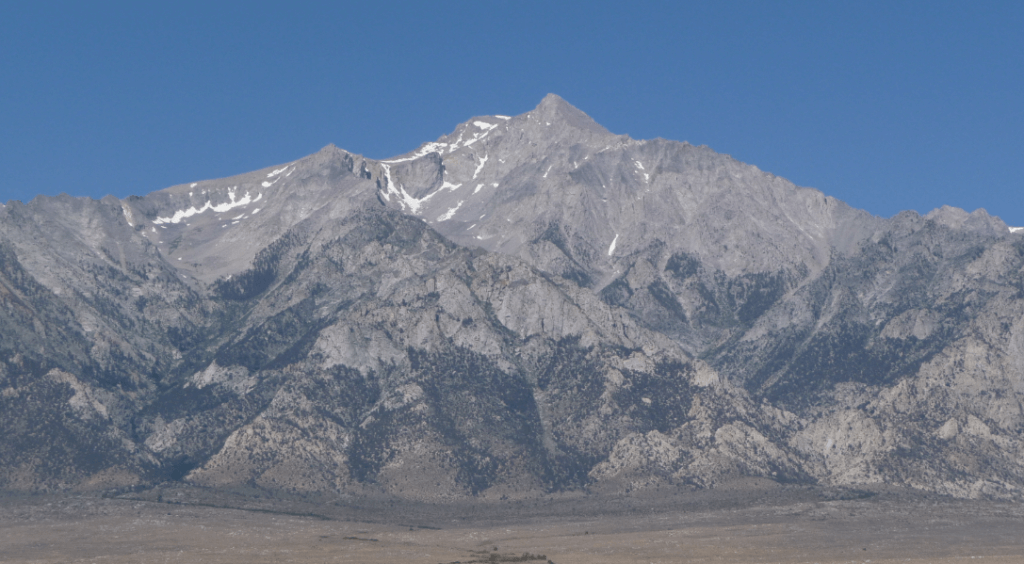
Mount Williamson, soaring to 14,379 feet (4,383 m), holds the distinction of being both the Sierra Nevada range’s second-highest mountain and California’s. Ranked sixth in elevation in the contiguous United States, this towering peak is within the John Muir Wilderness. Its proximity to Mount Whitney, the tallest mountain in the contiguous US, is notable at a mere 6 miles (10 km) north. Meanwhile, Shepherd Pass, which provides the closest trail access, is about 2.5 miles (4 km) to the southwest.
California can be found approximately 12 miles (19 km) to the north-north-east of Mount Williamson. An interesting geographical note is that although the mountain is located roughly 1 mile (1.6 km) east of the Sierra Crest – the boundary that demarcates the western edge of the Owens Valley. Its position places it somewhat closer to the Owens Valley floor compared to Mount Whitney. This positioning emphasises its grandeur. This is because there’s a sheer drop of 8,000 feet (2,400 m) from the summit to the forest’s edge within about 4 miles (6.4 km). Yet, despite its majestic presence, Mount Williamson remains less frequented by climbers than its loftier counterpart, Mount Whitney.
19. Blanca Peak: Colorado’s Sierra Blanca Apex

Situated prominently in the Rocky Mountains, Blanca Peak, known in Navajo as Sis Naajinį́, ranks the fourth loftiest summit in North America and Colorado. Rising to an impressive 14,351 feet (4,374 m), this peak takes the crown as the pinnacle of the Sierra Blanca Massif, the Sangre de Cristo Range, and the broader Sangre de Cristo Mountains. It is located a mere 9.6 miles (15.5 km) to the north of the Town of Blanca. Moreover, this mountain delineates the boundary between Rio Grande National Forest and Alamosa County on one side and the historic Sangre de Cristo Land Grant alongside Costilla County on the other.
This towering summit is not only the zenith of both Alamosa and Costilla counties. It also dominates the entire drainage basin of the Rio Grande. Geographically, Blanca Peak surpasses the elevation of any other point in the US to its east.
Not far from its summit, approximately 251 feet (77 m) to the northeast, lies the tripoint of Alamosa, Costilla, and Huerfano counties. It marks the border of the San Isabel National Forest. Notably, this tripoint stands as the loftiest point in Huerfano County.
20. La Plata Peak: Colorado’s Silver Sentinel
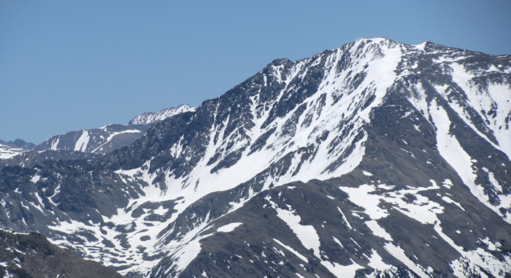
Nestled within the Collegiate Peaks Wilderness of San Isabel National Forest, La Plata Peak proudly stands as the fifth loftiest summit in the Rocky Mountains of North America, as well as the state of Colorado. Towering at an impressive 14,343 feet (4,372 m), this magnificent fourteener lies approximately 22.7 miles (36.5 km) northwest of Buena Vista in Chaffee County.
The peak’s name, “La Plata”, translates from Spanish as “The Silver”. This nomenclature pays homage to the area’s rich history of silver deposits. In the early 20th century, the vicinity witnessed the rise of silver mining towns, with Winfield and Hamilton standing out prominently. These towns, now ghostly remnants, serve as a testament to the region’s vibrant past. Adding to the mountain’s storied history, a team from the Hayden Survey ascended La Plata Peak for the first time on July 26, 1873.
It’s worth noting a discrepancy in records: the elevation marked as 14,361 feet on the USGS Mount Elbert Quadrangle is inaccurate. The correct height, based on the NGVD 29 vertical datum, is 14,336 feet.
21. Uncompahgre Peak: Colorado’s Volcanic Giant and Sixth Loftiest Summit
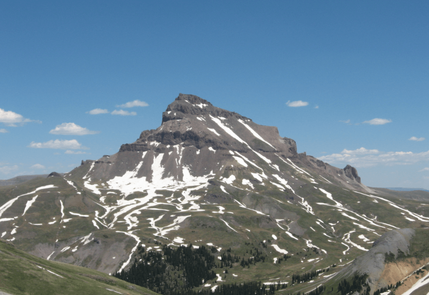
This mountain is located in the northern San Juans within the Uncompahgre Wilderness. It boasts the title of the sixth loftiest summit in North America’s Rocky Mountains and Colorado state. Towering at an elevation of 14,321 feet (4,365 m), this peak dominates the San Juan Mountains. Notably, it stands as the apex within the drainage basins of the Colorado River and the Gulf of California. To paint a geographical picture, this majestic mountain lies roughly 7 miles (11 km) west of Lake City in the northern reaches of Hinsdale County.
The peak is unique. Its vast summit plateau elevates approximately 1,500 ft (500 m) above the expansive alpine basins encircling it. While its southern, eastern, and western faces are relatively moderate in gradient, the northern facade presents a daunting 700 ft (210 m) cliff. This makes it a challenge for climbers. Though Uncompahgre emerges from volcanic roots, it is not classified as an active volcano.
For those adventurers inclined to ascend this towering giant, the most frequented path is the Uncompahgre National Forest Service Trail Number 239. This trailhead begins at the culmination of the Nellie Creek Road, positioned to the east-southeast of the peak. For accessibility, the Nellie Creek Road requires a four-wheel drive and can be reached via Henson Creek Road. Embarking on this trail promises a demanding hike, with a gain of 2,919 ft (890 m) throughout approximately 3.5 mi (6 km).
A hint of history is infused in the mountain’s name, derived from the Ute term “Uncompaghre”. This term can be translated as “dirty water” or “red water spring”. This nomenclature likely pays homage to many hot springs around Ouray, Colorado.
22. Crestone Peak: A Towering Jewel in Colorado’s Crestones
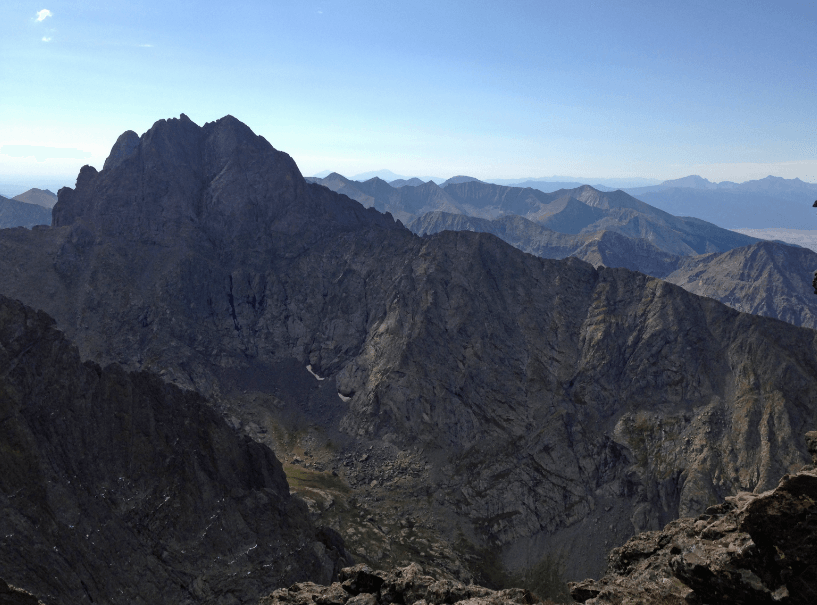
With its impressive elevation of 14,300 feet (4,359 m), Crestone Peak stands as the seventh-highest summit in the Rocky Mountains of North America, proudly positioned within Colorado. Among the renowned Crestones, this peak holds the distinction of being the tallest. Furthermore, within the majestic Sangre de Cristo Range, only Blanca Peak surpasses its height. This striking summit nestles within the protective embrace of the Sangre de Cristo Wilderness, a part of the Rio Grande National Forest. It is situated roughly 5.0 miles (8.1 km) to the southeast of the quaint Town of Crestone in Saguache County.
Dominating the landscape, Crestone Peak towers a staggering 7,000 feet (2,100 m) over the eastern fringe of the San Luis Valley. In the vicinity, one can also find the Crestone Needle, another significant fourteener sharing a namesake with Crestone Peak. These peaks, along with Kit Carson Peak, Challenger Point, Humboldt Peak, and Columbia Point, form the illustrious Crestones cluster in the Sangre de Cristo Range, known for their captivating beauty and challenge to adventurers, all of which can be approached from shared trailheads.
23. Mount Lincoln: A Tribute to the 16th US President in the Rockies
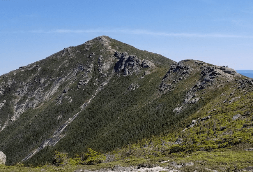
Prominently rising to 14,293 feet (4,356.5 m), Mount Lincoln is the eighth tallest peak in the Rocky Mountains of North America. This majestic summit, located in Colorado’s Pike National Forest, is not only the pinnacle of the Mosquito Range but also ranks as the eleventh-highest mountain across the contiguous United States. A mere 5.2 miles (8.3 km) away from the town of Alma, situated in Park County, Colorado, Mount Lincoln further distinguishes itself as the highest elevation point within the county and throughout the expansive drainage basin of the Missouri River. Moreover, as a testament to its historical significance, this towering peak was christened in tribute to Abraham Lincoln, the United States’ 16th President.
24. Castle Peak: Colorado’s Ninth-Highest and Its Unique Climbing Challenges
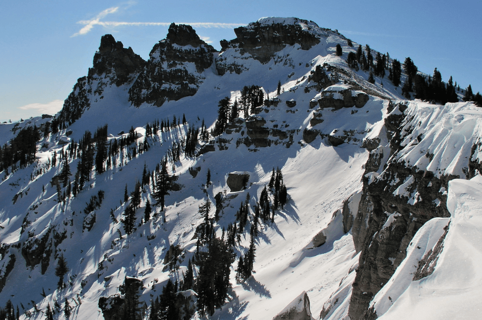
With its notable elevation of 14,279 feet (4352.2 m), Castle Peak stands as the ninth-highest summit of the Rocky Mountains in North America. Dominating the Elk Mountains and Maroon Bells-Snowmass Wilderness in Colorado, this peak sets itself apart on the drainage divide that separates the Gunnison National Forest from the White River National Forest. This geographical significance means the mountain is the loftiest point in both Gunnison and Pitkin counties.
Characterised by its castellated summit, Castle Peak offers climbers a diverse range of challenges. The Montezuma Glacier, a steadfast snowfield between Castle and Conundrum Peaks, presents its best face from June to September. As for the ascent, two predominant routes beckon to climbers. The Northwest Ridge provides a moderate snow climb that transitions into a straightforward ridge scramble. However, caution is advised in the later summer months when climbers encounter a stretch of loose dirt and scree near the Castle-Conundrum saddle’s pinnacle. On the other hand, the Northeast Ridge might start with a more benign snow climb but demands more rigorous scrambling and nuanced route-finding as one progresses along the ridge.
Adjacent to Castle Peak is Conundrum Peak, a northern offshoot. Possessing two summits nearby, its northern elevation surpasses 14,040 feet (4279+ m). While it stands merely 0.4 miles (0.6 km) from Castle Peak and has a distinct topographic prominence of 200 feet (61 m), it doesn’t match the conventional 300-foot (91 m) prominence benchmark to qualify as an independent peak. Nonetheless, its allure is undeniable, and many choose to ascend it alongside Castle Peak.
25. Grays Peak: A Pinnacle of the Continental Divide
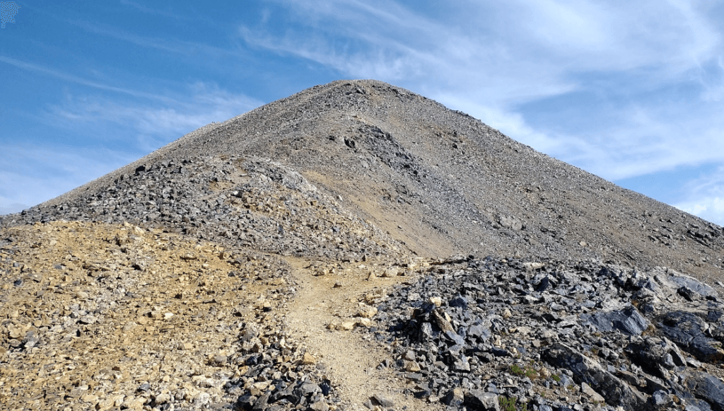
Situated in the heart of the Rocky Mountains, Grays Peak stands as the tenth-highest summit in North America and Colorado. Rising to an impressive height of 14,278 feet (4,352 m), this commanding fourteener doesn’t just dominate the Front Range. Furthermore, it holds the title of the loftiest point on both the Continental Divide and the Continental Divide Trail. Although there exist taller summits like Mount Elbert, they don’t have the privilege of being directly on the Divide. Nestled within the bounds of Arapahoe National Forest, Grays Peak lies approximately 3.9 miles southeast of Loveland Pass. It straddles the boundary between Clear Creek and Summit counties and marks the zenith.
Among Colorado’s renowned 53 fourteeners, Grays Peak holds a special place, not just for its stature but also for its history. In 1861, Charles C. Parry, a botanist, was the first to ascend this mountain officially and chose to dedicate its name to his esteemed colleague, Asa Gray. However, it wasn’t until 1872, a full eleven years later, that Gray himself had the opportunity to witness and scale the peak bearing his name. Furthermore, for those familiar with Colorado’s mountains, Grays Peak is frequently associated with its neighbouring summit, Torreys Peak.
26. Mount Antero: A Gemstone Giant in Colorado’s Southern Sawatch Range
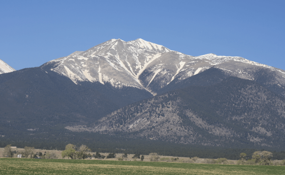
Situated in the southern Sawatch Range of the Rocky Mountains, Mount Antero stands as its highest peak, with an elevation of 14,276 feet (4,351.4 m). Nestled within the San Isabel National Forest, this majestic fourteener lies 12.2 miles (19.6 km) southwest of Buena Vista in Chaffee County, Colorado. The mountain pays tribute with its name to Chief Antero, a notable figure from the Uintah band of the Ute tribe.
Apart from its towering height, Mount Antero boasts a rich tapestry of gemstone deposits. It mainly draws attention to having one of the nation’s densest concentrations of aquamarine. The mountain’s bounty doesn’t go unclaimed; several active private mining claims are underway on its slopes and the nearby areas.
Lying directly south of Mount Princeton, which captures more immediate attention due to its distinct visibility, Mount Antero nonetheless makes a significant mark in the Sawatch Range. It commands an elevation rise of an impressive 7,200 feet above the town of Salida to its southeast. For those adventurous at heart, two main climbing routes beckon. One popular approach commences from the east, starting at the Browns Creek Trailhead, tracking alongside Little Browns Creek, and eventually joining Forest Road 1A, which leads nearly to the peak. An alternative route, originating near the historic ghost town of St. Elmo, takes climbers up Baldwin Creek via the same forest road. However, those opting for this path should anticipate considerable mining activity and a surge of tourists, especially in the summery months of favourable weather.
27. Mount Blue Sky: A New Identity in the Front Range
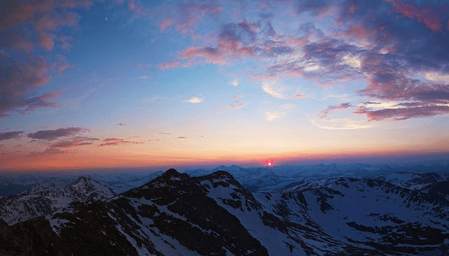
In the Mount Evans Wilderness within the majestic Front Range of the Rocky Mountains, Mount Blue Sky, which stands at an impressive height of 14,271 feet (4,350 m), is the region’s highest peak. Additionally, this iconic fourteener lies 13.4 miles (21.6 km) southwest of Idaho Springs in Clear Creek County, Colorado, marking the drainage divide between the Arapaho and Pike National Forests.
Dominating the western skyline of the Great Plains, Mount Blue Sky shares this distinction with other notable Front Range peaks such as Pikes Peak, Longs Peak, and the nearby Mount Bierstadt. Its prominence is such that it’s visible from over 100 miles (160 km) to the east and offers panoramic views in multiple other directions. The mountain’s silhouette looms large over the Denver metropolitan area, towering over 9,000 feet (2,700 m) above it. Furthermore, it can be observed from locations as diverse as Castle Rock to the south, Fort Collins to the north, and even Limon to the east.
The peak’s former name, Mount Evans, was a topic of discussion for several years. This is due to its association with Territorial Governor John Evans and the unfortunate events of the Sand Creek Massacre. The United States Board on Geographic Names eventually renamed it Mount Blue Sky on September 15, 2023.
28. Longs Peak: Colorado’s Northernmost Fourteener and Its Historical Significance: Longs Peak
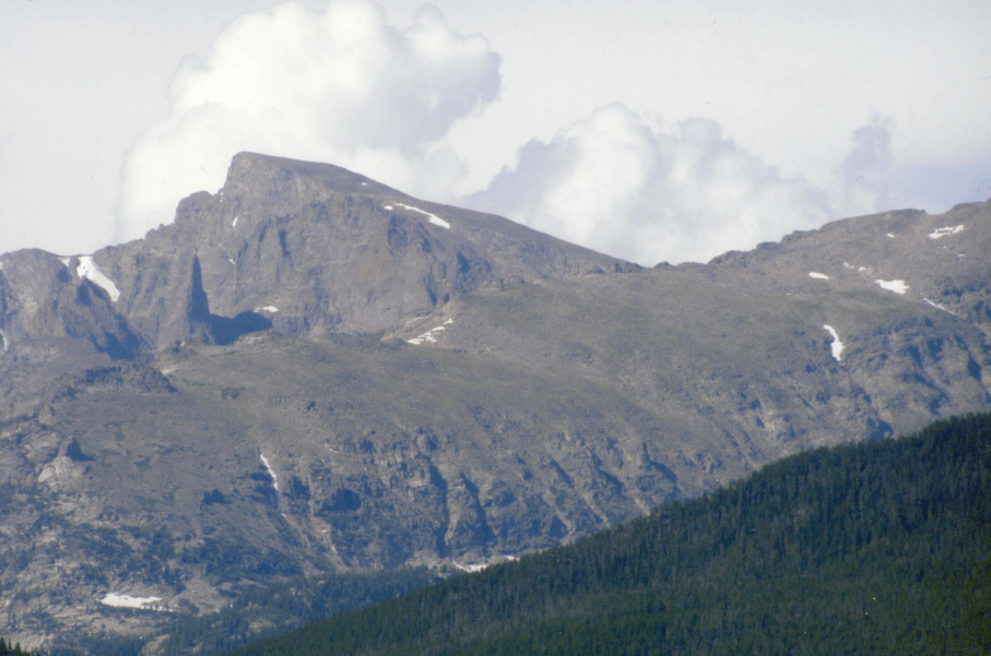
Also known as Neníisótoyóú’u, Longs Peak stands as a notable sentinel in the northern Front Range of the Rocky Mountains. With a height of 14,259 feet (4346 m), it claims the title of the northernmost fourteener in Colorado’s Rocky Mountains. Its strategic location within the Rocky Mountain National Park Wilderness is 9.6 miles (15.5 km) southwest of the picturesque Town of Estes Park. As the highest pinnacle in Boulder County and Rocky Mountain National Park, Longs Peak is not only geographically significant. It also carries historical weight. The mountain’s name pays tribute to Major Stephen Harriman Long. He was the first explorer to lay eyes on the Front Range in June 1820 during a US government-sanctioned expedition.
For those in Colorado, Longs Peak is a familiar sight. From the vantage points of Longmont, it hides behind Mount Meeker, while in Loveland, its prominence is more direct. Indeed, as one traverses the northern Front Range Urban Corridor, the mountain’s grandeur is unmistakable. Its stature is particularly striking when considering its rise of 9,000 feet (2,700 m) from the Great Plains. This makes it one of Colorado’s most dominant elevations.
Adjacent to Longs Peak is Mount Meeker, standing tall at an elevation of 13,911 feet. The proximity and stature of these two peaks have led to their collective reference as the “Twin Peaks”. It is a moniker distinct from the nearby Twin Sisters mountain.
29. Mount Wilson: San Miguel’s Majestic Summit
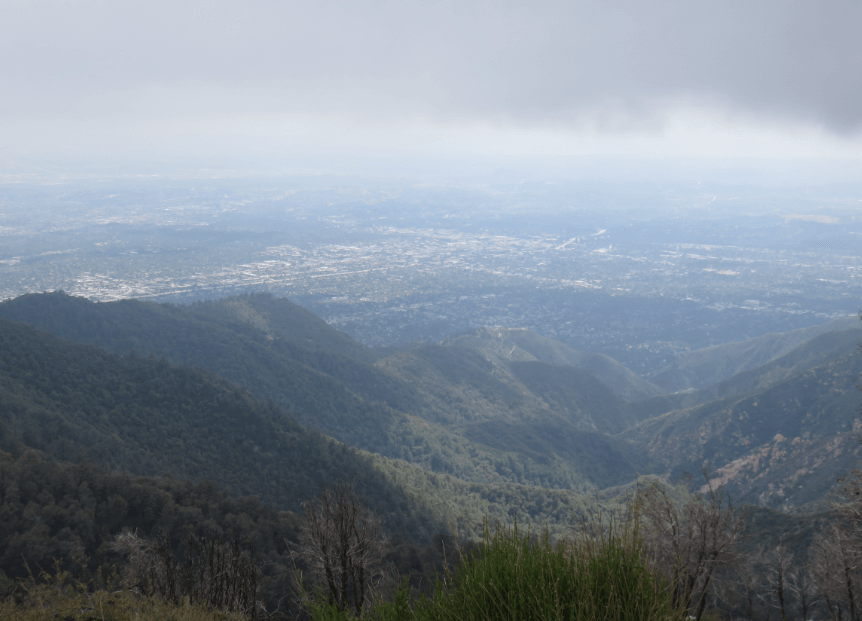
Nestled within the Lizard Head Wilderness of San Juan National Forest, Mount Wilson stands as the crowning glory of the San Miguel Mountains range. With its impressive height of 14,252 feet (4,344 m), this majestic peak is located a mere 10.6 miles (17.1 km) north by east of the Town of Rico, situated in Dolores County, Colorado. Distinctly, Mount Wilson towers above its neighbour, the lower Wilson Peak, and they shouldn’t be mistaken for one another.
The history of Mount Wilson’s name is rooted in homage to A.D. Wilson, a noted topographer associated with the Hayden Survey. Interestingly, Wilson was among the pioneers who first summited this mountain. He took the challenging south ridge route on September 13, 1874—a pathway that remains infrequently ventured by modern climbers.
30. White Mountain Peak: California’s Unique Fourteener
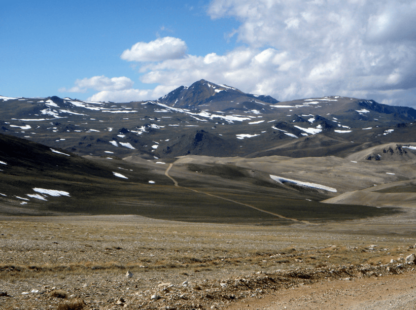
Often referred to as White Mountain, the White Mountain Peak is a testament to California’s diverse topography. With an elevation of 14,252 feet (4,344 m), it claims the title of the highest point in the White Mountains and Mono County. Moreover, within the state’s borders, only Mount Whitney and Mount Williamson surpass its height. Contrary to its name, the mountain’s summit reveals a dramatic landscape with dark patches punctuated by striking orange scree and rock. This unique colouration results from the Mesozoic metavolcanic rock formation, a spectacle of ancient lava transformed by rising granite.
In a broader context, White Mountain Peak is notable on the national stage. It ranks as the fourteenth most topographically prominent peak in the contiguous United States. Remarkably, it is one of two Californian fourteen peaks soaring above 14,000 feet outside the renowned Sierra Nevada. The other is the distant Mount Shasta in the state’s northern reaches within the Cascade Range. Setting it further apart, White Mountain Peak has the distinction of being the sole fourteener in the contiguous US. This is outside the Rocky Mountains, the Cascade Range, or the Sierra Nevada. Its location is firmly within the Inyo-White Mountains range.

