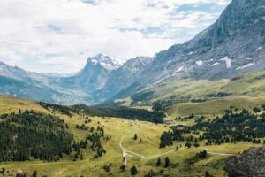
In the heart of Switzerland lies its major geographical feature, the Swiss Alps, alternatively known as Schweizer Alpen in German, Alpes suisses in French, Alpi svizzere in Italian, and Alps svizras in Romansh. The Swiss Plateau, Jura Mountains and the Swiss Alps collectively constitute the three significant physiographic regions of Switzerland. Spanning both the Eastern and Western Alps, the Swiss Alps encompasses an area colloquially referred to as the Central Alps.
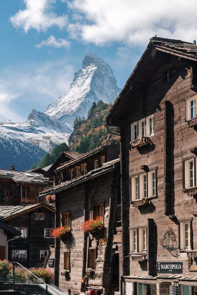
From the Bernese Alps to the Appenzell Alps, Switzerland’s northern ranges belong solely to the country. However, the southern ranges, which begin from the Mont Blanc massif and end at the Bernina massif, are shared with neighbouring nations, including France, Italy, Austria, and Liechtenstein. Among the Alpine peaks, the Swiss Alps holds most of the tallest mountains, such as the towering Dufourspitze at 4,634 meters, the Dom at 4,545 meters, Liskamm at 4,527 meters, the Weisshorn at 4,506 meters, and the iconic Matterhorn at 4,478 meters. Other significant peaks follow these in the comprehensive list of Switzerland’s mountains.
Woven into the tapestry of history, transits across the Alps have been significant since the Middle Ages. Particularly, the region north of St. Gotthard Pass crystallized into the Swiss Confederacy’s nucleus in the early part of the 14th century.
Comprehensive Overview of the Swiss Alps’ Geography and Environment
Switzerland, covering 41,285 square kilometres (15,940 sq mi), is dominated by the Alps, which occupy 60% of its landmass, thus making it highly alpine. Although the Alps span 192,753 square kilometres (74,422 sq mi), only 14% of that lies within Switzerland. Within this portion are 48 of the 82 alpine peaks over 4,000 meters, with the remaining 34 positioned mainly within 20 kilometres (12 mi) from the Swiss border.
The Swiss Alps are also home to extensive glacial areas, covering 1,220 square kilometres (470 sq mi), which makes up 3% of Switzerland’s total area. This constitutes 44% of the total glaciated area in the Alps, which is 2,800 square kilometres (1,100 sq mi).
Geographically, the Swiss Alps are located south of the Swiss Plateau and north of the national border. The boundary separating the Alps and the plateau stretches from Vevey along Lake Geneva’s shores to Rorschach on Lake Constance’s shores. It passes near many cities, including Thun and Lucerne. The vaguely-defined regions in Switzerland bordering the Alps, particularly on the northern side, are known as the Swiss Prealps. These regions mainly comprise limestone and rarely exceed 2,500 meters (8,200 ft).
The Swiss Alps stretch across different cantons, namely Valais, Bern, Graubünden, Uri, Glarus, Ticino, St. Gallen, Vaud, Obwalden, Nidwalden, Schwyz, Appenzell Innerrhoden, Appenzell Ausserrhoden, Fribourg, Lucerne and Zug. The mountain ranges also extend towards neighbouring countries such as France, Italy, Austria, and Liechtenstein, from west to east.
Exploring the Major Mountain Ranges of the Swiss Alps
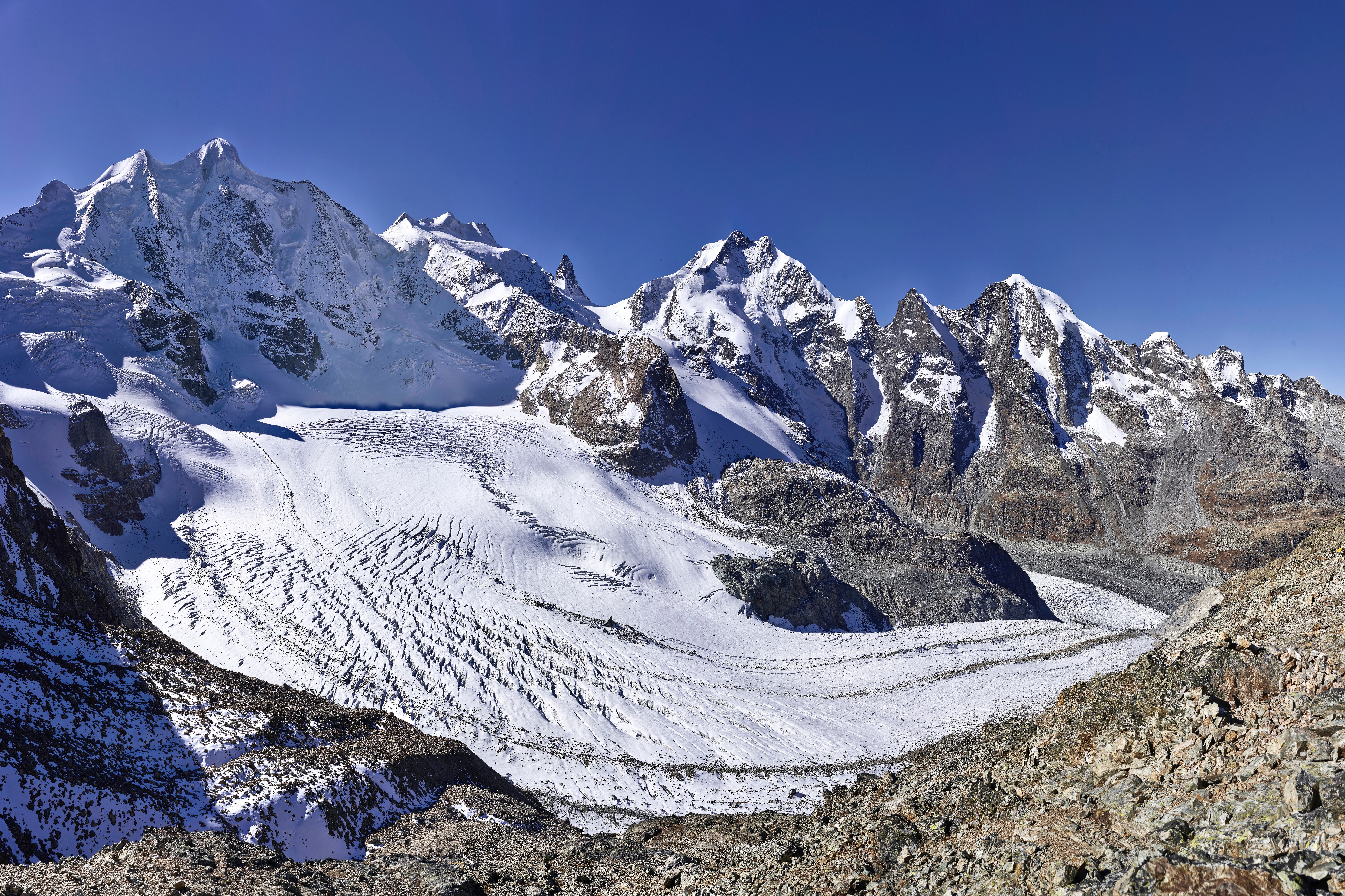
Separated by the Rhine from Lake Constance to the Splügen Pass, the Swiss Alps conventionally split into the Eastern and Western Alps. The Western Alps, more expansive, envelop most of Switzerland, while the more abundant but smaller Eastern ranges nestle within the confines of the Graubünden canton. These Eastern ranges, barring the Ortler Alps – part of the Southern Limestone Alps – belong to the Central Eastern Alps. The nation’s highest ranges include the Pennine, Bernese, and Bernina Range, with 38, 9, and 1 summits surpassing 4000 meters, respectively. The Appenzell Alps, with a height of 2500 meters, remain the lowest range.
Switzerland is home to most of the Alps’ highest peaks, such as the Dufourspitze, more commonly known as the Monte Rosa (4,634 m), the Dom (4,545 m) – the highest peak residing solely in Switzerland – the Liskamm (4,527 m), the Weisshorn (4,506 m), and the Matterhorn (4,478 m). The Alps’ highest peak, Mont Blanc (4,807 m), straddles the French-Italian border, with its eastern foothills extending into Switzerland.
Of the 82 Alps peaks exceeding 4000 meters, 48 are in Switzerland, with the remaining 34 almost all within 20 kilometres of the Swiss border. The primary subranges of the Swiss Alps include:
- The Pennine Alps, delineating the Swiss and Italian border, are home to 38 of Switzerland’s 4,000-meter peaks, many of which cluster around Zermatt, providing unparalleled views from its high perches.
- The Bernese Alps sit north of the Pennine Alps and Switzerland’s Rhone Valley. Nine peaks here exceed 4000 meters. Often labelled as the Bernese Oberland, corresponding to the mountains rising above the Swiss canton of Bern, the Bernese Alps comprise eminent peaks like the Eiger, Mönch, and Jungfrau within the widely-known Jungfrau Region. The Eiger, famed for its imposing North Face, however, barely misses the 4,000-meter mark.
- The Bernina Alps in the southeastern Swiss canton of Graubünden host the solitary Swiss peak above 4,000 meters and envelope the St. Moritz ski resort.
Swiss Alps: Home to the Majority of Alpine Glaciers
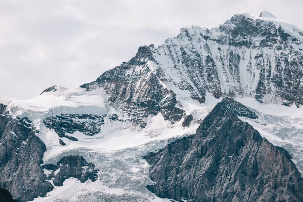
The Swiss Alps are home to 44% of the entire glaciated region of the Alps, covering a sweeping area of 1,220 square kilometres. This majestically icy landscape represents 3% of the country’s total area. The striking mountainous region of Jungfrau in the Bernese Alps is celebrated as the hub of the highest concentration of glacial expanses in the Alps.
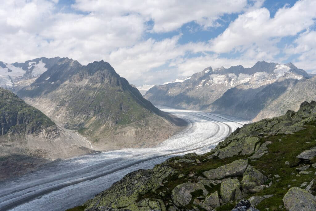
The spectacular Greater Aletsch Glacier, boasting the title of the largest and longest glacier within the entire Alps region, is a noteworthy attraction in the Bernese Alps, reaching optimal depths of 900 meters. This stunning area, which includes the Fiescher and Aar Glaciers, was recognized for its natural beauty and geological importance when the encompassing Jungfrau Region was designated a UNESCO World Heritage Site in 2001.
River Systems of the Swiss Alps
The Swiss Alps’ northern slope is shaped by the Rhône, Rhine, and Inn rivers, the latter being part of the Danube basin. In contrast, the southern slope is primarily nourished by the Ticino River from the Po basin. The northern rivers flow towards the Mediterranean, North, and Black Seas, while the Po River from the south drains into the Adriatic Sea.
Switzerland is home to three significant triple watersheds in the Alps: Piz Lunghin, Witenwasserenstock, and Monte Forcola. The European Watershed, a divider between the Atlantic (North Sea) and Mediterranean Sea (Black and Adriatic Sea) basins, runs between Witenwasserenstock and Piz Lunghin. However, this watershed only partially lies on the main alpine chain.
With 6% of Europe’s freshwater housed within its borders, Switzerland has often been dubbed the “water tower of Europe.”
Mountain Lakes in the Swiss Alps: A Study of Natural and Artificial Water Bodies
Prominently positioned within Alpine regions are the world’s loftiest dams, which give rise to substantial artificial mountain lakes. These striking bodies of water not only serve as beautiful scenic attractions but also function as hydroelectric reservoirs. Some of these man-made lakes are found perched above the 2,300-meter mark. Conversely, naturally occurring lakes exceeding 1 km² in size are typically located below 1,000 meters. Notable exceptions include Lake Sils in Engadin and Oeschinen in the Bernese Oberland. An intriguing phenomenon occurs when low-altitude glaciers melt, generating brand-new lakes. This process led to the creation of the Triftsee, a 0.25 km² large lake which materialized between 2002 and 2003.
Innovative Energy Solutions in Switzerland Amidst Glacial Melting
As the climate transitions, Switzerland has seized the opportunity to innovate new energy production methods. The country is heavily reliant on hydroelectricity for its nearby communities, which is problematic as melting glaciers cease to refreeze, disrupting energy creation. Scholars have been examining the anticipated shifts in the terrain as glaciers dwindle, delving into potential building expenses, projected energy output, and foreseeable issues with these novel developments.
The need to redefine the future of energy production in the face of climate change isn’t unique to Switzerland, it is a worldwide concern. However, Switzerland leads the charge in devising innovative and imaginative solutions, forming a blueprint the international community will inevitably need to adopt.
Tracking Permafrost and Glacial Shifts in the Swiss Alps with PERMOS
The Swiss Permafrost Monitoring Network (PERMOS) aims to generate enduring scientific records of permafrost shifts within the Swiss Alps. It garners up-to-date data on alpine conditions by documenting various metrics, including permafrost temperatures, thermal fluctuations within boreholes, ground surface temperatures, the base temperature of the snow layer, and the progression of snow cover.
Additionally, PERMOS periodically captures aerial photographs from specific regions. It consistently refines these monitoring methodologies, incorporating new findings and data gathered over time. Notably, over the past 90-120 years, the region’s glaciers have lost approximately half of their volume, pointing to significant environmental changes within the Swiss Alps.
Swiss Alps: Protecting Biodiversity and Climate Zones Amid Glacial Melting
In a determined effort to preserve threatened species, some key locations have been designated as protected zones. The initiative began in 1914 when the Swiss National Park in Graubünden was founded, marking the birth of the first alpine national park. In 2001, the Entlebuch district was bestowed the title of a biosphere reserve. Switzerland’s most extensive protected region is the Parc Ela, inaugurated in 2006, which encompasses an impressive 600 square kilometres. Notably, the Jungfrau-Aletsch Protected Area bears the honor of being the Alps’ first World Heritage Site.
Understanding Altitudinal Climate Zones in the Swiss Alps
In the Swiss Alps, a distinctive climatic division is observed, attributed to the decrement in temperature with altitude. On an annual average, the temperature falls by 0.56 °C for every 100 meters ascended, thus creating three unique altitudinal zones, each characterized by its unique climatic conditions.
Understanding the Subalpine Zone of the Swiss Alps
Positioned beneath the tree line, the Subalpine zone marks the most expansive and significant of the three regions found in the Swiss Alps. This zone is vibrant with human settlements and fertile lands, bringing a sense of human proximity to the fragile landscapes of the Swiss Alps. Dominated by coniferous forests that stretch above elevations of 1,200-1,400 meters, while deciduous trees find their home at lower heights, this region represents an essential part of the overall alpine ecosystem.
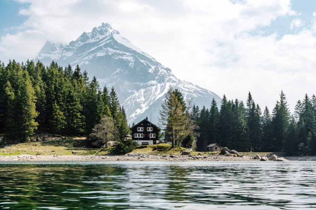
The upper bound of the Subalpine zone typically rests at roughly 1,800 meters on the northern flanks of the Alps, extending to approximately 2,000 meters towards the south. Nevertheless, these measurements can vary based on the specific geographical locale, as observed in areas like the Appenzell Alps, which descend to 1,600 meters, or the Engadin Valley, where the upper boundary rises to 2,300 meters. Thus, this geographical heterogeneity adds another layer of intrigue to the sublime beauty of the Swiss Alps.
Exploring the Treeless Terrain of the Swiss Alps’ Alpine Zone
Enveloped by chilly temperatures that prohibit tree growth, the Alpine zone, situated above the tree line, is defined by terrain comprising mostly grass, minute plants, and an array of exquisite mountain blossoms. The alpine meadows, which lay below the permafrost limit of around 2,600 meters, are often utilized for pasture. A few villages, such as Riederalp (1,940 m) and Juf (2,130 m), are nestled in the lowest altitudes. The formation of the first permanent snow defines the extent of the Alpine zone. Its altitude is between 2,800 and 3,200 meters, although this greatly varies depending on its location or orientation.
Understanding the Glacial Zone in the Swiss Alps
Areas of permanent snow and ice, known as the glacial zone, span regions of the Swiss Alps where the incline of the mountains isn’t too severe. These sites become repositories for snow that eventually compacts into ice, transitioning into flowing glaciers that can extend to heights as low as 1,500 meters, as evident with the Upper Grindelwald Glacier.
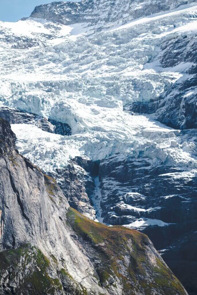
For mountainsides that are too precipitous, snow forms seracs or towering ice structures that, due to the glacier’s downward motion, periodically collapse and trigger ice avalanches. The Bernese Alps, Pennine Alps, and Mont Blanc Massif host the majority of the Alps’ glaciated expanses. Aside from a handful of research stations, such as the Sphinx Observatory, these virtually inaccessible stretches of the Alps remain devoid of human habitation.
Climate Change Effects on the Swiss Alps: From Glacial Melting to Economic Risks
As weather patterns shift, warmer, drier summers and moister winters are anticipated in the Swiss Alps. This transformation is linked with heightened risks of serious rock slides and massive flooding due to heavier precipitation. Changes in geography and wildlife stemming from melting permafrost zones are also projected. Increased frequency of natural hazards such as avalanches and landslides heightens the danger.
The supply of water previously provided by the glaciers is dwindling, posing challenges to energy production, agriculture, and other human needs. An additional consequence of the glacial melting is the risk to the economy as tourism and recreation services, typically bolstered by these glaciers and ecosystems, may see diminished revenue.
These wide-ranging effects are disruptive to adjacent communities, necessitating the implementation of modern infrastructure and safety measures to avert catastrophic events.
Historical Evolution and Current Trends in Swiss Alps Tourism
The Swiss Alps welcomed the dawn of alpine tourism with the initial ascents of its famed peaks, notably Jungfrau in 1811, Piz Bernina in 1850, Monte Rosa in 1855, Matterhorn in 1856, Dom in 1858, and Weisshorn in 1861. These climbs were accomplished predominantly by British alpinists in the company of local guides during the Golden Age of Alpine Mountaineering.
Infrastructure was developed in the mid-nineteenth century to accommodate the growing tourism. Hotels and mountain huts began to feature around the landscape, the Swiss Alpine Club was formed in 1863, and railways started to crisscross the mountains, such as the Rigi in 1873, Pilatus in 1889, and Gornergrat in 1898. Notably, in 1912, the Jungfraubahn inaugurated a service leading to the highest train station in Europe – the Jungfraujoch.
Tourism pioneer Thomas Cook curated the first global group tour in 1863, introducing thrill-seekers to Switzerland. Further underlining this era’s significance, the inception of winter tourism in the Alps can be traced back to the British tourists’ first visit to St Moritz in 1865.
Exploring the Swiss Alps: A Haven for Summer Hiking and Mountaineering
Boasting an impressive network of 62,000 kilometres of perfectly maintained trails, Switzerland is indisputably a trekker’s paradise. A substantial part of this network, specifically 23,000 kilometres, sprawls across the mountainous terrains, providing hikers with a slice of adventure and thrill. These mountains, with their massive 4000-meter summits and striking north faces like Eiger, Matterhorn, and Piz Badile, magnetize alpinists across the globe.
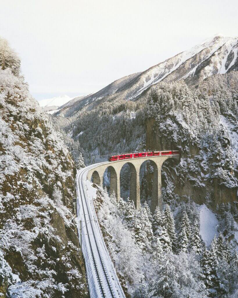
The country’s expansive winter resorts transform into sought-after destinations during the summer season too. The reason? Most of the aerial tramways that operate year-round make conveniently scaling high altitudes a breeze for hikers and mountaineers. Notably, Europe’s highest summit, the Klein Matterhorn, enjoys a unique distinction – a cable car service caters to it, making it a standout attraction for enthusiasts seeking outdoor excitement in Switzerland’s Alps.
Exploring Winter Sports Destinations in the Swiss Alps
Pioneering winter sports destinations found in Valais, Bernese Oberland, and Graubünden are renowned for their skiing amenities. Unique attributes include villages such as Riederalp and Bettmeralp that exclude cars entirely, relying solely on public transportation for access. Zermatt and Saas-Fee, while not exclusively winter destinations, also boast phenomenal summer skiing areas. The Swiss ski season, in general, kicks off in November and extends through May. Despite this elongated season, the abundance of ski resorts predominantly unveils their winter charm from December to April.
Impacts of Climate Change on the Swiss Alps Tourism Economy
Climate alterations are imposing a profound impact on European Alpine tourism due to an upsurge in frequency and severity of natural hazards, thus threatening the accessibility and infrastructure of many coveted tourist spots. The beauty of the Alpine landscape isn’t left untouched by climate change, as the thawing glaciers start to affect it dramatically. In addition, the elevating winter temperatures could lead to a condensed skiing season, and snow coverage might dwindle due to these climatic modifications, limiting its quantity.
With these climatic and geographical shifts, there’s been a marked decrease in the number of tourists, alongside diminished revenues. This could potentially have a striking economic influence on winter tourism. To combat these incoming threats, Switzerland has adopted the method of artificial snow production to maintain the demand for these tourist hotspots and ensure the stability and prosperity of the economy.
Exploring the Extensive Transport Network in the Swiss Alps
Known for its extensive transport system, the Swiss Alps and Switzerland offer seamless accessibility to virtually every mountainous village. This connectivity is made possible through various transportation methods ranging from railways and buses to funiculars and cable cars. The key operators of this harmoniously integrated public transportation system comprise of:
- Swiss Federal Railways (SBB CFF FFS)
- Rhaetian Railway (RhB)
- Matterhorn Gotthard Bahn (MGB)
- GoldenPass Line
- PostBus (PostAuto / CarPostal / AutoPostale / Auto da Posta)
The alpine regions are conveniently situated within 1 to 3 hours of Switzerland’s primary cities and their corresponding airports. The Engadine in Graubünden stands 3 to 6 hours apart from major cities. The scenic train ride, be it through the Glacier Express or the Bernina Express, attracts numerous tourists.
Located near St. Moritz, Engadin Airport stands at a towering height of 1,704 meters, making it the tallest airport in Europe.
The Alps constitute a significant divide in certain parts of the European continent. This necessitated the creation of efficient transit routes through the Alpine range. Since the onset of industrialization, Switzerland has seen continuous improvements and developments in its transalpine network. This progress began in the year 1882 with the construction of the Gotthard Rail Tunnel, followed by the Simplon Tunnel in 1906, the Lötschberg Tunnel in 1913, and the Lötschberg Base Tunnel in 2007. The most recent addition to this list is the 57.1-km long Gotthard Base Tunnel, the world’s longest railway tunnel, providing a direct, flat rail link through the Alps since its inauguration in 2016.
Exploring the Swiss Alps: 15 Must-Visit Destinations and Attractions
Exploring Lucerne: A Scenic Gateway to Swiss Alps Adventures
Nestled alongside the glittering Lake Lucerne and ensconced at the foot of Mount Pilatus, the city of Lucerne proudly stands as one of the most picturesque locations in Switzerland. The city also serves as a favoured starting point for voyages into the Swiss Alps. Lucerne’s historic medieval centre is a must-experience, which can transition smoothly into an exploration of the mountains for those who enjoy activities like hiking, cycling, or winter sports.
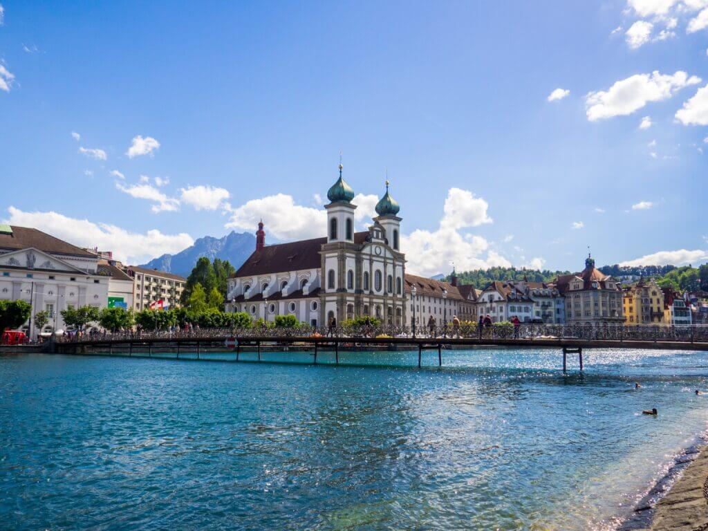
Adventures begin in the city with a leisurely walking tour, showcasing iconic Lucerne landmarks, including the Lion Monument and Chapel Bridge, recognized as the oldest covered wooden bridge across Europe. Cultural enthusiasts will relish a trip to the Picasso Museum, while a stop-off at the lakeside farmers markets will invigorate all senses. For history buffs, a stroll along the ancient fortifications of the Musegg Wall is highly recommended.
For those travelling from Zurich, one can come for a day trip that features two-way transportation coupled with a boat cruise on Lake Lucerne. Travellers opting for a longer visit may choose to venture further into the Alps to discover sights such as Mount Rigi, Mount Pilatus, and the Bernese highlands. Lucerne is also often included in multi-day tours of the Swiss Alps which cover other notable towns, including Interlaken, Gruyères, and Zermatt.
Exploring the Swiss Alps on Europe’s Highest Open-Air Railway: The Gornergrat Bahn
Established in 1898, the Gornergrat Railway, located in Switzerland, holds the title of being the highest open-air railway in Europe. This railway takes travellers and ski enthusiasts from the resort town of Zermatt up to the 10,135-foot-high station of the mountain. The journey rewards passengers with breathtaking sights of quaint Alpine hamlets, towering glaciers, and the prominent Matterhorn.
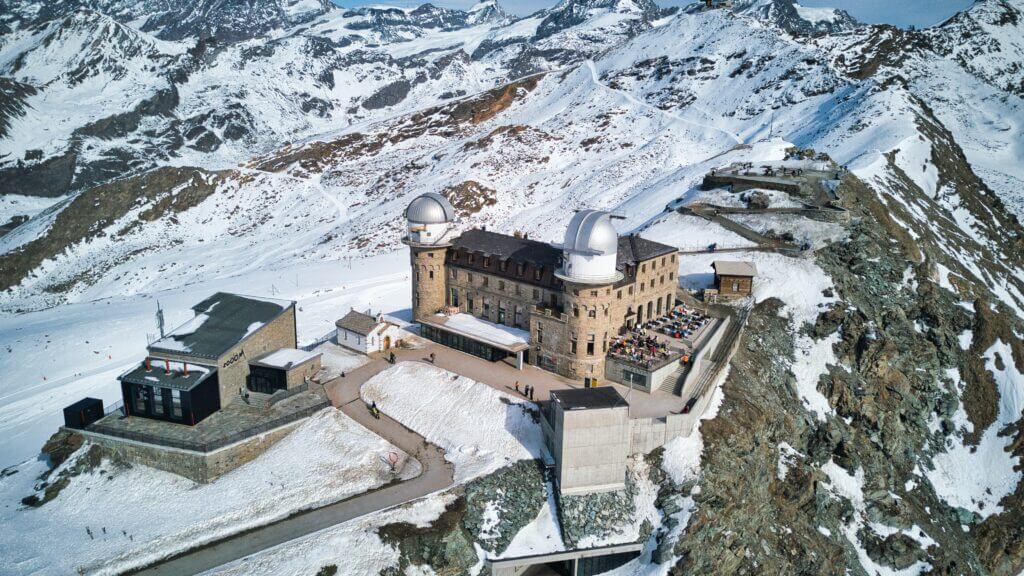
Upon boarding the classic cogwheel train, passengers are gradually guided to the vertiginous peak of Mt. Gornergrat. Once at the summit, guests can snap photos from the observation deck, shop at the highest shopping centre in Europe, indulge at a mountaintop dining establishment, or partake in outdoor adventures such as skiing, hiking, or sledging. There is a plethora of half or full-day activities to select from.
Day excursions often commence in a chief Swiss city, incorporating a mountainous trip with a walking tour of Zermatt or other Alpine wonders. Those opting for multi-day tours will experience a more extensive view of Switzerland, with certain tours even extending to neighbouring Italy or Liechtenstein. Further, the Swiss Travel Passes offer a discounted admission to the mountain railway and unlimited access to the broader transportation system of Switzerland.
Exploring the Sphinx Observatory at Jungfraujoch: The Top of Europe
Nestled high on a rugged cliff at an elevation of 11,716 feet (3,571 meters), the Sphinx Observatory stands as a functional laboratory housing an expansive telescope. This iconic structure is found on the peak of Jungfraujoch, also known as the “Top of Europe,” boasting breathtaking views of the Bernese Alps and beyond from its observation deck, one of the loftiest in Switzerland.
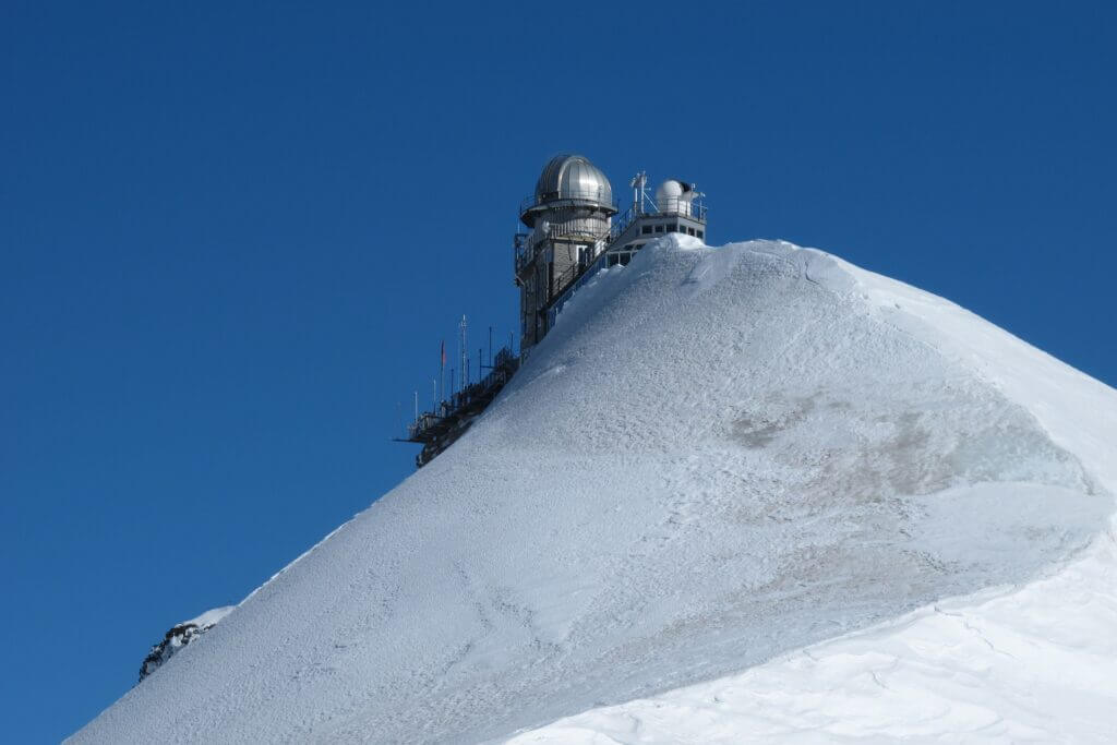
While the observatory itself remains closed to the public, the vistas it offers, a brief elevator journey from the Jungfraujoch railway station, attract many visitors. The summit features other attractions as well, such as an ice sculpture display, the Snow Fun Park providing sledging, skiing, and other frosty activities, and a snow-covered walk to Mönchsjochhütte, complete with comforting fondue.
Jungfraujoch tickets can be booked for a day excursion, or opt for a guided tour departing from principal cities like Bern, Zurich, and Interlaken. Alternatively, consider a multi-day itinerary visiting the observatory along with other nearby attractions.
Exploring the Picturesque Glacial Lake Thun in the Swiss Alps
Nestled near Interlaken, Lake Thun, locally known as Thunersee, is a captivating glacial lake. Its vibrant turquoise water, flanked by expansive mountains and valleys, encapsulates the quintessential beauty of Switzerland.
Alongside Lake Brienz, Lake Thun lends its name to the town of Interlaken— transmuting to ‘between lakes’. It serves as an idyllic location for tranquil spring strolls and blissful summer boat rides, ranking amongst the region’s most inviting destinations.
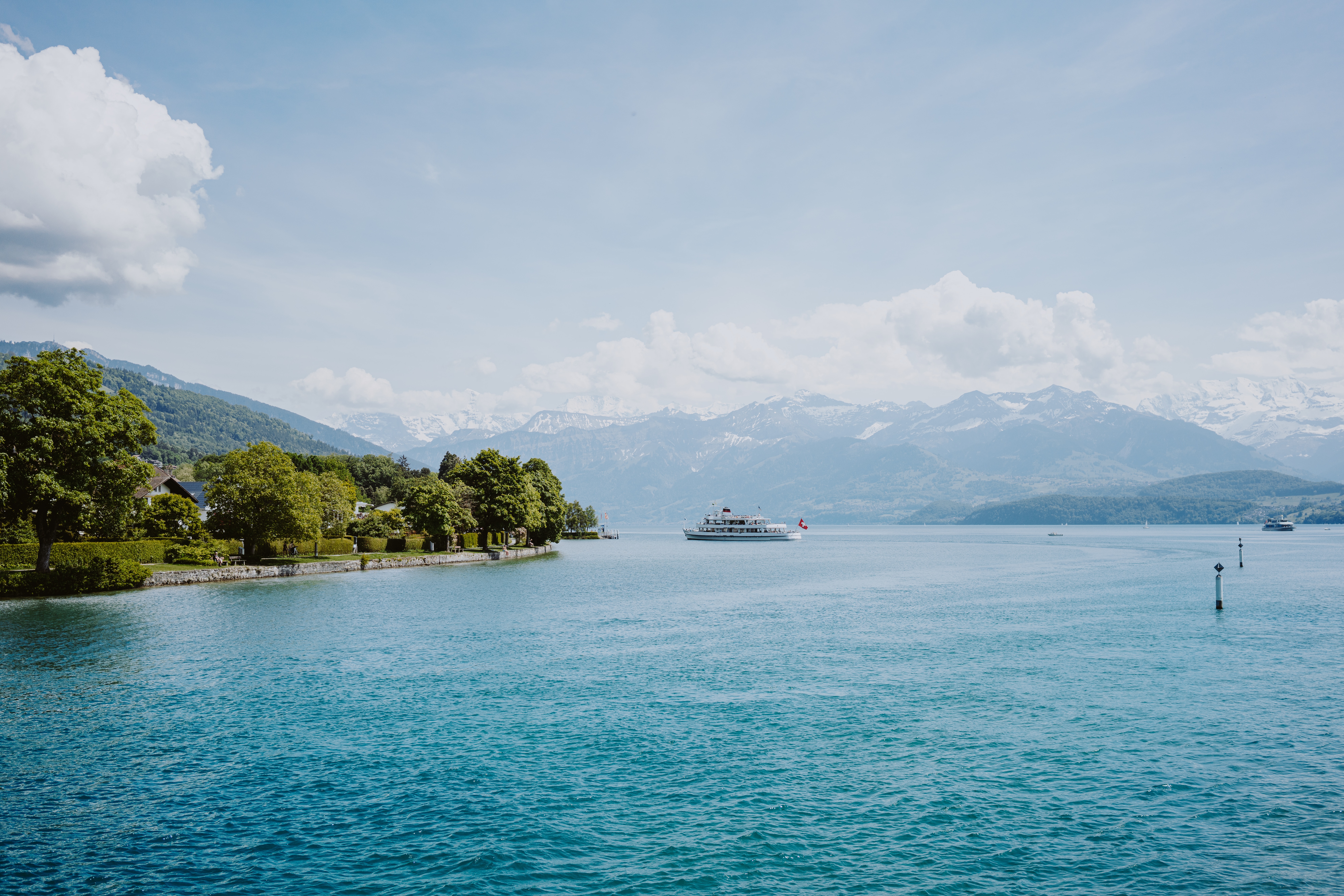
For those seeking physical activities, the hiking trails that commence from the lake’s northern side towards the St. Beatus Caves, reminiscent of the Hobbit, are remarkably enticing. On the other hand, day-long leisurely cruises that weave through the dual lakes hold an inherent charm for those with a more relaxed approach. To delve deeper into its treasures, visitors can embark on a guided tour that meanders the lakeshore by car or even a multi-day guided sightseeing adventure.
Exploring Harder Kulm: The Scenic Mountain Peak Over Interlaken
Situated in the lofty heights above the Swiss city of Interlaken, Harder Kulm viewpoint provides scenic panoramic vistas of the Berner Oberland region’s mountainous landscapes and charming valleys. Tourists can either ascend to this spot by hiking from the city or utilising the funicular railway for a relaxing journey. Upon reaching the viewpoint, one can relish the views, taste some refreshments, and indulge in numerous attractions.
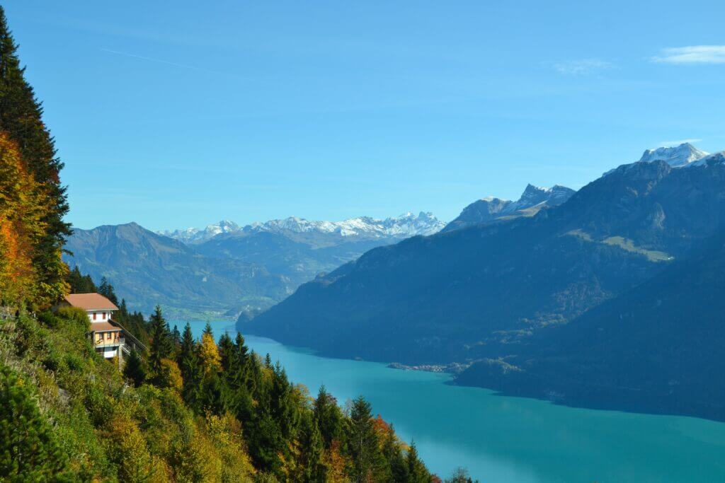
Being elevated at 4,334 feet (1,321 meters) above sea level, reaching the Harder Kulm viewpoint can be an arduous hike from Interlaken. Fortunately, the historic funicular railway eases this journey for visitors by transporting them to the top of the mountain, a service it has proudly offered for over a century. This journey only takes about 10 minutes, making it a convenient option for many.
On reaching the summit, there is the choice of relishing coffee or a meal at an ancient mountaintop castle that also doubles as a café. Adventurous visitors might be intrigued by the Two Lakes Bridge, a vertigo-evoking structure that extends over the valley, seemingly defying the laws of gravity. Additional amenities feature a family-oriented wildlife park, playgrounds, and array of hiking trails. For a relaxed excursion, consider purchasing funicular tickets or signing up for a guided half-day tour.
Exploring the Iconic Matterhorn Peak in the Swiss Alps
Popularly dubbed as the “Mountain of Mountains”, the Matterhorn stands as an iconic emblem of Switzerland, soaring at a striking height of 14,692 feet (4,478 meters). Among the tallest summits in Europe, its unique triangular outline has won international fame and even features prominently on the Toblerone chocolate brand logo, another manifestation of Swiss culture.
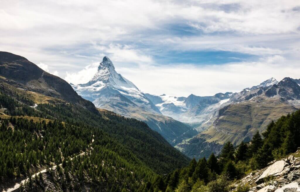
Embarking on an expedition to the Matterhorn often commences from the town of Zermatt, although day trips from several surrounding localities such as Zurich, Lucerne, Geneva, Montreux, or even Stresa in Italy across the boundary are quite feasible. Reaching the summit involves a fascinating cable car journey to Matterhorn Glacier Paradise, where breathtaking vistas encompassing the Swiss, Italian, and French Alps can be savoured. An alternate route involves a cogwheel railway ride to the summit of Mount Gornergrat, another nearby peak that offers spectacular views of the Matterhorn. Complementing the physical adventure, a visit to the Matterhorn Museum in Zermatt enriches the experience with insightful information about the pinnacle.
Exploring Lake Brienz: A Scenic Jewel in the Swiss Alps
Nestled adjacent to the well-known vacation hub of Interlaken, Lake Brienz (Brienzersee) exudes Swiss charm with its neighbouring idyllic village of Brienz. This enchanting location, known for its traditional wooden chalets, stands against a breathtaking backdrop of majestic, snow-capped Alps.
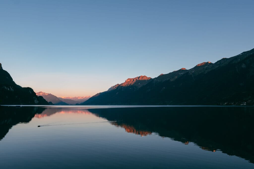
Lake Brienz stretches over a distance of 8.6 miles (14 kilometres) and extends 1.7 miles (2.8 kilometres) wide. The lake’s source, the Aare River, infuses it with a distinctive character. For an encapsulating experience, wander along the lakeside promenade, embark on scenic boat excursions and relish a ride on Switzerland’s oldest funicular railway. Other highlights include witnessing the captivating Giessbach Falls, which plunges down from a height of 1,640 feet (500-meters), hopping onto the Rothorn Bahn steam train to scale Mount Brienzer Rothorn and exploring over 300 miles (500 kilometres) of hiking trails that envelope the lake.
The common starting point for most travellers to Lake Brienz is the nearby town of Interlaken. Multiple guided day tours originating in this bustling hub offer a variety of experiences like hiking, biking, and cruising on Lake Brienz.
Exploring the Majestic Glacier Canyon in the Swiss Alps
Glacier Canyon showcases the mighty works of nature, having been shaped over time by the progression of the Lower Grindelwald Glacier. Waterfalls and streams cascading into the Lütschine River create an all-encompassing sensory experience on a stroll through the majestic canyon.
Nowhere to be seen, the glacier that sculpted this splendid canyon is absent, but its powerful hand in shaping the landscape is exhibited in the vestiges of its existence. Pathways flank the borders of the canyon while towering cliffs rise to a remarkable height of 330 feet (100 meters) on both flanks. An intriguing feature not to be skipped is the chain of “spiderweb” ropes that cross the canyon, positioned 23 feet (7 meters) above the cascade, challenging the bold to clamber or creep across.
Exploring the Glacial Wonders of Jungfrau in the Swiss Alps
Deemed a UNESCO World Heritage Site, the Jungfrau offers a towering spectacle nestled in the Swiss Alps. One can behold fascinating vistas of sprawling glaciers and snow-capped peaks that are part and parcel of the Bernese Oberland. A thrilling journey aboard a slim cog railway will take visitors to Jungfraujoch, also known as the “Top of Europe” where the breathtaking view of Aletsch Glacier, Europe’s lengthiest glacier, can be savoured.
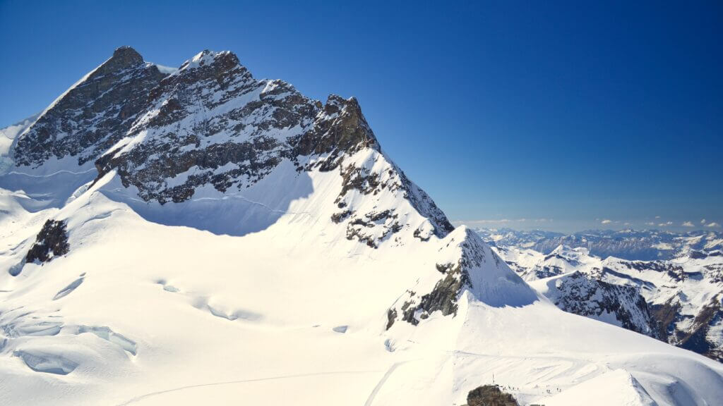
Several guided excursions are organized regularly from Zurich, Lucerne, Interlaken, and Bern, making the route to the Jungfrau enjoyable. These trips often include the cost of the cog train tickets and, in some instances, side trips to other picturesque locations in Bernese Oberland. For independent travellers, purchasing a train ticket beforehand is recommended to avoid the rush. A scenic journey then ensues, skirting the notorious foot of Eiger’s North Wall, passing through a tunnel carved out from a mountain, and finally arriving at Jungfraujoch, elevated at 11,330 feet or 3,454 meters. This height marks Europe’s loftiest railway station, which houses the Sphinx Observatory.
Perched at 3,454 meters high, the Jungfraujoch represents an extraordinary alpine landscape. This high-altitude marvel, situated in a UNESCO World Heritage district, offers a panorama between Mönch and Jungfrau mountains, thereby making it one of the most frequented spots in Switzerland.
Jungfrau is not only about glacial wonders, the surrounding regions such as Wengen, Murren, Grindelwald, and Lauterbrunnen also come to play, graced with some of the most commendable hiking trails globally.
Exploring Mt. Titlis: Central Switzerland’s Highest Peak and a Tourist Gem
Encompassing a height of 10,626 feet (3,239 meters) above sea level, Mt. Titlis, Central Switzerland’s loftiest peak, boasts a spectacular viewpoint. Its crowning feature is the sophisticated transportation, notably a rotating cable car that executes a full 360-degree turn while in transit to the topmost station, 9,908 feet (3,020 meters) high. Passengers are treated to magnificent, sprawling views of the majestic Alpine peaks, precipitous rock formations, and a dazzling glacier scored with icy crevasses.
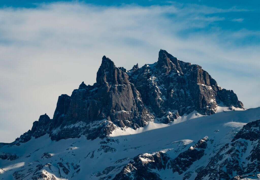
There are various methods to ascend Mt. Titlis. Visitors can acquire a cable car pass and independently wander to Engelberg, initiating an independent expedition to the summit. Simultaneously, arranged excursions that start from Zurich and Lucerne provide round-trip transportation to Engelberg. Winter disciplines many curated tours to include trips to popular nearby attractions like the Lion Monument, along with supervised snow sports add-ons such as tubing or skiing, accessible to beginners. During the balmy seasons, organized hiking tours are an enticing option.
Exploring Maienfeld: A Village Nestled in the Swiss Alps Known for Heidi and Wine
Recognized as the setting of the iconic children’s novel Heidi, the Swiss mountaintop hamlet of Maienfeld offers more than literary fame to its visitors. Nestled amidst mountainous terrain and the Bündner Herrschaft vineyards, this destination is celebrated for its bold, fruity red wines as well as its breathtaking alpine vistas.
The Heidi Trail (Heidiweg) links the Maienfeld railway station to the hills, offering a picturesque route to Heidi Village (Heididorf) in Oberrofels, situated at an altitude of 3,645 feet (1,111 meters). This mountain-close, family-friendly trail winds to Heidialp, the location of the reconstructed homestead of Heidi’s grandfather, Alpöhi. This scenic vista offers majestic panoramic views, enough to inspire the inner yodeler in anyone.
The convenience of one-day excursions from Zürich or Liechtenstein makes Maienfeld and the Heidi Village a frequent feature on many travel agendas. It should be noted that “Heidiland”, a term often seen in tour schedules, encompasses a broader area between Lake Walen and Chur and does not exclusively denote the village of Maienfeld. Should a visit to Maienfeld occur, many tours will include a detour to Salenegg Castle. One of the oldest wineries in Europe is found here, further cementing Maienfeld’s status as a noteworthy stop on any tour.
Exploring the Engadine Valley: A Prime Swiss Alps Destination
Stretching across 50 miles (80 kilometres) and hugging the Inn River’s path, the Engadine Valley is nestled in the heart of the Swiss Alps, making it a highly coveted holiday spot in Switzerland. Captivating visitors with its sunny climate, pristine lakes, and majestic alpine scenery, this bustling valley hosts notable destinations such as the famous St. Moritz, making it one of Europe’s most densely populated valleys.
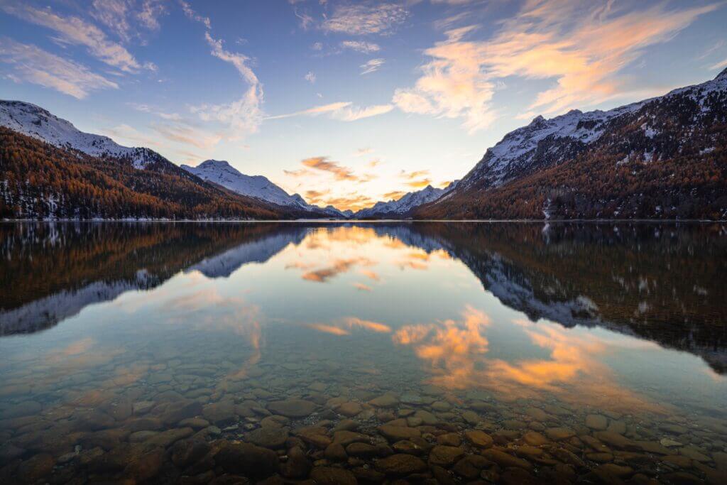
Among the many draws to Engadine is the Upper Engadine Valley, accessible via the Rhaetian Railway and Bernina Express. This area proudly displays the Bernina Range’s towering peaks, ski resorts, striking glaciers, and a variety of outdoor activities available throughout the year. Annual festivals and events contribute to the region’s allure, with notable highlights including skiing contests, horse racing, and snow polo on the frozen St. Moritz Lake. Winter months bring windsurfing marathons and the admired traditional horse-drawn sleigh parade.
Adventure seekers can also embark on all-day journeys from Milan on the historical Bernina Express, a renowned Swiss mountain train. These trips afford travellers leisure time to explore St. Moritz before their return journey to Milan.
Unveiling the Schilthorn Summit: Spectacular Views and James Bond Glamour in the Swiss Alps
The Schilthorn summit, nestled within Switzerland’s Bernese Alps, may not be a globally recognized name, but it nonetheless enchants with some of Europe’s most breathtaking mountain vistas. Set dazzlingly high at 9,744 feet or 2,970 meters, it captures extraordinary panoramas that encompass iconic peaks such as Jungfrau, the Eiger, and the more remote Mont Blanc.
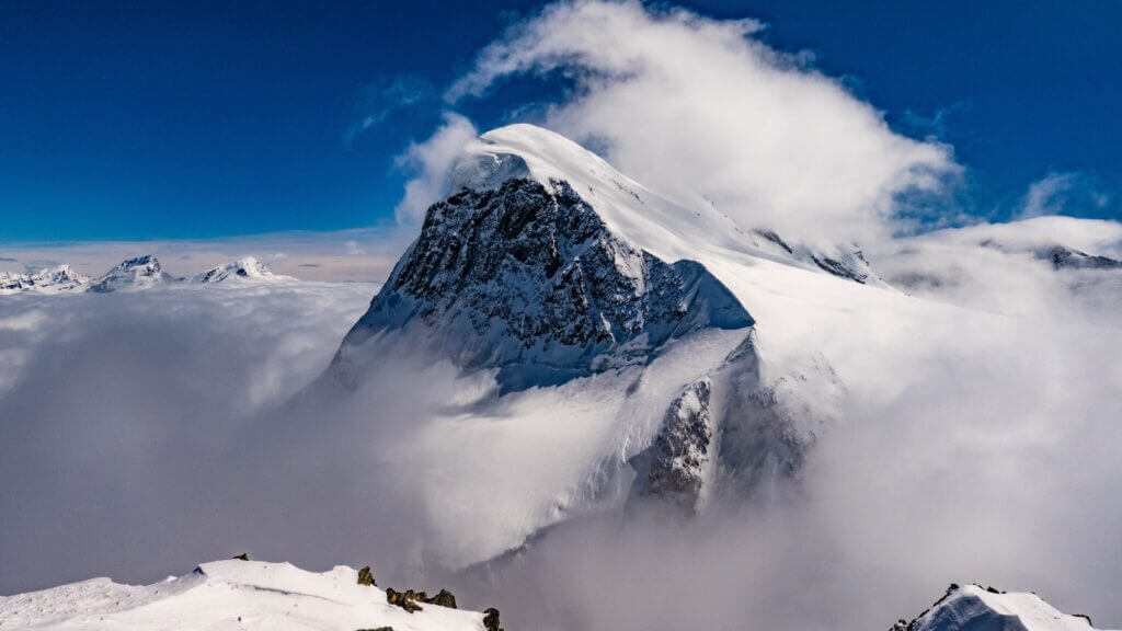
The summit also plays host to a unique revolving mountaintop diner known as Piz Gloria, which holds the distinction of featuring in the 1969 James Bond film, ‘On Her Majesty’s Secret Service.’ However, the standout feature at Schilthorn is surely the Thrill Walk, a 650-foot or 200-meter open-air observation pathway that promises awe-inspiring views.
Beyond the mountain’s natural landscapes and cinematic connections, further allure can be found at the interactive Bond World exhibition, the 007 Walk of Fame, and the enchanting Igloo7 snow igloo. Whether for a hearty meal or an adventure-packed outing, this Swiss summit is a must-see for every adventurer.
Exploring the Great Aletsch Glacier: Europe’s Largest Glacial Landscape in the Swiss Alps
Spanning more than 45 square miles (72 square kilometres), the Great Aletsch Glacier holds the title of being the most expansive glacial landscape on the European continent. Nestled in the eastern region of the Swiss Alps, it is bordered by towering peaks such as Eiger, Mönch, and Jungfrau.

The majority of hiking trails leading to the glacier’s southern slopes originate from the Alpine town of Brig. To the north, a relatively gentle yet popular trail guides adventurers from Eggishorn to Lake Märjela, concluding the trek at Fiescheralp. Those seeking an unparalleled train journey can ride to Jungfraujoch, the highest railway station in Europe, standing at an impressive 11,000 feet (3,352 meters) above sea level. This can be done independently or as part of a guided tour. The journey culminates at the Sphinx Observatory, where visitors are treated to astounding views of the glacier and snow-dusted peaks stretching out into France and Italy.
Experiencing the Swiss Alps aboard the Bernina Express Railway Route
Scaling to an impressive height of 7,392 feet (2,253 meters) above sea level over the Bernina Pass, the renowned Bernina Express ranks as one of the most picturesque railway routes throughout Europe. Stretching above 75 miles (122 kilometres) from Chur in Switzerland to Tirano in Italy, it is the sole railway that unites the North and South Alps, providing breathtaking alpine vistas.
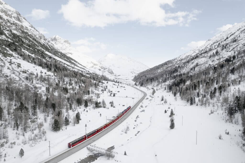
Taking the Bernina Express, also known as the Rhaetian Railway, travellers can journey between Tirano and Chur, a trip of 4 hours; to St. Moritz, a 2-hour trip; or to Davos, which takes approximately 3.75 hours. If only a single day is available, options include a reciprocal Bernina Express rail tour from Chur or St. Moritz or a round-trip day excursion from Milan to St. Moritz, inclusive of a Bernina Express journey and a return trip via bus. Zurich offers multi-day tours featuring an overnight stay in St. Moritz, a train and bus trip to Lugano, and a stay overnight in Lugano.

