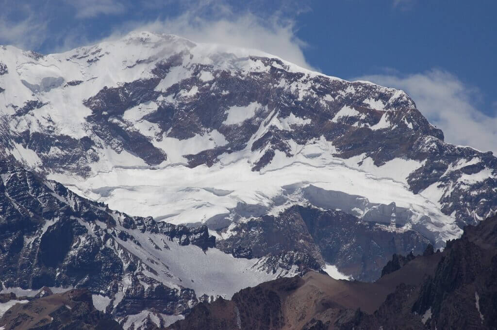
As the highest mountain in South America, the Southern Hemisphere, and one of the “seven summits” of the world, Aconcagua calls out to be climbed. It is located in the Mendoza province of Argentina and has a breathtaking peak of over 22,000 feet (over 6,500 metres) within the Andes-mountain range.
Aconcagua is often referred to as one of the highest trekking peaks in the world. People call it an ‘easy’ mountain to climb. They generally view the main routes as long walks rather than mountaineering expeditions, even though hikers may need to break trails in deep snow or traverse long sections of hard ice, in which case ice axes and crampons are necessary.
But make no mistake, Aconcagua’s routes could present a serious challenge, even for experienced mountaineers, due to their long days at altitude and lower oxygen levels, which include nearly 10,000 feet (3,000+ meters) in vertical ascent. So, even though most of Aconcagua’s routes do not require technical gear, the unforgiving conditions make it a challenging climb.
About Aconcagua
Located in the Principal Cordillera of the Andes mountain range in the Mendoza Province of Argentina, the Aconcagua mountain stands as the highest mountain in the Americas, outside Asia, and the Southern Hemisphere, with a summit elevation of 6,961 meters (22,837 ft).
Located 112 kilometres (70 miles) northwest of Mendoza city, 5 kilometres (3 miles) from San Juan Province, and 15 kilometres (9 miles) from the Argentina-Chile border, it is also one of the Seven Summits of the seven continents.

The mountain’s peak is located in Argentina but builds from the coastal lowlands of Chile, just north of Santiago. It also has two summits, north and south, connected by a ridge called Cresta del Guanaco, which is about 0.6 miles (1 km) long. The Valle de las Vacas is a valley that bounds Aconcagua to the north and east, and the Valle de Los Horcones Inferior bounds it to the west and south.
The mountain boasts several glaciers, including its largest, the Ventisquero Horcones Inferior, which spans a distance of approximately 10 km (6 mi) and descends from the south face to about 3,600 m (11,800 ft) near the Confluencia camp. The Ventisquero de las Vacas Sur and the Glaciar Este/Ventisquero Relinchos are two other prominent glaciers in the mountain. The most well-known glacier is the Polish Glacier, which is known as a popular route of ascent.
A brief history of Aconcagua.
Aconcagua possibly got its name from the Quechua words Ackon Cahuak meaning “Sentinel of Stone”. The mountain is of volcanic origin. It was formed by the subduction of the Nazca Plate beneath the South American Plate. It was an active stratovolcano in the Late Cretaceous or Early Paleocene era through the Miocene, consisting of several volcanic complexes on the edge of a shallow sea basin.
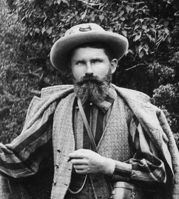
In 1883, a party led by German geologist and explorer Paul Güssfeldt made the first attempt to summit Aconcagua. They approached the mountain via the Rio Volcan and made two attempts on the peak by the northwest ridge, reaching an elevation of 6,500 meters (21,325 ft). They failed, but the route they prospected is the standard route up the mountain today.
In 1897, a Swiss climber named Mathias Zurbriggen was credited with summiting Aconcagua first. He achieved this during an ascent with a European expedition group led by the British mountaineer Edward FitzGerald. Zurbriggen is credited as being the first person to reach the summit, but traces of Inca civilisation and culture have been discovered near the summit.

A few centuries ago, the routes around Aconcagua were used for military expeditions, just like the routes in the Himalayas. In 1817, General Jose de San Martin used one of these routes to help Chile become independent from Spain. By 1950, most of the routes up the mountain had been climbed, with many variations of these routes also successfully used to reach the summit.
Are you ready to climb Aconcagua, the “easy” mountain?
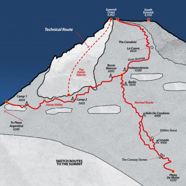
The Normal Route, Vacas Valley Polish Variation (Polish Traverse), and the Guanacos Glacier Route are traditionally offered as guided routes on Aconcagua. However, the Guanacos Route has been closed in recent years to protect the breeding and raising of young guanacos in the area. The Polish Vacas Variation Route on the east side of the mountain offers a more aesthetic approach, with less traffic and the opportunity to traverse the mountain. The Normal Route is shorter and less demanding.
General considerations
Experience walking in crampons and using an ice axe is a good plus for climbing Aconcagua, but nothing more is generally required. However, the mountain’s height and cold temperatures make for a difficult ascent, even for experienced mountaineers. Climbers must spend extended periods camping at high altitudes, which can be physically and mentally demanding. Additionally, they must carry more than just their day packs to the high base camp. And weather conditions at high altitudes can change quickly, with temperatures dropping as low as -30°C.
Some pre-requisites
To ensure personal safety, success, and team compatibility, it is important that climbers have adequate training and be in excellent physical condition before attempting to climb Aconcagua. Climbers should prepare themselves both physically and mentally to handle strenuous situations at high altitudes.
Being in excellent physical condition is not only necessary for personal enjoyment of the ascent but also to be an effective member of the climbing team.
In addition to being in excellent physical condition, Climbers should have;
- Spent multiple nights outdoors.
- Done winter camping.
- Completed multi-day trips with a 40 lb. pack (lesser pack weight if porters are used).
- Good backpacking skills.
- The ability to assist guides with setting up camps and tents.
Climbing Aconcagua
Best time to climb Aconcagua
Every year, the climbing season on Aconcagua officially runs from November 15th to March 31st, with the peak season generally occurring from mid-December to the end of January.
The summit remains cold all year round. Climbers often experience frostbite as temperatures drop to around -30°C during the climbing season. Wind speeds near the summit frequently surpass 50 mph, and dust on the lower reaches can pose a significant challenge.
Aconcagua often experience storms, and the weather can change drastically over a very short period of time. As a result, we advise climbers to monitor the weather forecast throughout the climb. White-outs near the summit are common, and many climbers often get lost on the mountain, so it’s essential to take necessary precautions.
We recommend visiting Aconcagua during its high season to reduce the chances of facing these risks and increase the chances of summiting.
Possible itineraries and routes
To summit Aconcagua, there are several routes of ascents you can choose from. They include;
- Polish Traverse
- Normal Route
- Direct polish glacier route
- Ibanez-Marmillod Route
In this article, we would deal with the two most popular routes; The ‘Normal route’ and the ‘Polish Traverse’ route. These routes begin at opposite sides of the mountain and then join each other at around 1,000 meters (3,280 ft) below the summit.

Possible itinerary for the Polish Traverse route:
| Day | Activity | Est. time expected |
| Day 1 | End of Vacas valley – Pampa laina (8,200 ft / 2500m) From the road to camp | 4-5 hours |
| Day 2 | Casa Piedra (9,200 ft / 2,804m) | 5-7 hours |
| Day 3 | Plaza Argentina (13,200 ft / 4,023m) | 5-7 hours |
| Day 4 | Rest | |
| Day 5 | Carry load to camp 1 (16,200 ft / 4,937m). | 4-6 hours |
| Day 6 | Move up to camp 1. | 4-6 hours |
| Day 7 | Rest | |
| Day 8 | Carry load to camp 2 (19,200 ft / 5,852m) (high camp). | 4 – 6 hours |
| Day 9 | Rest | |
| Day 10 | Move up to camp 2 (19,200 ft / 5,852m). | 4 – 6 hours |
| Day 11 | Walk to Independencia (21,500 ft / 6,553m) to understand the route. | 2-3 hours |
| Day 12 | Get up early by 3:00 am and start for the summit with headlamps and crampons this is a long day allow 10-12 hours or longer for the round trip. | 7-12 hours |
| Day 13 | Descend to base camp, arrange mules with the rangers for your gear and walk out to Casa Piedra to spend the night. | 3-7 hours |
| Day 14 | Walk out to the highway at the mouth of the Rio Vacas, have your pick-up scheduled in advance and have the rangers confirm it if possible. If not you will have to walk or hitchhike (which is difficult since it is so close to the border). You can always call the hotel at Penitentes from the truck customs building at the mouth of the Vacas. They will pick you up if you will stay or eat there. So have the number tucked away. | 4-8 hours |
Possible itinerary for the Normal route:
| Day | Activity | Est. time expected |
| Day 1 | Puenta del inca to Confuencia (9,200 ft / 2804m) | 3-4 hours |
| Day 2 | Confluencia to base camp (Plaza de Mules, 13,000 ft / 3,962m) | 6-7 hours |
| Day 3 | Rest | |
| Day 4 | Carry to load to Camp Canada (16,000 ft / 4,976m) | 4-6 hours |
| Day 5 | Move up to Camp Canada | 4-6 hours |
| Day 6 | Rest. | |
| Day 7 | Carry to load Berlin (19,100 ft / 5,821m) | 5 – 6 hours |
| Day 8 | Move up to Berlin (19,100 ft / 5,821m) | 5 – 6 hours |
| Day 9 | Rest day and trail exploration | 5-6 hours |
| Day 10 | Summit day 8-12 hours, & round trip 8-12 hours | |
| Day 11 | Clean up camp and descend to base camp. | 3-4 hours |
| Day 12 | Arrange mules and walk out to Puenta del Inca or Confluencia | 6-8 hours |
| Day 13 | Walk out if you camped at Confluencia | 2-3 hours |
Another popular route is the ‘Polish Glacier’. Considerable amounts of technical climbing skills are required to take this route. The Polish glacier route cuts straight through the east side of the mountain. Ice climbing skills are necessary for this route.
Climbing permits
The Aconcagua Provincial Park encompasses the mountain and its surroundings. To enter the park, you have to obtain a permit.
Permits are sold exclusively at the Dirección de Recursos Naturales Renovables (Renewable Energy Resources Bureau) on Avenida de los Plátanos in Parque General San Martín. You will need to show your passport and fill in some forms, as well as pay the correct permit fee.
Separate permits are required for trekking (up to 4300m (or 14107 ft) maximum) and for ascending to the summit. A short trekking permit is valid for 3 days. A long trekking permit is valid for 7 days. An ascent permit is valid for 20 days. The validity of the permit starts from the date you enter the park.
“Toilet” service
After you check in at Plaza de Mulas, you will be handed a ‘poop’ bag by a Ranger. You must carry this bag with you throughout the entire ascent and back. Returning from your ascent without this bag attracts a $200 fine. The bag is there to replace the functions of an actual toilet. It is mandatory that you use it each and every time a toilet isn’t available for your pressing needs during the ascent. If you do not comply and a guard spots you doing it another way, this will attract an additional $100 fine.
There are camps with toilets along the routes going up the mountain. It is in these camps you will have the opportunity to dispose of your waste.


