• Skip to main content
  • Skip to header left navigation
  • Skip to header right navigation
  • Skip to site footer
  • Home
    • Adventures
    • Places
    • Prophets
    • Apparatus
    • Sustainability
  • Explore
    • Your next adventure
    • Your guides
endorfeen

endorfeen

The Media For Sustainable Outdoors.

  • About us
  • Write/ share
  • endorfeen – instagram page
  • enforfeen Facebook page
  • endorfeen twitter page
  • Pinterest

Archives for June 2022

Midi Plan traverse

June 28, 2022 by Iain Williams

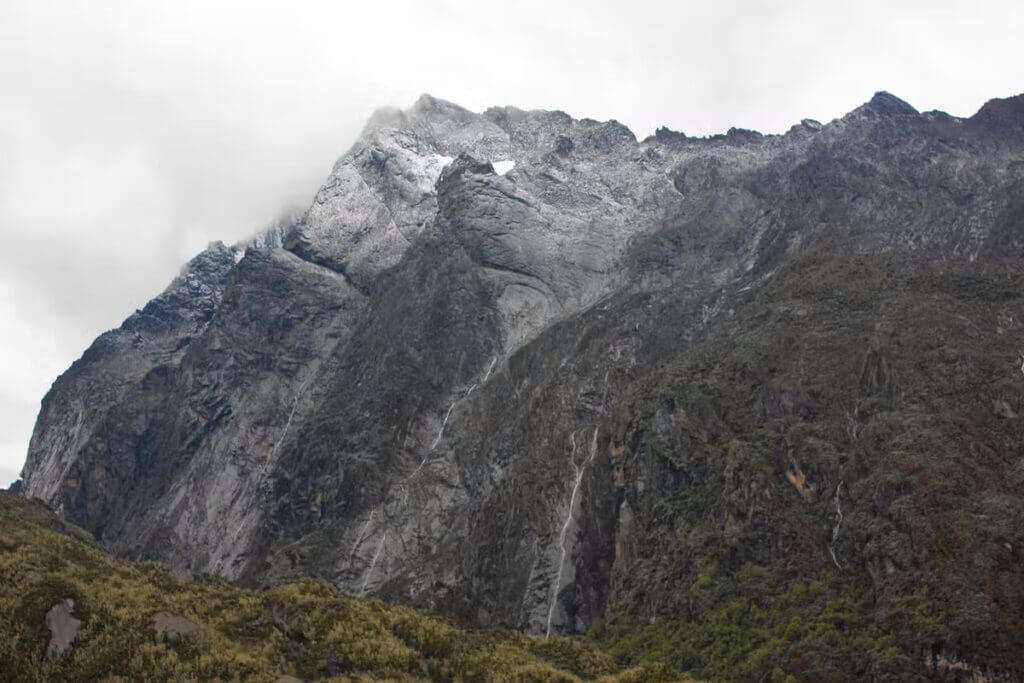
The Midi Plan traverse was our third climb of the week, and it turned out to be a lot of fun.

Earlier in the week, we had met Jack, on his own, on the Aiguille du Tour and had enjoyed several lazy lunches with him over the following days. He had climbed and skied extensively in the area and was an interesting source of info.

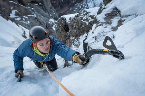
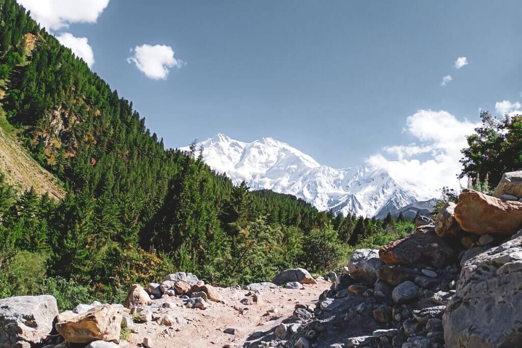
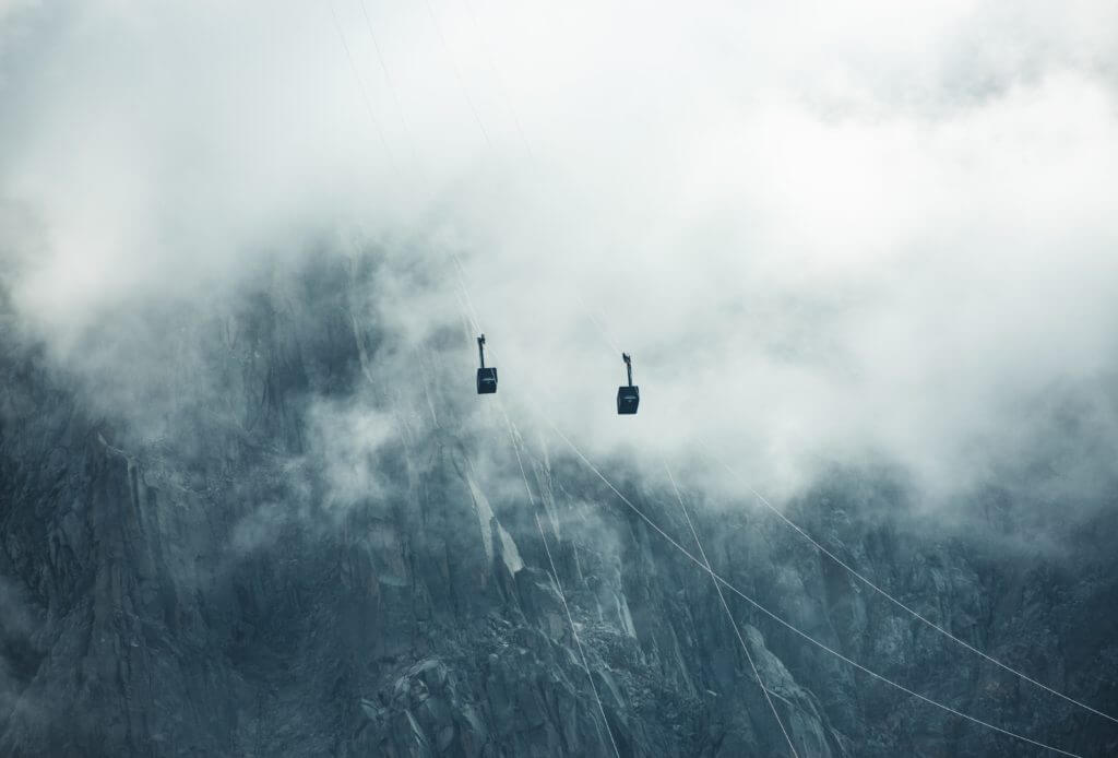
Midi Plan traverse – startup at Aiguille du Midi

We thought it would be good to do a route together, so over another lazy lunch, we made plans to meet up at the télépherique station the following morning in time to get the first cable car up to the Aiguille du Midi.

Photo by Chris Henry

Adrian and I managed to get ourselves up and out of the campsite on time. The weather for the day was forecast to be ok for the morning with storms in the afternoon. We planned to traverse from the Aiguille du Midi across to the Aiguille du Plan and then return on the same route, back down in Chamonix in the middle of the afternoon and enjoying a beer or two.

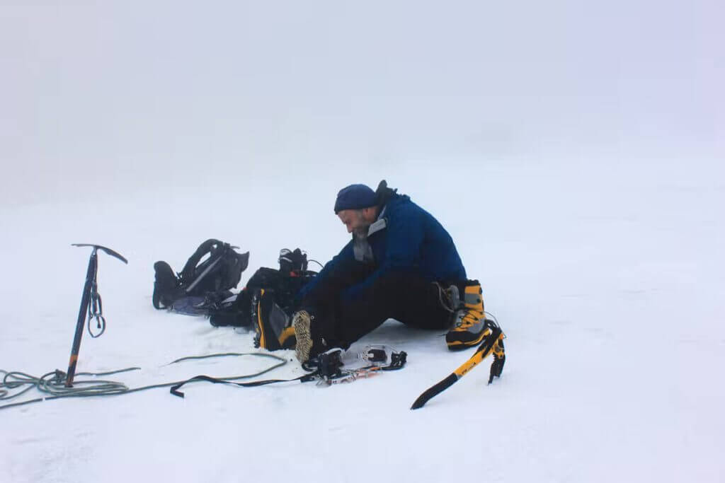
We met Jack, bought our tickets and then waited, with many other climbers, eating breakfast of oranges, muesli bars and chocolate. The ride up was the usual squash, and once at the top, we went in search of loos and then got kitted up in the Midi station complex’s cold, damp, rocky tunnels.

Outside, the wind was blowing coldly and strongly. I put on plenty of clothing and felt a bit apprehensive. By the time we got going for real, it was about 7:15 am. We plodded out of the tunnel entrance onto the snow. Many parties were heading out and down the ridge, some going our way and some heading down the ridge and breaking off to the right. The initial descent was pretty steep, but the snow was good and the steps large.

On our left, the ridge fell away steeply down to Chamonix. Our route soon flattened off, and we plodded along with Jack at the front and myself at the rear. The route rose and fell, keeping to the snowy crest of the ridge. At times we had the odd awkward step down to contend with, but generally, it was easy going.

The descent from Aiguille du Midi

We then started a steep descent down onto the Col du Plan. From here, the route got more interesting. Finally, we left the ridge and skirted off onto a dirty steep snow face to the left.

Aiguille du Midi
credits: Krzysztof Kowalik

After going a short distance, Jack gave the order to turn around. But unfortunately, he was having problems with one of his crampons and wasn’t too keen on reversing the section later in the day. So back on the col, he said he’d leave us and head back to the Midi station. We then went back onto the steep ground with Adrian in the lead. We front pointed our way round and below some crumbly rock.

Above us was an English youth anchored to the rock. We waited for him to move on. Time ticked away, so Adrian put in a screw while we waited. Eventually, we gave up waiting, climbed up to the rock, and carefully traversed along with it before front-pointing back onto the ridge. It was a good section despite the dithering English youths. We left the screw in place with the intention of using and collecting it on our return. We continued along the snowy ridge for a short distance before descending onto another col. It was then a scramble up some loose rocky terrain to regain a more snowy ridge.

Challenging Abseils

We then came to a cliff section. As we only had one rope, we needed two abseils to get down. I decided to leave my crampons on and, on the first abseil, slipped sideways, banging my bare elbow on the warm brown granite. A nice bloody gash appeared. Not liking the sight of blood, I successfully did my best to block it out of my mind.

The second abseil deposited us onto a steep snow slope, which really didn’t feel too secure. We got ourselves roped up and then carefully headed across the steep slope. After a few steps, Adrian stopped briefly. There was then a loud, soft thud behind me. I immediately thought someone had fallen, but turning around, I saw a large flat rock tumbling quickly down the slope taking plenty of soft snow with it. Looking up at the cliff, we thought, “where the hell did that come from”. It had fallen a long way out from the secure-looking cliff above. Nevertheless, we didn’t dwell on our close call and moved carefully and swiftly across the slope, thinking it might avalanche at any moment.

Midi Plan traverse – to the summit

Thoughts of returning were not filling me with joy. However, I felt some relief once we got back to the crest of the ridge. The rocky summit was now very close. We slowly plodded up to the base of the rock. We met another party of four who had just abseiled down and had caught their rope whilst pulling it down. Then Adrian took the lead and shot up after we had a quick search for the most straightforward line up. The climbing was easy and fun.

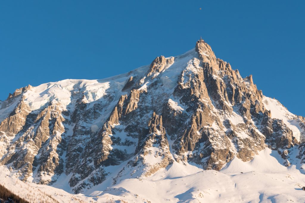
I took the lead on the next pitch and stopped just below the summit to avoid rope drag. Adrian finished the last 10ft off with an elegant mantle move, and we were then on the small flat rocky summit. As usual, the views were awesome. We had the usual photo shoot and then took a good break and discussed how to return. We decided the snow was now too soft to return the way we’d come safely and that the safest option was to descend the steep crevasse-ridden Envers du Plan glacier down to the Requin hut, plod along and down the Mer de Glace and then take the train from Montenvers back down to Chamonix.

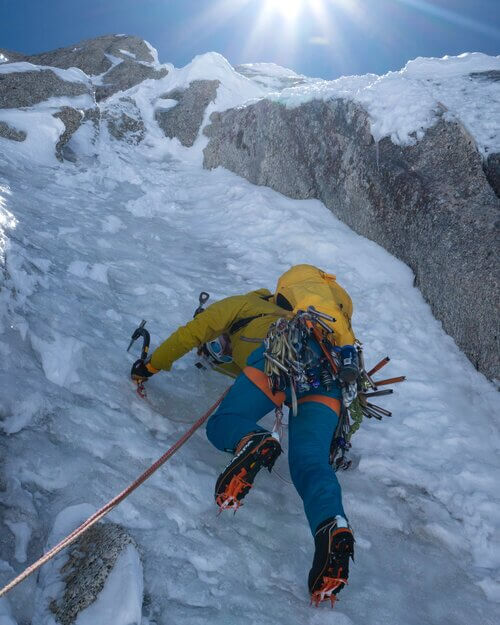
Midi Plan traverse – starting the descent

As we sat there, some small birds joined us. They had their heads back, beaks open and were calling out for food. I found the situation a little unsettling. We sorted the rope and abed off. Not learning from the party we saw earlier, we also got our rope jammed as we pulled it down. Adrian did a nifty little climb to retrieve it. The adrenaline started flowing at the top of the steep snow slope on the Col Sup du Plan. I set off in front, at first facing out, then opted to face in, kicking good steps as we slowly descended.

My left leg instantly sank up to my groin

As we neared the bottom, we came to a steep rimaye with a snow-covered crevasse below. Foolishly I tried to front point down it and swung my axe into the soft snow for some support. Not surprisingly, the head just slipped through the snow, and I fell a couple of feet before Adrian held me on the rope. He slowly lowered me onto the snow bridge, where my left leg instantly sank to my groin.

Panicking like mad, I tried to scramble out and off the snow bridge. It was hard work, but eventually, I got out and slumped down onto more solid snow breathing heavily with my heart thumping. I then belayed Adrian down and across while he made short and easy work of the obstacle.

We took a short break.

As we sat there, soft, slushy snow poured down the slope across to our right. We quickly got going and enjoyed some flat terrain before the glacier started to drop steeply down. Our route took us around some huge gaping crevasses, often on steep, narrow bridges around and across them. At times we had to descend steeply between large yawning drops. I found the descent mentally taxing and was happy to get out of the wide crevasses and onto easier terrain. Unfortunately, the cloud was rolling in as we neared the hut, and rain was looking very likely. It had taken us 2 hrs to get down.

We took our packs off and sorted out the rope and our gear. The guardian came to us to find where we’d come from. We downed a couple of cokes while the guardian explained how we should descend the Mer de Glace to return to Montenvers. We had an hour and a half to get down if we were to catch the last train. So we set off at pace in some light drizzle and descended down onto the large flat dry glacier. We took a line heading down and across to the right. This was what I thought the guardian had instructed.

After skirting around a heavily crevassed section, we found ourselves on the rubbley moraine on the wrong side. It soon became apparent we were way off course. We slowly plodded up and down the moraine, trying to find evidence of a track, occasionally spotting the odd cairn. It was miserable hard work, we were both tired, and the chances of making it to the train quickly disappeared.

Eventually, we left the rubble and headed back onto the glacier. We crossed some fast-flowing streams, falling into one would have been curtains, and carried on heading down and across. Adrian slowly pulled away from me. I felt totally beat. We had missed the last train, and I really didn’t want to hike all the way back down to Chamonix.

I stopped and bent down to drink from small pools on the glacier a few times. The water was beautifully refreshing and chilled. As we neared the end of the glacier, we found route markers. It was then a steep climb up some metal ladders onto a well-worn track above.

Walk back to Chamonix – the end of the Midi Plan traverse

The hike back down to Chamonix took about an hour and a half. It was pretty pleasant being back in the trees and off the snow. I regretted not filling my water bottle whilst on the glacier. As we neared Chamonix, it was nearly dark. Once back on the tarmac roads, we headed for the station and stopped at a café for a couple of cans of cold coke. They tasted great. It was then a quick march back to the campsite before the shower room closed at 9:30.

It had been a long day; we had climbed only a few hundred metres but descended close to 3000m and covered about 17km. It was also the first peak I had climbed, where my start point was higher than the summit. After a clean shower and a change of clothes, we headed back into town for a mighty feed, but when the food arrived, we discovered we really didn’t have an appetite and only managed to force down a plate of pasta.

All in all, it was a fine day on a route that seemed to have a bit of everything.

Review: Grivel North Machines Long Term Review

June 21, 2022 by Ryan Colley

These are the all-terrain tool of alpine climbing. Similar to the Petzel Quarks, the North Machines cover a wide range of terrain and can comfortably take you to most places in the mountains. Two years ago, I first tried the North Machines when climbing with my mate Chris in the Remarkables, New Zealand. After using them for a pitch or two of mixed climbing, I was sold.

I got a pair the day I arrived in Chamonix and used them as my only set of tools for the next 18 months in the Alps. As they were my only option, I got to see how they performed on many different parts of the mountain, from glacier approaches to mixed cragging and waterfall climbing to scrambling up icy north faces.

Thoughts:

The ability to plunge, arrest, dagger, dig, scrape, torque, and climb makes them perfect for harder alpine and ice routes, where you usually have to cover a lot of mountains and still be able to climb through steep cruxes.

The design is two different styles put together. If you compare the North Machine with the Tech Machine (pictured below), you can see that the shaft and head curvature are almost identical. The grip, although curved, looks much more like a classic axe handle. This combination, along with the big adze and hammer, creates a versatile alpine tool.

Because they are designed for steep North face routes, they do lose some qualities suited to classic mountaineering. But for that compromise, you get a tool that performs well on most moderate ice and mixed ground without needing to go full tech.

To complete my European quiver, I have since added the Tech Machines for winter climbing and the Petzel Gullys for snow plods and skimo, but because of its versatility, I’ll still reach for the North Machines most times I head out.

Specifications:

  • 500g (Carbon)
  • 50cm
  • Semi-technical curvature
  • Replaceable technical and non-technical picks and other accessories
  • Hammer and shovel
  • T-rated shaft and picks
Review - Grivel North Machines
Grivel North Machines
Climbing with Grivel North Machines

Grivel North Machines – the Good:

They feel good – the curvature, weight, and size give them great shape for daggering and a balanced swing.

Solid build – they come with steel picks and reliable design to withstand years of alpine abuse. Always comfortable torquing on Grivel’s hot-forged blades.

Versatility – Lightweight and straight enough to use as a walking axe but more at home on steeper terrain. I found them techy enough to use on WI4 and M5. But if you want proof they can climb harder, you should look at Mario Sertori’s Alpine Ice guidebook. A lot of hard ice and mixed routes were climbed with these!

Grivel North Machines – the Bad:

No Second Grip – No trig rest or second handgrip comes with them. There is a tiny lip above the handle. I keep my shafts wrapped for added grip, but when swapping axes or adjusting grips, I want a trig rest. I don’t see a real downside to having one on these axes. If compared to Quarks, this is an obvious must-have for such a versatile axe. You can buy a trigger separately.

Spikey Walk Grip – this is only a minor problem, but it gets annoying. The ice picks are designed for burly climbing and have teeth that run along the top. These make the axe uncomfortable in a walk grip or plunging and will wear down gloves. Maybe Grivel’s alpine pick would alleviate this.

Poor Spike – Another walking inconvenience; the spike is very average. A better spike would make a difference when pushing up rocks or ice steps.

So Then…

If you are looking for an all-rounder geared towards alpine routes and classic ice climbs, have a look at the North Machines.

Price: Approx 400 Euros for the carbons.

Tom Ballard: the legacy of this generation’s greatest climber

June 13, 2022 by endorfeen

Tom Ballard was a striking figure in the solo climbing scene. In his short-lived life, he became the first person to solo climb the six major alpine north faces in just one winter season. Although an avalanche took his life in 2019 on the ninth tallest mountain in the world. Only 100 miles away from the place where his mother lost her life 24 years prior. Leaving behind a legacy in mountain climbing essence.

Despite his young age at the time of his death, he had already sealed quite a reputation as one of the greatest climbers of our time. He was also known for being bold and innovative in his decisions.

TOM is a documentary film about the British alpinist Tom Ballard

Tom Ballard was ‘born into’ mountaineering

Many would argue that Ballard was ‘born into’ mountaineering. Both of his parents, Jim Ballard and Alison Hargreaves, already hold their status as respected mountaineers. His mother, Alison, was the first woman to ever summit Everest without the requirement of assistance of Sherpas. She carried her belongings and did not use bottled oxygen.

Born in 1988 in Derbyshire, England, Tom was often exposed to peaks, base camps and mountaineering expeditions. This often took place when he, along with his sister Kate and their father would accompany their mother on her expeditions through the Himalayas and the Alps.

In 1995, when Tom was just 7 years old, the family relocated to the Scottish Highlands in order to support Hargreaves’ climbing training as she prepared to climb Everest. She passed away later that year during a climbing accident on K2. The same mountain range that would later claim Tom’s life in eerily similar circumstances.

The Alps, the birthplace of a pioneer

Creating new routes

Tom, Kate and their father later moved to the Alps, followed by the Dolomites in 2009. It is noted that it was there that Tom really branched out and carved his status as a pioneer. He became especially known for creating new routes. During his first year of living in the Alps, being 21 at the time, Tom climbed his first of several new routes on the Eiger.

He later named them the Seven Pillars of Wisdom. Tom gave an interview with The Alpinist in 2009. He stated that during his first free ascent of the Scottish Pillar, he came to the realisation that there were several inconsistencies in the way that the routes were established and drawn, leading him to create a new one.

The Alps’ North Faces

He said ‘The Eiger is like another family member!’. ‘My ‘experience’ started before I was born – my mum climbed the ‘1938’ Heckmair Route in 1988 whilst six months pregnant with me! In summer 1993 she soloed the Lauper Route as part of her Six North Faces project to climb the six great north faces of the Alps alone, in one season. I was with my father and sister waiting down in Grindelwald.’

The Eiger is like another family member!

Tom Ballard

These early-on unique and meaningful experiences regarding the mountains are what most likely fuelled Tom’s future interest in scaling amazing heights of some of the world’s tallest peaks. And it even captured the interest of his sister, Kate. He also spoke to the Alpinist about the time both of them went on an expedition on the Eiger, during which time Kate set herself a new record.

During the time between December 2014 and March 2015, he embarked on a project called ‘Starlight and Storms’. Tom solo climbed the six major alpine north faces, nearly 20 years after his mother – telling the BBC that it was “just a coincidence”. His mammoth feat was documented in a 2015 film by the name of “Tom”. Which went on to win Best Mountaineering Film and multiple film awards shows around the world.

Tom Ballard’s accident on Nanga Parbat

In 2019 it was reported that Tom had gone missing during one of his climbing expeditions in Nanga Parbat while experiencing extreme bad weather. Nanga Parbat is an enormous mountain in Pakistan that has claimed the lives of numerous climbers over the years. Tom attempted a route which is known as the Mummery Spur along with his climbing partner Daniele Nardi. He also accompanied him on his previously unsuccessful attempt at climbing the North-East face of Link Sar in Pakistan.

Nanga Parbat
Photo by Muhammad Affan on Unsplash

Prior to their disappearance, Tom posted on Facebook saying that he and Daniele were enjoying their time while waiting for the weather to improve. ‘Basecamp life is becoming, almost, like a holiday while we wait for that elusive weather window,’ Tom wrote on February 19, this being his last post.

A grand-scale rescue mission was launched on February 24. It contained high-altitude drones, military helicopters and mountaineers but it was all altered due to heavy snowfall. And, according to the BBC, the tension between India and Pakistan at that time. Their tent was discovered buried by an avalanche, yet there was still no sign of either of the climbers.

On day 6, with no success in finding Tom or Daniele, the search was shut down. However, the following day a Basque climber reported a sighting of the outline of two bodies strung together on the Mummery Spur. Later, the two climbers were declared dead after images were shared with both families and identified.

Tom Ballard, one of the most adventurous solo climbers

Tom remains known as being one of the most adventurous solo climbers of this generation. And had his time not been cut short, he most certainly would have achieved groundbreaking achievements in the world of climbing.

His life and what he leaves behind were documented in the 2021 BBC film “The Last Mountain”. It covers moments when his sister Kate visits Nanga Parbat. She retraces his last steps and shares family footage. It includes shots captured from Tom’s solo days before his disappearance. The movie honours the great climber, Tom Ballard.

Climbing and Snowboarding in the Rwenzori Mountains, Uganda

June 8, 2022 by Matt McCullough

Day 1: entering the Rwenzori Mountains

Please meet the team

My climb began from the Trekkers Hostel (@1450m) in Kilembe on April 24th. I was with a guide named Benard and a porter, Vincent, both with Rwenzori Trekking Services. While walking through the village and up to the Rwenzori Mountains National Park ranger post we stopped all along the way to greet the smiling kids and village people. All were asking who is the “Mzungu” (white person) and what was the strange board I was carrying.

Rwenzori Mountains - start
At the start of the climb from the Trekkers Hostel with my guide, Benard, and porter, Vincent

Entering the National Park

The park entrance officer gladly received 900,000 Uganda shilling (~$250 USD) from me for the 8-day permit. However, she asked what my board was for since she had never seen one. She asked my guide if it was allowed. This was a tense moment since snowboarding was my primary intent for the trip; I had gone to great trouble to get my board there. I explained that people had used skis on the mountain before and this device for gliding down the glacier should not be treated differently. Fortunately, she seemed to go along with the argument as my guide concurred. The snowboard and I were allowed to proceed. Benard and I made our way up the Kilembe trail with Vincent following. Benard spoke English pretty well, so we had lots of good conversation as we passed through groves of Bamboo and Afro-montane forest with moss and vine-covered trees.

Occasionally we spotted a colobus monkey. We made it to the first hut (Sine @ 2596m) in a little over 5 hours. A second guide, named Edson, also joined up with us for the climb. I washed up at the beautiful Enock’s Falls nearby and took some pictures while waiting for dinner. I decided to go to bed early as I was still trying to catch up on my sleep after 30+ hours of flight from Houston to Entebbe (I don’t sleep on planes well), just a couple of days before.

View from the lower Kilembe trail on the way to the Sine Hut
Enock's Falls
Enock’s Falls

Unfortunately, I could not sleep until sometime after 3:00 am.

Day 2: to Mutinda, first night in the Rwenzori Mountains

I awoke in the early morning to a pounding at my door and after a tasty breakfast of french pancakes. Edson began to lead me to the next camp (Mutinda @ 3588m). We stopped at the Kalalama camp where we met some Ugandan soldiers who had been returning from training higher on the mountain with French alpine rangers. Apparently, there had been as many as 200 of them on the mountain with only 11 making it to high elevations near the summit. Many had altitude sickness combined with possible hypothermia. I had noticed some along the trail being assisted down.

The soldiers I saw seemed to be ill-prepared and appeared to have just their standard-issue cotton clothing and thin jackets. As we had ascended towards the Kalalama camp and above, the beauty of the Rwenzori Mountains become more and more apparent. We had gone through bamboo forests, by small waterfalls and bright green moss-covered rocks, tangles of bearded heather trunks, and into the mist with hillsides layered with various shades of green and silhouettes of giant heather trees reaching into the heavens.

Day 3: to Bugata camp

The night at the Mutinda camp went poorly for me with regards to getting sleep.

Ugandan soldiers in adjacent huts chronically coughed through the night with loud explosive heaves, possibly to try and clear water from their lungs which I figured was accumulating from either pulmonary edema associated with altitude sickness and/or lung infections from their long exposure to the cold. Fortunately, they headed down as morning came with some individuals being assisted by soldiers on each side.

The guides and I continued upward towards the Bugata camp (4062m). This was a boggy trail day mixed with beautiful scenery, waterfalls, giant lobelias, and a lot of interesting geology. I’m a geologist by profession and was very interested in the rift margin stratigraphy and structure I was seeing in the hills on the west side of the trail. At lunch, I took a brief excursion to some outcrops to take a better look at the outcrops.

We arrived at the Bugata camp around 4.00 pm. At dusk, there was an amazing sky over the Rwenzori Mountains as the waning sunlight painted the rocks and clouds above the mountain ridge an array of eerie colours. A view I will never forget.

Day 4 and 5: acclimatization in the Rwenzori Mountains

The next day was an acclimatization climb up to 4450 m through the Bamwanjara Pass and then down to the Hunwick camp at 3974m.

I also had my first glimpse of a patch of snow or a small glacier on Mt. Baker which stoked my hope of snowboarding! Subsequently, on our 5th day of climbing, we hiked up to the 4495 m Margherita camp and planned for an early 3:00 am departure to reach the summit and allow time for me to snowboard.

My first glimpse of snow on Mt. Baker in the Rwenzori

There had been a slight rain throughout the day so I continued to be hopeful that it would be snowing near the summit.

Day 6: Snowboarding and Summit Day

A bad night’s sleep

The stress of knowing that I needed to get some sleep before our early departure for our summit climb, means I didn’t sleep well. The key to falling asleep for me is to not think about sleeping, but that’s hard for me to do in situations when I really think I need to optimize my rest.

Benard, Edson, and I left camp at 3:00 am and fortunately the rain had stopped. We climbed making our way over slick rocks and steep portions with some fixed ropes and using ascenders. By 5:00 am, we reached the edge of the glacier on the Stanley Plateau. We put crampons on and roped up and made our way across a black cruddy mix of ice and broken snow crust.

Just before dawn around, 6:30 am, we had hiked to where I thought we should be for a snowboard run at a position on the glacier just to the south side of Alexandra Peak (Rwenzori Mountains). I had seen a relatively recent photo (maybe just a year or two old during the same season) of hikers making their way up a long smooth snowfield on the south side of Alexandra Peak and with the Margherita summit on the right.

The right place?

The slope was gentle to moderately steep slopes to the south of Alexandra Peak with Margherita Peak to the right. The powdery-looking snow in the photo looked great for snowboarding. That is where I wanted to be, and I had tried to pick the right time of the season for that opportunity. Unfortunately, as the sun was coming up there was near whiteout conditions, and at my feet was just a thin firm snow crust and patches of cruddy dark ice. It was so different from what I had hoped for or expected. Was I in the right place?

I came to the conclusion that the glacier had sadly changed that much from the time of the photo

After much discussion with the guides about our location and walking around a bit looking for better snow conditions, I came to the conclusion that the glacier had sadly changed that much from the time of the photo. We also discussed summiting first but conditions were not expected to improve. Also, we would need to ditch the board for the summit climb, and the Margherita Peak portion itself would not be rideable anyway. It would also be a lot to expect to have the time and energy left to search out and find a better place for snowboarding and make a significant run after 5 more hours of climbing. I made the decision to go ahead and snowboard as far as I could safely do so from the current position.

The run

Benard walked downslope as far as he could still see me and for Edson to walk down as far below Benard to be able to see him. I would make a run towards both of them and only go as far past as I thought Edson could see me. Edson was going to take some pictures with his camera, and I had given Benard my camera to video the run. I put on my snowboard boots, strapped in, and began my descent towards Benard who I could just barely see in the distance.

As I made my way I noticed the glacier surface did not improve anywhere and existed of slightly carvable crust and patches of black cruddy ice. I continued past Edson until I noticed that the slope was becoming more convex and steepening slightly, so I decided to turn out and stop. The glacier steepened abruptly just before ending at a cliff. I also didn’t want to go any further than Edson could see me. It was a short run. I walked back up. Edson had found out his camera batteries were dead and Benard wasn’t sure he understood the video controls on my camera. I showed Benard again how to operate the video and took off for a second similar run. It turned out that the video did not record.

Fortunately, I did have a GoPro activated on my helmet, but the run was not that interesting in terms of snowboarding. The video I recorded is documentation of the poor snow conditions and the rapidly melting glacier conditions on Mt. Stanley. I am grateful, in any case, that I was able to see and experience first-hand one of the few glaciers left on the continent of Africa before it disappears.

I cached my board alongside the Alexandra glacier next to some rocks. We then started our final climb towards the summit.

A hard climb

We walked through a rocky canyon portion with odd ice formations with one reminding me of a barracuda’s mouth. We reached a steep edge of the Margherita glacier and roped up. The climb was difficult; even with crampons up a steep icy section until we made it into the main axis of the glacier. The main axis of the glacier actually had very good snow; I was a little bummed that I had not chosen that portion to snowboard down, especially after walking up a long clean section having a nice powdery quality to it.

Preparing to take my first snowboard run down Alexandra glacier on Mt. Stanley

The Alexandra and Margherita peaks briefly came into view. I was filled with emotion and began to think about my son and I recorded a personal message to him using my GoPro. One could see a large ice wall & wind stacked snow formation at the base of Margherita and some crevasses off to the right. I saw Benard, who was leading walk safely past the left side of the crevasse. I followed pretty much in the same tracks.

All of a sudden I felt my body fall

Thanking the rope

All of a sudden I felt my body fall. I managed to catch myself with my arms at my armpits and my right knee was sort of pinned up against my chest against the lip. I planted my ice axe into the snow ahead of me as I yelled for Benard to arrest and he dropped to a sitting position. He then tried to pull me out, but couldn’t. Edson who was roped behind me downslope made his way around wide to my left to come up to Benard’s position. Looking down between my left arm and my chest I saw nothing but black without a view of any bottom or edges.

My guides pulled me out on three as I managed to also lift up somehow and use my pinned right knee as leverage. I quickly scrambled upslope away from the lip. I don’t recall thinking about it much other than I was lucky and glad we were roped. We continued up to the start of the ice and snow wall and began to traverse around a narrow catwalk with a drop-off to the right and a strange-looking ice formation with long icicles on the left. We traversed further to a rocky wall where I needed to use my hands as we carefully climbed up along a crag of rock and snow to another steep section with some fixed lines that were not ideally placed.

To the summit

Benard climbed ahead of me to a perch to be able to belay me as I climbed using the ropes as well as my hands on the rock to where he was. From there we were able to simply scramble to the top about 60m above us. Our small group had reached the summit around 12:30 pm and decided to not spend much time there. We couldn’t see much anyway with the foggy conditions and we had a long way to go to reach the planned Bugata camp at 4062 m.

Together, we were able to quickly rappel down with a top belay the two steep rocky sections and down the steep edge of the Margherita glacier. Then, we unroped and took off our crampons. Through the rocky canyon and to the edge of the Alexandra glacier, we retrieved my snowboard. From there we climbed up onto the glacier, but for some reason, we did not rope back up or put on our crampons. I assumed we did this in the interest of time and based on the fact that we had made it across earlier without the guides seeing any major issues.

Steeper sections to reach the summit

However, as I made my way across the glacier I noticed that our traverse was on a steeper section than we had crossed earlier. I admit I began to have some real concerns about not having my crampons on. My boots slip a time or two. I saw there were more areas of slick cruddy ice than before. The slope to my left steepened convexly such that I thought if I fell I might just keep sliding and then drop off a cliff to sure death. I determined to be very careful. For additional traction, I walked along with a subtle foot-wide offset I saw in the slope which paralleled a dark seam that transversed the glacier.

We all made it safely across. It was almost 7 pm by the time we made it back to our starting 4495 m camp and it was getting dark quickly. We had been climbing (except for my snowboarding) for over 15 hours. Our original plan to was to make it to the Bugata camp so as to not have to go so far the next day, but we decided to stop for the night and depart around 3:00 am to make up the schedule. Thank goodness! I didn’t want to continue to walk for another 3 or 4 hours.

At the summit
At the summit

Day 7: back to camp

For some reason the guides overslept and we did not start until almost 7:00 am. I knew this was going to be a long day since we were also going to take a longer new loop route back to the Kiharo camp (3430 m).

That route turned out to have some pretty treacherous sections. We did not get to them until nighttime – over 12 hours later. We were still a long way from our camp. It also rained the whole way. We encountered a steep chasm with very slick rocks. I was having to sit or use all fours to descend with a weak dying-battery headlamp and Edson was having to go ahead of me and point his light back to where my feet needed to be.

It took 3 hours to descend hundreds of meters to reach the valley floor. We did not reach camp until after 10 pm. We had been hiking for 15 hours. I went to bed after just a few bites of dinner.

Day 8: the last day down

Starting with a bad night’s sleep

It rained hard all night pounding the hut roof like a drum. I recall I didn’t get much sleep. By dawn, the rain had fortunately decreased. Edson and I set out for our last day down the ~15 km trail back to Kilembe.

Benard and the porter, Vincent, were going to join up with us later. It was not long before Edson and I came to a stream crossing. The rain from the previous night and day had transformed what was normally a small quiet stream into a torrent. The stream was not safe to cross at the trail path location. Fortunately, we found a place to leap boulder to boulder downstream.

I was beginning to wonder about other streams we would need to cross throughout the day and hoped that they would recede since the rain had lessened, but that did not seem to happen. Inevitably we came upon a much larger one, a raging river actually. Edson and I looked upstream and down and did not see a safe place to cross. Downriver there were steep drops with large boulders and upstream the river was much wider and split into two. We decided to look further upstream just as Benard and Vincent showed up to help. We found a place to try but we had to cross over thick brush and boulders to get there. I checked to make sure there was a safe stretch below us that was free of sweepers, sharp rocks, and drop-offs. The river branched with the first crossing not being too difficult.

Some difficulties

However, the second branch was wider and there was a large gap that would need to be leapt across to get onto the far bank. We also would need to wade across swift portions since there were no exposed rocks or downed trees to use. Benard went first slowly and was able to scout out where there were submerged flat rocks to stand on at shallow enough depth that the current wouldn’t sweep you off your feet. He also managed to leap over the final gap onto the very brushy bank without sliding back into the river. I then worked my way across as Benard pointed out where the rocks were to stand on.

Edson followed close behind me as we both had ends of a blue strap in hand as a safety measure (the only thing like a rope we had with any of us). We both managed to leap safely onto the opposite bank together. Vincent made it across as well. Fortunately, the worst of the stream crossings were over. At this point, I was able to relax and enjoy the hike down as the sun began to come out. Ridge upon ridge of heather trees came into view highlighted with misty shades of blue, grey, and green.

Later, I was sad to find out that my camera didn’t catch any of these images well. There was much condensation within the lens.

The final leg: a childhood memory

I recall as a child I ran downhill after an all-day hike on a mountain with my parents in Colorado. The hike had been too long and perhaps not all that interesting for a kid and I was excited at the thought of getting back to the campground. I was allowed to run ahead and did so as fast as I could.

I remember the feeling of lightness and almost a sense of flight as my body essentially “fell” down the slope while my legs barely or what seemed like magically were keeping up to avoid actually falling.

While descending the last leg of my trek in Uganda, I noticed that the trail was becoming less muddy and the slope more gradual and even. I decided I could run – even in my wet boots and socks. I also very much wanted to go home. As I ran I felt like I was gliding effortlessly by the bamboo trees and jungle. Sunlight broke through the mist with a strobe-like flickering through the canopy. I flew quickening my stride at the times I saw better or gentler sections of trails ahead.

I hollered as I hurdled a downed tree across the trail at full speed. On and on I ran down the mountain joyfully. It was like I was reliving my childhood on that mountain long ago. Finally, I rested and my guides soon caught up with me. I had pretty much caused them to run as well to keep up with me as required. At times I heard their laughter behind me. That said, I don’t know if they enjoyed it as much as I did. I just knew I was happy to be going home.

Tanriverdi Falls, a challenging hike

June 8, 2022 by Keith Winston

Tanriverdi Falls, in the Santa Ana Mountains

Tanriverdi Falls (or Tanrierdi) is one of the crown jewels of the Santa Ana Mountains and is probably seen by only a handful of people each decade. There is no easy way to get there. I considered the long approach from the bottom of Hot Spring Canyon, coming from Chiquito Basin (heavy poison oak), Los Pinos ridge, and the north ridge of Old Sugarloaf, but decided descending from the top of the canyon was still the best. Note: canyoneering site ropewiki also refers to this as Salamander Canyon. Jerry Schad’s Afoot and Afield in Orange County covers the hike from the bottom, a 10 hour round trip, according to his write up. It also covers the walk to the second waterfall from the top, but not the wild mid-canyon section below it. Here is a part of his description:

Being in excellent physical condition, having considerable experience in cross country travel over rugged terrain, and possessing good judgement do not automatically guarantee that you’ll be able to reach the falls and return without mishap. You must be cautious, patient, and determined too. Hazards include slippery rocks (some concealed by leaf litter), prickly vegetation, and literal forests of poison oak.

I had hiked to the second waterfall in 2013 and scouted above it. The difference this time was the conviction to make it to the big falls. I would not recommend attempting without conviction. It is difficult and dangerous, and for about an hour, I was genuinely concerned that I would not make it out.

North ridge of Old Sugarloaf clogged with chaparral (scouted by Gimpilator, thanks!)

Long Canyon Road was open again, and the first part was newly paved and smooth. I parked at the Falcon Campground and got ready for a fight. The pants, shirt, and socks I had on had been treated with permethrin, a kill-ticks-on-contact chemical that you aren’t supposed to spray on while wearing the clothes being treated. Serious chemical warfare. I added long gaiters, gloves, and fleece for more brush protection. The easy part of the hike to the second falls was familiar and went quickly.

The second falls

I found five ticks on me getting to the second falls; the last one seemed to drop off on its own. The permethrin may have killed it. I decided to call the second falls “Gut Check Falls” because nothing comes easy after that. For the other falls, I used the names from the canyoneer trip report on Summitpost.org, matching up what I saw with their pictures and descriptions as well as I could. Most of the rocks in the canyon are worn as smooth as glass from the water, so down climbing big falls was a non-starter.

I followed a faint use trail on the right to bypass “Gut Check” and thought about descending back to the canyon, but I knew the “Single Track Falls” bypass would be required almost immediately so I stayed high on the wall, trying to follow the occasional animal trail. This was very difficult as the brush got thicker. Finally, I traversed across a side canyon, looking for a way to descend.

I found a way to the bottom of the side canyon and then fought through the hellish brush to get back to Hot Spring Canyon. What made the bushwhacking so bad was not just the native growth, but the years of runoff that filled the side canyon. Small trees, boulders, and debris mixed with the native plants to create an unholy jumble. I used the machete to hack some areas, but overall, it was a negative, getting caught on things as I tried to pass under. The tick problem went away, probably because I was in such dense brush that the deer were not stupid enough to wade through. No deer, no ticks.

Back in the Canyon

Once I was back in the right canyon, I started running into large patches of poison oak, a lot of which I could not avoid. Most of the other large waterfalls I encountered had some bypass on the left or right, but for some, I had to force my way up the canyon wall, often with class 3 scrambling and back down. I was now moving at a crawl, about 1/2 mile per hour.

The route finding was challenging. I thought about turning back for each bypass I found, wondering if I could reverse my path on the return. But I kept going, hoping each new waterfall would be Tanriverdi Falls. Finally, the canyon started to clear out a little, and I could sense Tanriverdi was near. It was quite a thrill to reach it, even though only a trickle flowed over.

I had to find one final bypass to get around a 20′ waterfall I dubbed “Preview Falls” just before the big 160′ drop. There is another drop on the bottom tier. I found the webbing left behind by the previous canyoneers around a boulder used to make the long rappel. I took photos, ate something, and then thought about getting out. It had taken me 3.5 hours to reach the big falls, and I expected it to take at least as long to get out.

I was not happy with the bushwhacking I had to do coming down, so I decided to stay in the canyon as much as possible on the way back. Unfortunately, this meant dealing with even more poison oak, which was not growing on the walls. I was slapped in the face by some poison oak vines on the way out. After scrubbing my face with cold water and Technu, time will tell if I have to cope with that.

I was pleased that I found the bypasses on the way back that I had figured out on the way down. Of course, I eventually ran into some waterfalls where I had to fight up the canyon walls again, but in a decidedly different place than before. I climbed as high as I needed to feel safe before traversing across the side canyons and continued following any faint animal trail I could find. I checked my GPS to see if I had passed Gut Check Falls and saw that it was about 0.2 miles upstream.

Here is where things went sideways. At my location on the wall, the chaparral was nearly impassable. I looked for a lower animal trail and would struggle down to it only to find it quickly ended in another impassable snarl. Then, I fought up again only to be blocked. This happened several times before I got concerned. I didn’t seem to have any way forward. With my energy draining quickly, I decided my only option was to get back to the canyon floor and hope I didn’t cliff out. The brush was worse than the hellish mix I faced on the way down.

The machete would not have been effective against the small trees I faced. I could not take useful steps so I essentially somersaulted over the top crashing into wherever I landed. The wall was steep so I had to be careful to not tumble over the edge. This was effective at getting out of the worst of it and as I neared the edge, I was lucky to find a way to down climb to the canyon floor.

I thought I would have to face at least one more bypass but soon, it became clear that I had emerged above Gut Check Falls and would have an easy climb out. At this point, I was quite a mess, bleeding in at least seven places. I felt bruised on all limbs and had multiple hits from yucca and random thorns. Three hikers heading down who asked me if they were almost to the waterfall as I was almost out. I told them there were at least nine waterfalls, but they should stop at the second. I hope they took that advice.

This was the toughest route-finding I have ever faced, the nastiest bushwhacking, and probably the most dangerous hike I’ve ever done. Was it worth it? Maybe, but only because I got out alive. Looking back, there are two things I would have done differently. One, I would get back in the canyon right after Single Track Falls. Two, I made a mistake staying on the wall too long on the way back. Eliminating those two mistakes would have made my life much easier. Fair warning, I still can’t recommend this hike, unless you crave danger with a side of masochism. It is probably easier to rappel down many of the falls than bypass them, so come get it, canyoneers. I am done.

Social media

Instagram
Pinterest
Facebook
Twitter

Categories

Adventures
Apparatus
Places
Prophets

Information

About us
Contact us

Contributors

Login

Subscribe to the Natural Dispatch, great adventures come to those receiving our news
loader

Copyright © 2023 endorfeen · Privacy Policy · Contact Us

  • Facebook
  • Twitter
  • Instagram
  • English
    • Français (French)