• Skip to main content
  • Skip to header left navigation
  • Skip to header right navigation
  • Skip to site footer
  • Home
    • Adventures
    • Places
    • Prophets
    • Apparatus
    • Sustainability
  • Explore
    • Your next adventure
    • Your guides
endorfeen

endorfeen

The Media For Sustainable Outdoors.

  • About us
  • Write/ share
  • endorfeen – instagram page
  • enforfeen Facebook page
  • endorfeen twitter page
  • Pinterest

Archives for November 2020

Scafell Pike, England (UK – 3,209ft / 978m)

November 12, 2020 by endorfeen

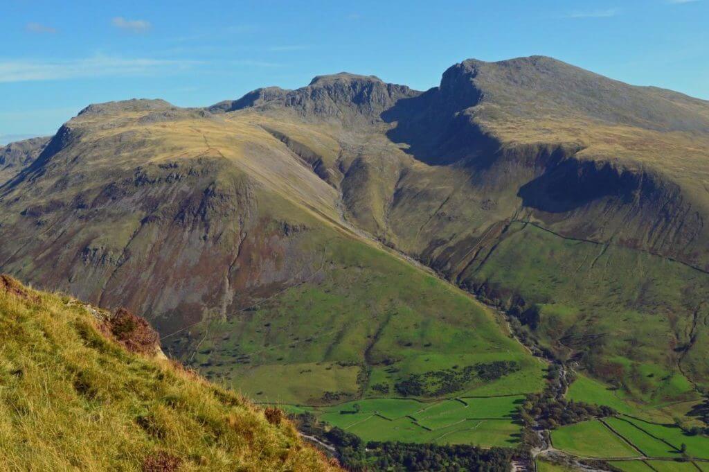
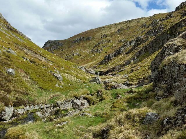
Overview of Scafell Pike

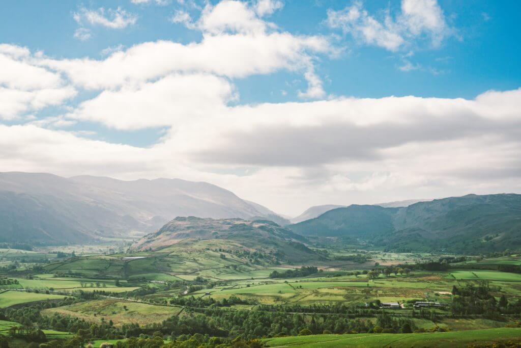
Scafell Pike is the highest mountain in England (257th highest peak in the British Isles). It offers breathtaking views on the Lake District, one of the most beautiful national parks in the country.

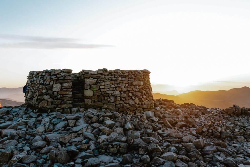
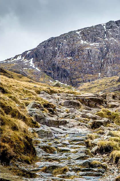
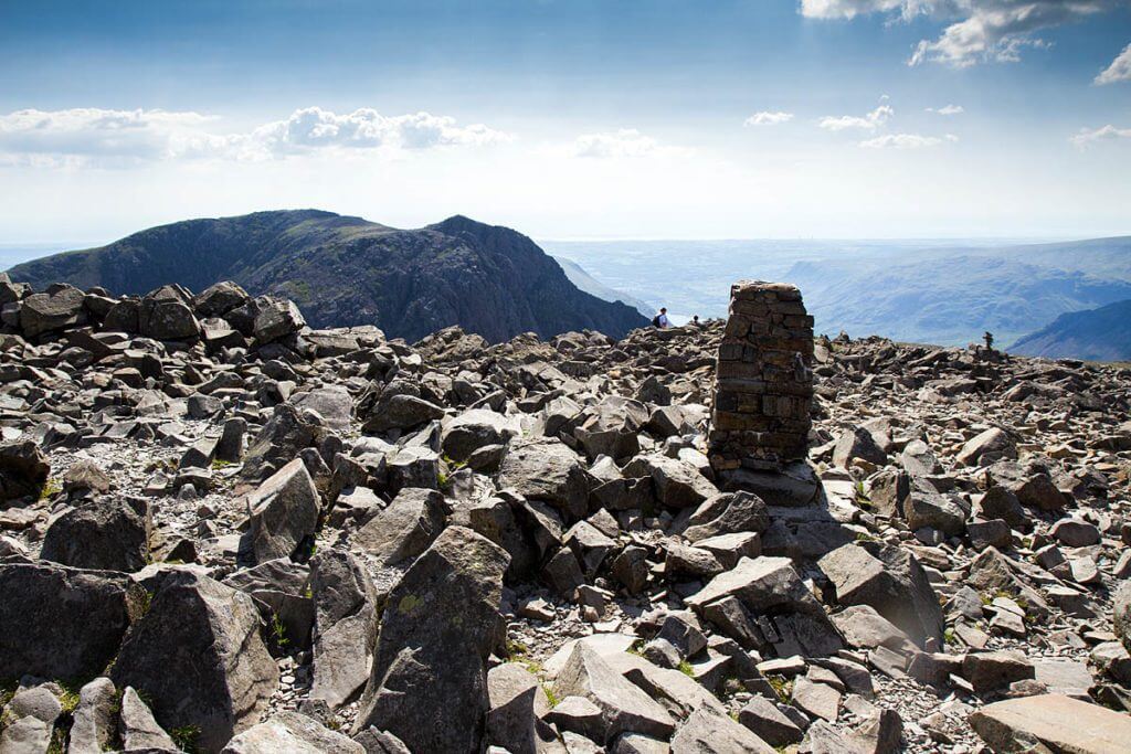
The peak looks smaller than its neighbouring Sca Fell but is actually 50ft above it. An extensive boulder field composed of shattered rocks covers the summit, formed through weathering and frost action, and providing a tough surface.

It is regarded as part of the National Three Peaks Challenge, which is an event that involves climbing 3 summits in 24h (Scafell Pike, Ben Navis and Snowdon).

Lord Leconfield gifted Scafell Pike to the National Trust in 1919 as a war memorial.
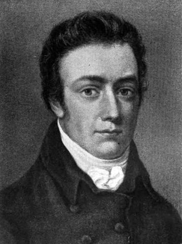
Samuel Coleridge

Samuel Coleridge was an English Poet (end of 18th and beginning of the 19th century). He completed the first recorded ascent of Scafell Pike at the start of the 19th century. In 1802, he wrote a letter from the summit and his climb was soon followed after by the poet Dorothy Wordsworth, and later on, her brother William.

While being underestimated for a long time, Scafell Pike, and the Lake District in general, became a source of inspiration for many Romantic artists and writers.

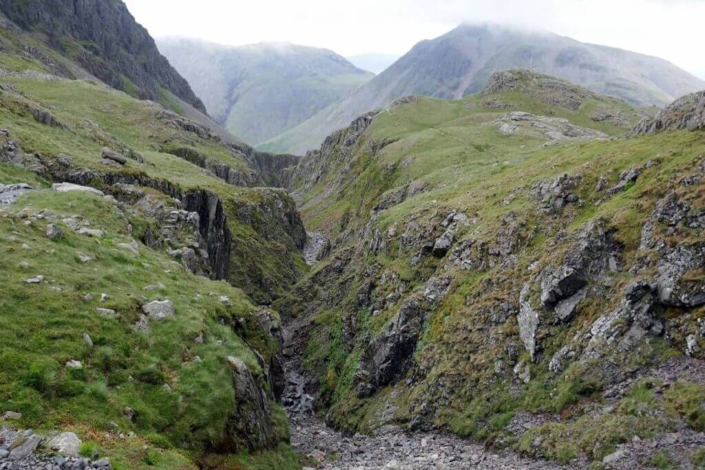
Routes to the summit

It exists 4 main routes to the summit.

Wasdale Head

Reaching the summit from Wasdale is the shortest route to the summit of Scafell Pike. It is the fastest and easiest one too, which makes it quite popular for beginners.

The walk starts at the parking of Lake Head. You will want to follow the Brown Tongue or Hollow Stone path on your way up and your way down.

The walk to the summit will take you approximately 2-3 hours (11km / 6.8mi).
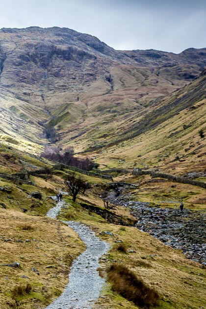
Scrambling on Scafell Pike

Borrowdale

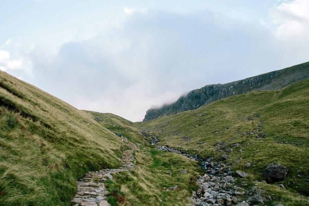
The Seathwaite route, through the Borrowdale valley, is also considered as being an easy walk. It is a tiny bit more arduous than the previous one.

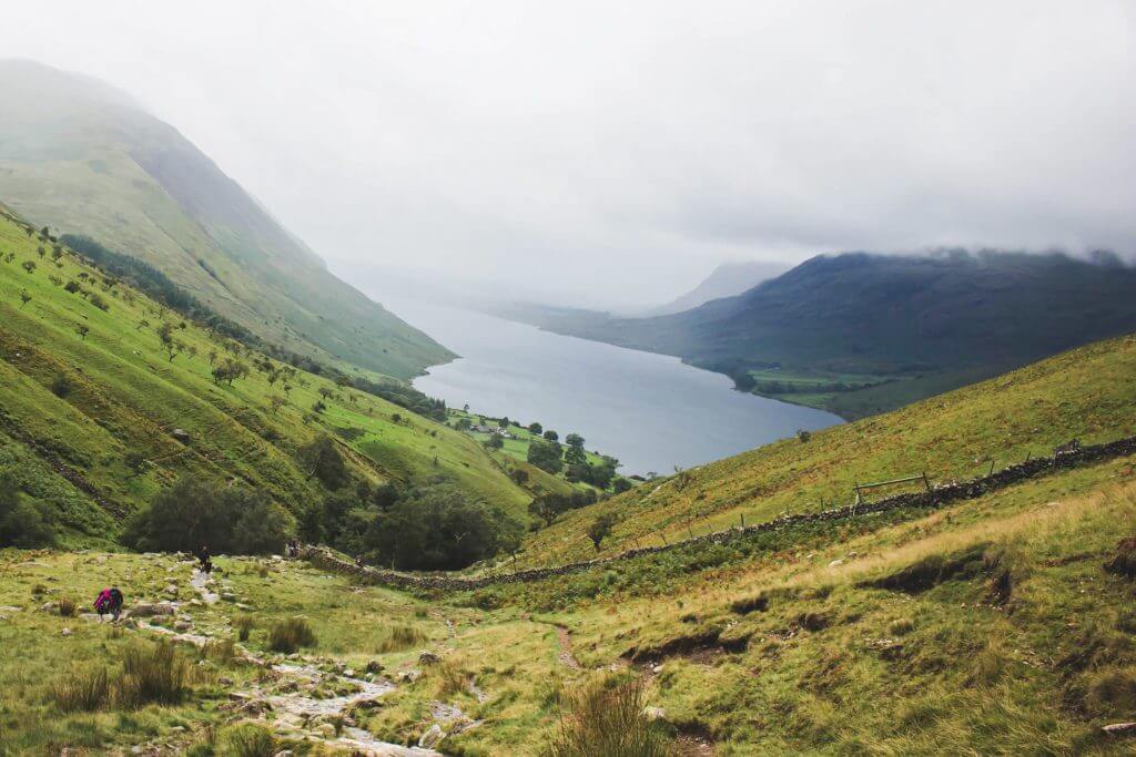
Leaving from Seathwaite Farm, going up the path to Stockley bridge and then to Sty Head before joining the Corridor path, it is the most popular route of all. It will offer the most panoramic view up to the summit. It is probably the best route!

The walk is approximately 15km (9.3mi) long. The path is a bit rockier but less steep and easier than other routes. The climb will take you 6 hours (depending on your fitness).

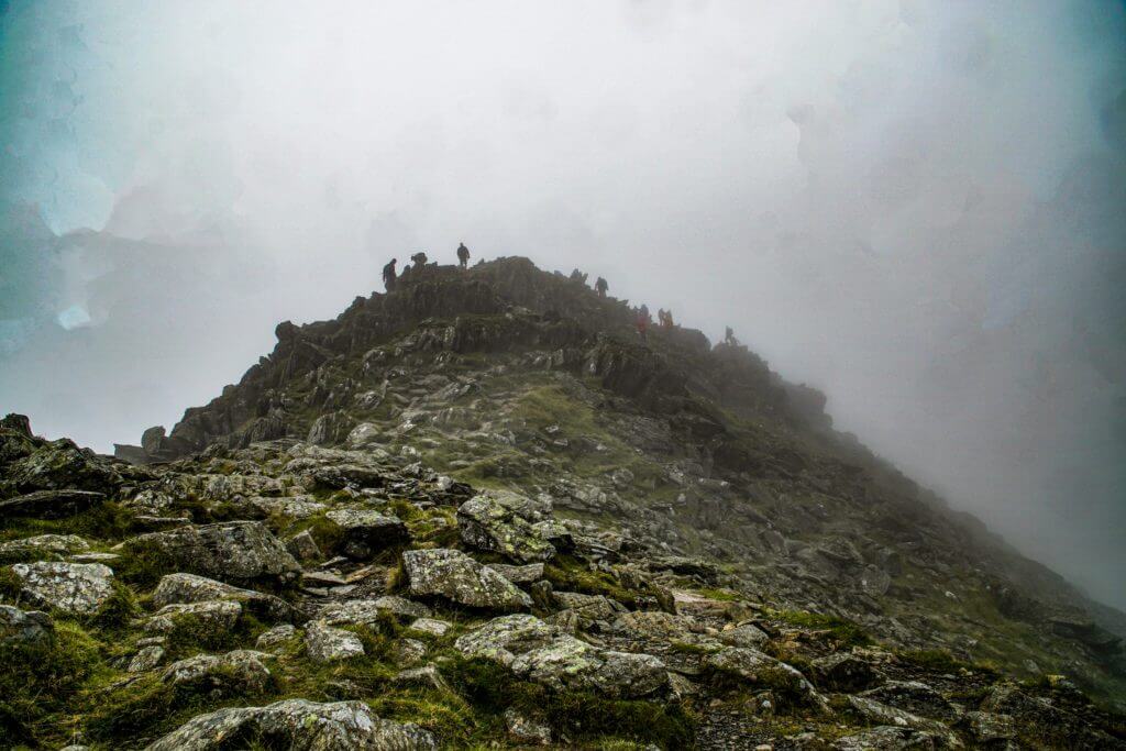
Seathwaite is one of the most humid places in England. You might face a bit of mist with limited visibility.

Scafell Pike, highest mountain in england
Great Gabble - one of the highest mountains in England

Great Langdale

Great Langdale is the longest and one of the most popular routes to Scafell Pike. It is approximately 22km (13.7mi) long.

You will start the ascend from the Old Dungeon Ghyll hotel. You will then go towards Mickledon before walking along the South-western part of Rosset Gill. At the summit, go towards Esk Hause, then go West through Calf Cove. You will then follow Crag and Broad Crag Tarn path to the main summit.

You will follow the same route to go down. It is easy to make a mistake so look at your compass! Some hikers like to add the climb of Sca Fell. It will add 5km (3.1mi) to your hike.

This route is a bit more challenging and should take you 6 to 8 hours. You will be able to enjoy breathtaking views on sunny days.

Eskdale

The Eskdale route is a 1-day hike of roughly 18km (11.2mi). It is the most difficult routes of all to Scafell Pike summit.

You will start at Brotherilkeld, cross river Esk and follow the path to the bridge over Scale Gill. 

L’itinéraire d’Eskdale est une randonnée d’une journée de 18 kilomètres (environ 7 heures), il est plus dur et plus aventureux que certaines des autres routes de Scafell Pike.

Commencez à Brotherilkeld, traversez la rivière Esk et suivez le sentier jusqu’au pont Scale. Continuez en dessous de Heron Crag jusqu’à l’entrée de Great Moss par Scar Lathing. De là, longez le bord de Great Moss sous Cam Spout Crag jusqu’à How Beck. Profitez de la beauté des nombreuses cascades enchanteresses de Cam Spout, et continuez vers Mickledore et jusqu’au sommet de Scafell Pike.

La vallée est préservée et, parce que la majorité des gens prennent Wasdale et Borrowdale, vous êtes sûr de profiter d’une paisible promenade en suivant ce chemin.

Typical weather on Scafell Pike

The weather on Scafell Pike is very often humid and cloudy. It is very often one of the biggest challenge for hikers.

For weather forecast, check Mountain Forecast.

Frequently asked questions

How long is it to climb Scafell Pike?

It depends on the route you choose. You have 4 main ones that would take you anything between 2 to 7 hours. It will also depend on your general fitness level.

How high is Scafell Pike?

While Scafell Pike is the highest mountain in England (UK), it is not considered as being extremely high. It is 3,209ft / 978m high.

How hard is the climb?

Compare to other mountain ranges like the Alps or Himalayas, the climb is not technical. That said, the weather in mountain areas can change quickly and rescue is always a bit more complicated.

This will also depend on your level. It is a serious undertaking and should not be underestimated.

Where is Scafell Pike? / where is Scafell Pike in lake district?

Scafell Pike is located in the middle of Lake District, in North of England (United Kingdom).

Scafell Pike and the highest mountains in England

November 12, 2020 by endorfeen
View of Scafell Pike massif

At 3,209ft / 978m, Scafell Pike highest mountain in England, located in the Lake District. Lake District is a mountainous region, located in North West England. It is one of the best areas for hiking and walking in the UK.

While Scafell Pike is the highest summit, what are the other highest mountains in England? We’ve listed the top 35 peaks in England. We’ve added another top 5. As you will quickly realise, most of the top 35 are located in the Lake District. Our “other top 5” is composed of the following top summits that are located outside the Lake District.


The highest mountains in England

Scafell Pike, highest mountain in england
Scafell Pike, highest mountain in england 2

1. Scafell Pike

  • Location: Lake District – South West
  • Height: 3,209ft / 978m
  • Grid reference: NY215072

Scafell Pike is 978m (3,209ft) high. It is the highest summit in England and one of the most popular among hikers. It is also the most demanding and challenging summit of the Three Peaks Challenge (a contest where hikers need to climb the highest mountain in Scotland, Wales and England in 24 hours).

You have 4 main routes to go to the summit: Wasdale Head, Borrowdale, Great Langdale and Eskdale.

2. Scafell

  • Location: Lake District – South West
  • Height: 3,163ft / 964m
  • Grid reference: NY206064

Scafell or Sca Fell is the second-highest mountain in England. It should not be confused with the neighbouring Scafell Pike.

3. Helvellyn

  • Location: Lake District – North East
  • Height: 3,117ft / 950m
  • Grid reference: NY342151

Helvellyn is 950m (3,117ft) high. The path to the summit can be a bit challenging. You will encounter some aerial parts and the weather can be cold, humid and windy. You should take the usual precautions.

The summit is located North of Lake District. It is one of the most popular mountains in the area, offering some of the most wonderful views on the 2 largest lakes.

You can go up the mountain with a mountain bike without a problem. It will be steep!

4. Ill Crag

  • Location: Lake District – South West
  • Height: 3,068ft / 935m
  • Grid reference: NY223073

Ill Crag is the 4rth highest mountain in England. It is not a very popular summit mostly because of a low prominence (57 m / 187 ft).

It is located in the Lake District, as most of the highest mountains in England. The top of the mountain is quite rocky which makes progression slow. It overlooks Eskdale and has marvellous views across to Crinkle Crags and Bowfell.

5. Broad Crag

  • Location: Lake District – South West
  • Height: 3,064ft / 934m
  • Grid reference: NY218075

Broad Crag is the 5th highest mountain in England. It does not come as a surprise that it is in the Lake District.

The mountain is located near Keswick (Cumbria), has a low prominence of 52.0 m (171 ft) and is a child summit of Scafell Pike. 

6. Skiddaw

  • Location: Lake District – North West
  • Height: 3,054ft / 931m
  • Grid reference: NY260290

6th highest peak, Skiddaw is the 3rd highest mountain in England if you exclude Sca Fell, Ill Crag and Broad Crag, which have low prominence and fairly related to Scafell Pike. It is 3,064ft / 934m high. 

It is the highest mountain north of Keswick. Surrounded by flat valleys, it has a majestic appearance. The mountain in itself is quite different from the rest of the summits in the Lake District. It was shaped by marine deposits rather than volcanic activities. Skiddaw is quite easy to ascend as you won’t find any rock.

7. Lower Man

  • Location: Lake District – North East
  • Height: 3,035ft / 925m
  • Grid reference: NY337155

Lower Man is a peak in the Lake District – Eastern Fells region, located near the town of Ambleside (Cumbria). It has a very low prominence 18.0 m (59 ft). It is in the Helvellyn range and much less popular than its neighbouring parent Helvellyn.

8. Great End

  • Location: Lake District – South West
  • Height: 2,986ft / 910m
  • Grid reference: NY226083

The 8th highest mountain in England is Great End (2,986ft / 910m). It can be found in the Southern Fells of the English Lake District.

Located in the Scafell range (north-east), the mountain is often visited by hikers on a traverse of the range as a satellite peak to Scafell Pike but, in winter, it comes into its own as one of England’s premier winter climbing venues.

The summit gives breathtaking views down to Sprinkling Tarn below and to Skiddaw and Blencathra looking over Borrowdale and Derwent Water to the north; to the historical rock climbing crags of Great Gable to the north-west and finally back to Scafell Pike (Englands highest mountain) in the South West.

9. Bowfell

  • Location: Lake District – South West
  • Height: 2,959ft / 902m
  • Grid reference: NY244064

Bowfell is the perfect excuse if you like hiking while having scenic views of lakes. If the weather is clear, you will remember the views forever. It is a mountain on the far western side of Great Langdale. 

The most popular route starts from Great Langdale although routes are available from Borrowdale to the north and Eskdale to the south-west (a bit longer than the first one). More often than not the mountain is climbed along with Crinkle Crags (which is just to the south) as this makes up the ‘best ridge mile in Lakeland’ – A. Wainwright. If the fell is to be climbed on its own then the most common route is the one following the band to the east.

The view from almost 3000ft is spectacular. Scafell and Scafell Pike to the west look amazing and Great Langdale to the east stretches round to Lake Windermere.

One of the great natural features of the Lake District is located on Bowfell. it is known as The Great Slab and is a huge smooth piece of rock at a 40-degree angle which is free from any boulders.

Great Gabble - one of the highest mountains in England

10. Great Gable

  • Location: Lake District – South West
  • Height: 2,949ft / 899m
  • Grid reference: NY211103

Great Gable is located in the Lake District and is 2,949ft / 899m high. It is one of the most famous mountains in the UK and one of the most popular among tourists and hikers. Fro Wasdale, it has the shape of a pyramid (from other locations, it looks like a dome).

A high pass links Great Gable to its sister hill, Windy Gap. A lower pass (Beck Head) links it to its neighbour, Kirk Fell.

11. Cross Fell

  • Location: North Pennines
  • Height: 2,930ft / 893m
  • Grid reference: NY687343

Cross Fell is the highest point in the Pennines, the backbone of England, going from the Peak District in the midlands to the Cheviot at the border with Scotland. It is 893m (2,930ft) high and is the highest mountain, in England, outside the Lake District.

On clear days there are beautiful views, from the summit, across the Eden Valley to the mountains of the Lake District.

12. Pillar

  • Location: Lake District – North West
  • Height: 2,927ft / 892m
  • Grid reference: NY171121

At 892 metres (2,927 feet), Pillar is the 8th-highest mountain in the Lake District and located in its western part. Between the valleys of Ennerdale to the north and Wasdale to the south, it is the highest point of the Pillar group (a group of a dozen peaks clustered around it).

The fell takes its name from Pillar Rock nearby, which is considered to be the birthplace of rock climbing in the area.

13. Nethermost Pike

  • Location: Lake District – North East
  • Height: 2,923ft / 891m
  • Grid reference: NY343142

Nethermost Pike is a fell in the Lake District area. It is the 2nd-highest peak in the Helvellyn range (the highest of which being Helvellyn itself). Nethermost Pike has grassy western slopes and rocky outcrops on the eastern side. Although an inconsequential bump when approaching Helvellyn from the south, its eastern side forms a fine front to Grisedale.

While Nethermost Pike is 2,923ft / 891m, it has a very low prominence of 22 metres (72 ft).

14. Catstye Cam

  • Location: Lake District – North East
  • Height: 2,920ft / 890m
  • Grid reference: NY348158

Catstye Cam (or Catstycam) is a fell in the English Lake District. It is an outlier of Helvellyn in the Eastern Fells. Catstye Cam is the other end of Swirral Edge to Helvellyn. It is 2,920ft / 890m high with a prominence of 63 m (207 ft). It has the classic shape of a pyramid.

15. Esk Pike

  • Location: Lake District – South West
  • Height: 2,904ft / 885m
  • Grid reference: NY236075

Est Pike is a fell in the Lake District, one of the great cirque of hills forming the head of Eskdale. The top is quite stony.  Esk Pike’s central position above Eskdale gives it glorious views of the Scafells, with the Eastern and Northern Fells forming a fine panorama too.

16. Raise

  • Location: Lake District – North East
  • Height: 2,897ft / 883m
  • Grid reference: NY342174

Located in the Lake District, Raise stands on the main spine of the Helvellyn range in the Eastern Fells, between Thirlmere and Ullswater.

Raise is home to the Lake District Ski Club. Founded in 1936, it operates a 360-metre button tow on Raise. An hour’s walk from the mines at Glenridding, Raise is positioned for the best snow in the Lakes and the tow gives access to a substantial part of the mountain. There are up to nine runs available, depending on prevailing conditions, the longest of which is almost a mile. Raise’s ungroomed slopes provide for a unique experience, with a total of sixty days of skiing enjoyed during particularly good seasons.

17. Fairfield

  • Location: Lake District – North East
  • Height: 2,864ft / 873m
  • Grid reference: NY358117

Fairfield is one of the most popular fells in the Lake District (England, UK) because of the multiple hiking routes it offers. It is most commonly climbed as the high point of the Fairfield horseshoe. The Fairfield Horseshoe is an absolute classic Lake District walk and deserves its popularity, rewarding the walker with fine views overlooking much of Lakeland.

18. Blencathra

  • Location: Lake District – North East
  • Height: 2,848ft / 868m
  • Grid reference: NY323277

Blencathra (or Saddleback) is one of the most northerly hills in the English Lake District. It has six separate fell tops, of which the highest is the Hallsfell Top at 2,848 feet (868 metres).

It is a very popular hill for its walks. One of the most famous is via Sharp Edge, a knife-edged arête on the eastern side of the mountain.

19. Skiddaw Little Man

  • Location: Lake District – North West
  • Height: 2,838ft / 865m
  • Grid reference: NY266277

Skiddaw Little Man also called Little Man is a fell in the English Lake District. It is located four kilometres north of the town of Keswick and reaches a height of 865 m (2,838 ft). Just a kilometre and a half away from Skiddaw itself, Skiddaw Little Man can be included in a longer walk encompassing both, as well as some surrounding fells, or completed on its own.

20. WhiteSide

  • Location: Lake District – North East
  • Height: 2,831ft / 863m
  • Grid reference: NY337166

Whiteside stands at the western end of the Grisedale Pike- Hopegill Head ridge overlooking Crummock Water. It is 2,831ft / 863m and has sufficient prominence to be considered a Nuttall.

21. Crinkle Crags

  • Location: Lake District – South West
  • Height: 2,818ft / 859m
  • Grid reference: NY248048

At 2,818ft / 859m, Crinkle Crags forms part of two major rings of mountains, surrounding the valleys of Great Langdale and Upper Eskdale.

The Crinkle Crags walk is considered to be one of the best Lake District walks. The views are beautiful and dramatic as you work your way along the five summits of the Crinkle Crags ridge. Especially impressive is the sight of Scafell Pike. There are also good views of the Langdale Pikes.

22. Dollywaggon Pike

  • Location: Lake District – North East
  • Height: 2,815ft / 858m
  • Grid reference: NY346130

Dollywaggon Pike is the 22nd summits in England. It is located in the Lake District, in the Helvellyn range in the Eastern Fells. The summit carries a small cairn.

23. Great Dodd

  • Location: Lake District – North East
  • Height: 2,812ft / 857m
  • Grid reference: NY341205

Great Dodd is 2,812ft / 857m high. It is a fell located in the Lake District. The summit is a smooth grassy round dome. It belongs to the three Dodds (along with Watson’s Dodd and Stybarrow Dodd). These three are made of volcanic rocks. It is classed as “Wainwrights”.

24. Grasmoor

  • Location: Lake District – North West
  • Height: 2,795ft / 852m
  • Grid reference: NY174203

At 2,795ft / 852m, Grasmoor is the highest peak in a group of hills between the villages of Lorton, Braithwaite and Buttermere, and overlooks Crummock Water. The deep cleft of Lorton Gully is the most prominent feature. 

There are numerous routes of ascent which allows you to climb several other slightly lower mountains in the area. The summit is marked by a large sprawling ancient cairn – this being one of the highest ancient cairns in England.

25. Great Dun Fell

  • Location: North Pennines
  • Height: 2,782ft / 848m
  • Grid reference: NY710321

At a height of 848 metres (2,782 feet), Great Dun Fell is the second-highest mountain in England’s Pennines, lying two miles south along the watershed from Cross Fell, its higher neighbour.

Great Dun Fell has hosted a number of major international projects in the field of cloud aerosol interaction and cloud processing of aerosol. Many publications have resulted from work carried out at this site, a list of some of these publications can be found here.

The site is remote from highly populated areas, and as such experiences generally clean air masses. The Centre for Atmospheric Science no longer maintains a permanent station at the Great Dun Fell site but does have the option to use the site for short term measurement projects.

26. Stybarrow Dodd

  • Location: Lake District – North East
  • Height: 2,766ft / 843m
  • Grid reference: NY343189

We are now back in the Lake District. Stybarrow Dodd stands at 2,766ft / 843m, immediately north of Sticks Pass on the main ridge of the Helvellyn range in the Eastern Fells, which is located between the lakes of Thirlmere and the Ullswater. The summit of Stybarrow Dodd is a smooth, rounded, grassy dome.

27. Little Dun Fell

  • Location: North Pennines
  • Height: 2,762ft / 842m
  • Grid reference: NY704330

Little Dun Fell is a fell located in the North Pennines. Its parent summit is Cross Fell. At 2,762ft / 842m, it is the third highest mountain in the Pennines range.

28. St Sunday Crag

  • Location: Lake District – North East
  • Height: 2,759ft / 841m
  • Grid reference: NY369134

St Sunday Crag is a fell in the English Lake District, part of the Fairfield group in the Eastern Fells. It is a prominent feature in the Patterdale skyline, with a distinctive rounded shape.

The main starting point for ascents is Patterdale, either by climbing or traversing Birks. Arnison Crag can also be thrown in for good measure and the north-east ridge gives fantastic rearward views of Ullswater. A further Patterdale alternative is the Elmhow zig-zag which climbs the Grisedale face just north of the crags. 

Its rocky north-west face nearly 1.0km (0.6 miles) long is a haven for climbers with many dramatic gullies and ridges including the infamous Pinnacle Ridge. 

29. Scoat Fell

  • Location: Lake District – North West
  • Height: 2,759ft / 841m
  • Grid reference: NY159113

Scoat Fell is a fell located in the western part of the Lake District (England, UK). It stands at the head of the Mosedale Horseshoe with its back to Ennerdale. It can be walked as part of the Mosedale horseshoe from Wasdale, or part of a round encompassing Pillar along the ridge to Haycock from Ennerdale Water. 

Paths lead to Scoat Fell from Ennerdale over Steeple, from Wasdale over Red Pike, and along the ridge from Pillar. The top is a long plateau, running broadly east to west. Along it runs the stone wall of the Ennerdale fence, crossing the summit exactly. 

30. Crag Hill

  • Location: Lake District – North West
  • Height: 2,753ft / 839m
  • Grid reference: NY192203

Crag Hill is a mountain in the North-Western part of the English Lake District. It was formerly known as Eel Crag; however, the Ordnance Survey now marks Eel Crag as referring to the northern crags of the fell. It is not to be confused with another Crag Hill lying on the border of North Yorkshire.

Many ascents of Crag Hill are made indirectly as part of a full traverse of the Grasmoor to Causey Pike ridge. Climbs from Buttermere via Whiteless Pike and Wandope are also practicable. 

It has a prominence of 117m. Crag Hill is part of the “7 summit walk” that would take you up Knott Rigg, Ard Crags, Sail, Crag Hill, Grassmoor, Wandope and Whiteless Pike.

The next highest mountains in England, outside Lake District

Dufton Pike, with Knock Pike, right

35. The Cheviot

  • Location: Cheviot Hills
  • Height: 2,674ft / 815m
  • Grid reference: NT909205

Cheviot Hills is a volcanic mountain range. It sits on the border between England and Scotland. The Cheviot is the highest peak of the range, at 825 meters / 2,674 feet, and the 35th highest mountain in England.

The secondaries summits are all located in England are Hedgehope Hill, Windy Gyle (right on the border with Scotland), Cushat Law and Bloodybush Edge. Most of Cheviot Hills are open country.

46. Knock Fell

  • Location: North Pennines
  • Height: 2,605ft / 794m
  • Grid reference: NY721302

While Knock Fell is the 46th highest peak in England, it is one of the highest summits in the Pennines. A circular walk dominated throughout by the giant golf ball that is the radar station at Great Dun Fell. You will use some good roads, some tracks and the Pennine Way on this walk.

50. Mickle Fell

  • Location: North Pennines
  • Height: 2,585ft / 788m
  • Grid reference: NY804243

Mickle Fell, one of the highest mountain in England, is a mountain in the Pennines, the range of hills and moors running down the middle of Northern England. It is 2,585 feet (788 m) high and lies slightly off the main watershed of the Pennines, about ten miles south of Cross Fell. After Cross Fell, Mickle Fell is the highest Marilyn within the North Pennines designated Area of Outstanding Natural Beauty (AONB).


The historical county top of Yorkshire, Mickle Fell today resides in modern County Durham. Unfortunately, large parts of it are a military firing range and access is limited. Access to Mickle Fell is only allowed on designated non-firing days on the range. There are usually about 12 weekends a year that are advertised in advance, these can be found on a government website.

63. Meldon Hill

  • Location: North Pennines
  • Height: 2,516ft / 767m
  • Grid reference: NY771290

Meldon Hill is a grassy moorland to the west of Cow Green reservoir. The closest approach path is the Pennine Way to the south. The hill is 2,516ft / 767m high.

74. Burnhope Seat

  • Location: North Pennines
  • Height: 2,451ft / 747m
  • Grid reference: NY785375

At 2,451ft / 747m, Burnhope Seat is a high moorland summit above the pass between Teesdale and the South Tyne valley. Below the summit, ski-tows have been erected at Yadd Moss. The character of the fell is very typical of the high Pennines, with an extensive and poorly drained summit plateau of tussock grass and peat bog.

Social media

Instagram
Pinterest
Facebook
Twitter

Categories

Adventures
Apparatus
Places
Prophets

Information

About us
Contact us

Contributors

Login

Subscribe to the Natural Dispatch, great adventures come to those receiving our news
loader

Copyright © 2023 endorfeen · Privacy Policy · Contact Us

  • Facebook
  • Twitter
  • Instagram
  • English
    • Français (French)