• Skip to main content
  • Skip to header left navigation
  • Skip to header right navigation
  • Skip to site footer
  • Home
    • Adventures
    • Places
    • Prophets
    • Apparatus
    • Sustainability
  • Explore
    • Your next adventure
    • Your guides
endorfeen

endorfeen

The Media For Sustainable Outdoors.

  • About us
  • Write/ share
  • endorfeen – instagram page
  • enforfeen Facebook page
  • endorfeen twitter page
  • Pinterest

Archives for July 2022

Attempts to the Lyskamm traverse

July 26, 2022 by Andrea Sansoni

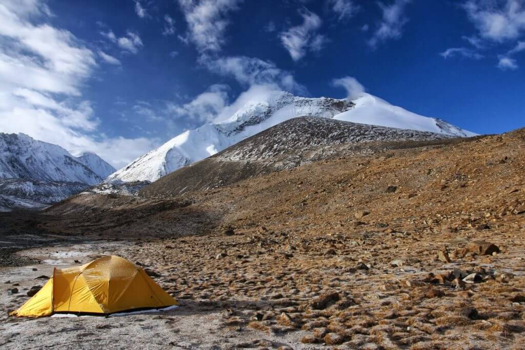
I attempted the Lyskamm Traverse, a classic traverse in the Alps, three times before. The first time was in mid-July of 2008 with Anna and Carlo, two friends from northern Italy with whom I have shared several great skiing tours in the previous years.

Lyskamm traverse – first attempt

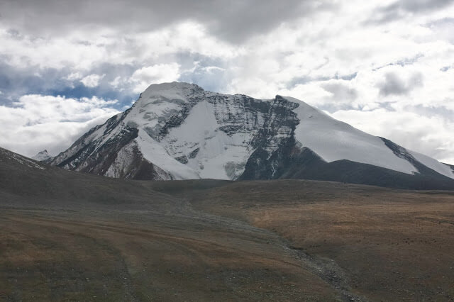
For the summer of 2008, we decided to join for some outings in the western Alps. The first plan was five days crossing in the Monte Rosa group, including Lyskamm, Castore, Polluce and the Breithorn traverse. It was quite a rough start for me coming from Rome, but not a problem for them living close to the mountains and always fit, acclimatized and ready to go high. The main obstacles of this crossing are Lyskamm and Breithorn.

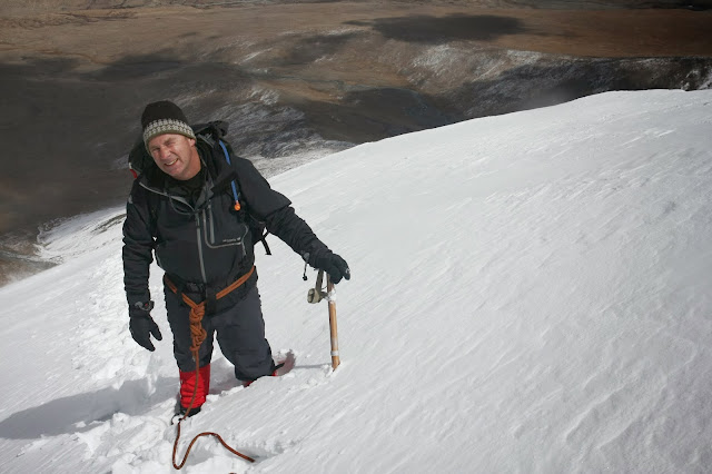
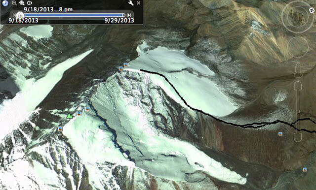
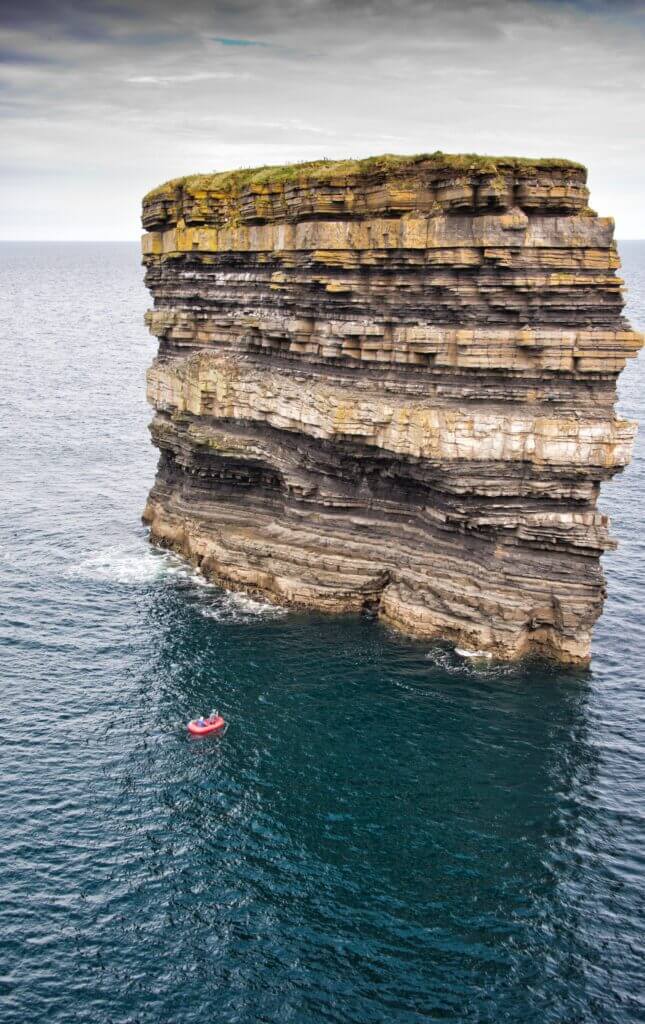
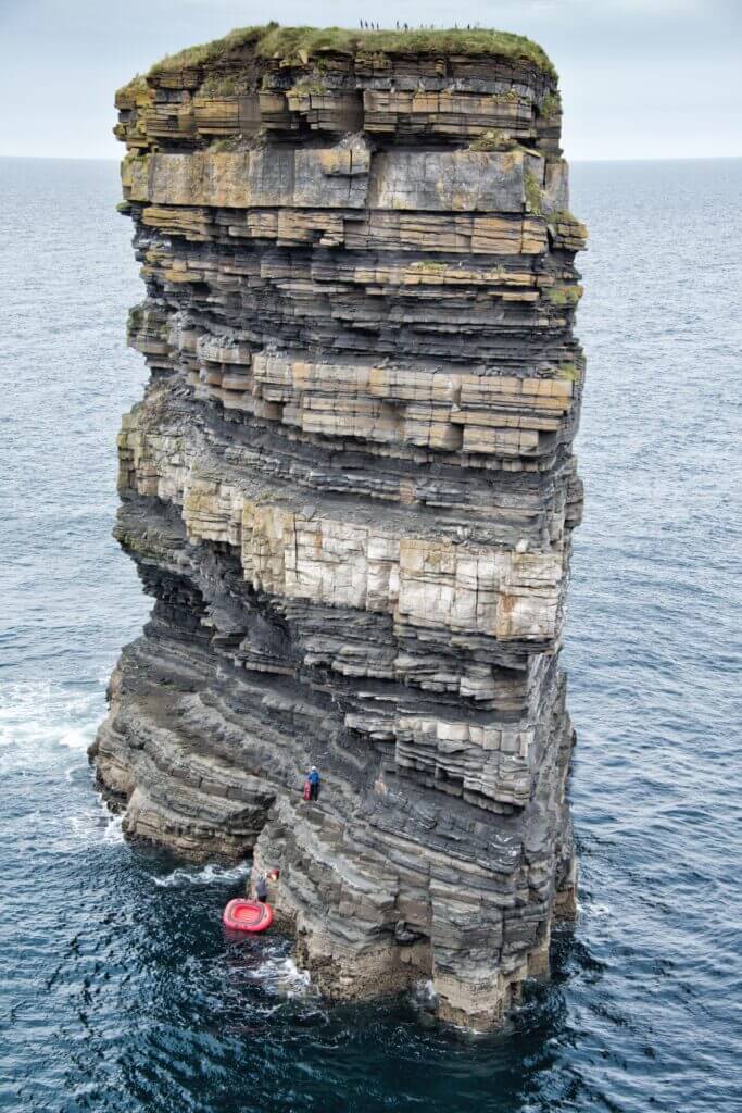
That year had been unusually cold in early summer, with significant snowfalls in June and early July, so we were pretty uncertain that we would be able to traverse Lyskamm and Breithorn by their summit ridges, but both could be bypassed in case of bad conditions or weather, by lower and more accessible routes. We arrived at Rifugio Mantova with a good 20cm of fresh snow on the ground from the previous night. Although I had never been there, the Lyskamm south face looked wintery to me. Anyway, the plan for the next day was easy, go to Punta Gnifetti or Zumstein and back to the hut, nothing more than a long acclimatizing walk on the glacier but providing a close view of the Lyskamm east ridge, the start of the Lyskamm traverse and our program for the next day.

On the way to Lysjoch, a team of two climbers from Spain turned left toward the east ridge, and a group of three was already starting up the ridge. At least from what we could see, the ridge was loaded with fresh snow, and there was no evidence of a track. As we proceeded toward Punta Gnifetti, we watched the attempts of the two teams and their quick retreat before the levelled section of the ridge, the first tricky part of the traverse.

The ridges of Lyskamm have a bad enough reputation for attempting them unless they are in good conditions, at least for us. Hence, it was an easy decision to settle for the easy alternative to the traverse; the following day, we were going to take the Naso route to the next hut. We then completed the crossing to Plateau Rosa with Castore, Polluce and a piece of the Breithorn traverse on virgin snow (the problem was the weather). Five fine days in the mountains, but the main goal remained on the wish list for another time.

East Lyskamm seen on the way to Lysjoch.

Lyskamm traverse – attempts 2 and 3

The following year the problem was different. I returned to Valle d’Aosta, but Anna and Carlo could not join, so I had to rely on other friends spending their vacation in the area and did some excellent climbing with them, but Lyskamm was not in their plans. One day hiking alone in the Gran Paradiso, I met a couple of residents in the area and started talking. It turned out that they also had the Lyskamm traverse in mind, so we exchanged telephone numbers. A few days later, she called, and we set an appointment. This time was going to be a blind date, with all the associated uncertainties, and the idea of roping up with unknowns on a narrow snow ridge was problematic. But they lived in a valley in the area and knew those mountains well, so I assumed they were up to it.

Moreover, it was not the first time I was going to join someone I didn’t know. It’s either that or no outing sometime. To cut a long story short, the weather was fine, the ridge in top condition, but, after the first section of the east ridge, when the ridge becomes narrow and exposed, she pretends to continue the route belaying! So I pretend that we turn around and go back. The end of the second attempt, but I was too upset to wait another year for the third.

On the way back, the route pass near the Balmenhorn, an outcrop in the middle of the glacier with an unguarded hut perched on its top, bivacco Giordano. While walking down, I decided to untie from the rope, stay at the hut for the night and try the next day again; maybe someone would arrive at the hut for the Lyskamm traverse, and I could join or attempt the traverse alone. There should not be technical problems on the traverse, and the advantage of being in a team with unknowns over being alone was not noticeable. So I said goodbye to my first date and prepared for the second one.

Quite late in the afternoon, two guys arrived at the already overcrowded hut; nine people were there with six bunks to sleep. When I realized they were headed for the Lyskamm traverse, I quit trying to persuade them to return to the Gnifetti hut. Guglielmo and his friend accepted my proposal to join for the traverse the next day, although they were also suspicious about me and suggested proceeding un-roped, maybe.

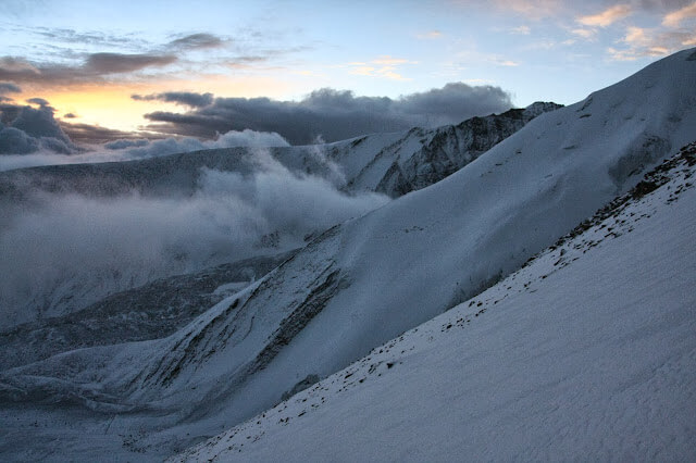
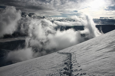
The night was awful, two more climbers arrived, and thirteen people had to share the bunks and the floor. The wake-up call was welcome, but outside was quite windy. We quickly worked our way to the start of the ridge, and by the time we got there, the summit of Lyskamm was already choked in clouds. When we reached the point where I turned back the previous day and could see the other side, a thick layer of dark clouds was proceeding toward us, pushed by a relatively strong northern wind. We watched the weather deteriorate for a while, uncertain about what to do, then after an hour or so, we all agreed to go back.

The morale was low, but given the early time, Guglielmo and I decided to head for the Parrot, an easy target nearby; Guglielmo’s friend returned toward the hut, carrying the rope we did not need. Halfway to the Parrot, the weather improved, and soon the Lyskamm was free of clouds. For a moment, we considered returning to the east ridge, but it was late, and we didn’t have a rope, so we reached the Parrot and returned, talking about our past experiences and planning the next attempt to Lyskamm.

On the summit ridge of Parrotspitze, Lyskamm in the background. 

Finally there

As usual, I start planning well before the summer season begins, and as usual, I plan to spend some time in the western Alps for the summer of 2010. Guglielmo is out with an injured tendon. By early July, Anna and Carlo are just recovering from an intense skiing season (90000m logged), so they are not eager to commit themselves. Giulio, a friend with whom I often go skiing in the central Apennines, is keen to join, so by mid-July, we are ready to go. The weather is very hot, a north-African heat wave is extending over Italy, and the freezing level in the Alps is always well above 4000m. For the first couple of outings, we avoided mixed snow and climbed nice routes in the Gran Paradiso e Mont Blanc groups, waiting for cooler weather.

Meanwhile, I keep calling Carlo to persuade him that conditions are not so bad after all. He rejects my advances and tells me about the horrible conditions and news he reads on the internet and climbing forums. The forecast improves, and the temperature should drop slightly in a couple of days, so we call the hut and make a reservation for the four of us. Rifugio Mantova has been recently renovated and is a very comfortable starting point for this traverse; furthermore, with the new cableway, one can reach the hut in 45 minutes. Shameful luxuries of alpine climbing. We arrive at the hut in time for supper and go to bed.

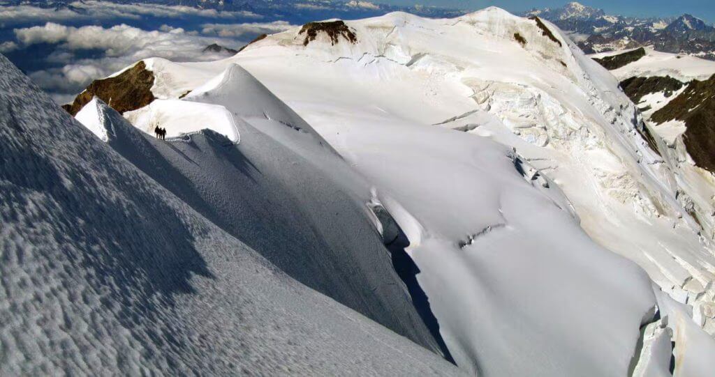
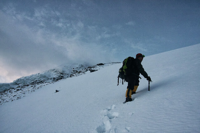
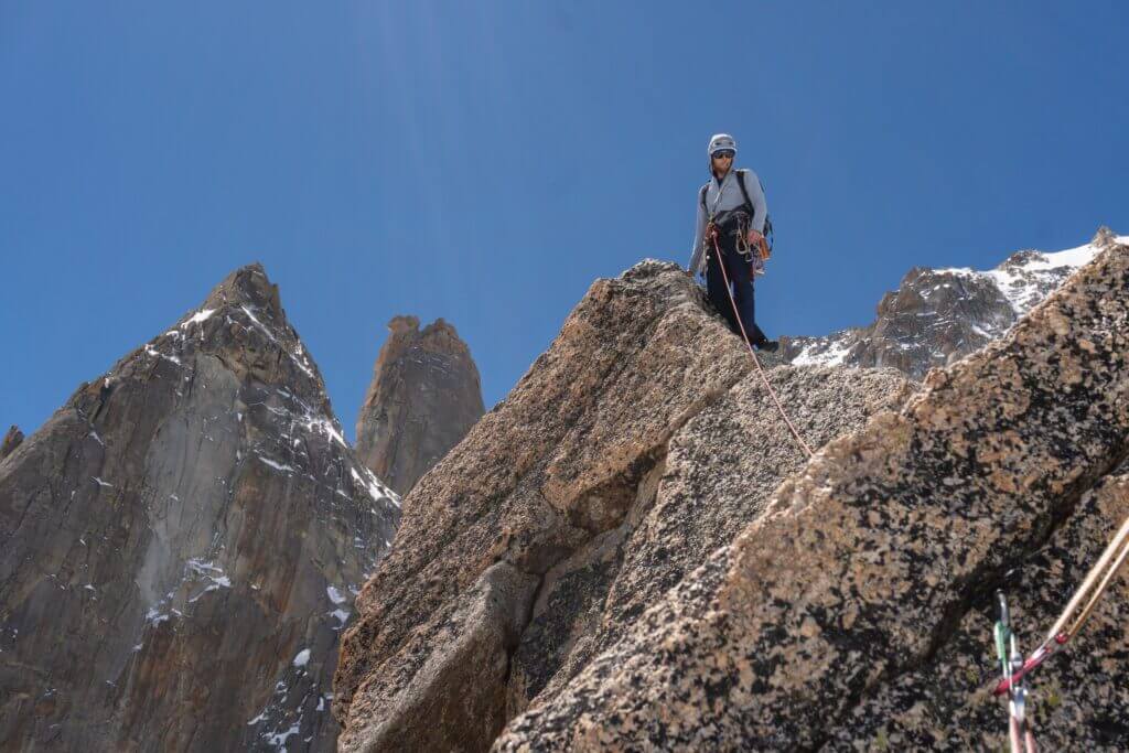
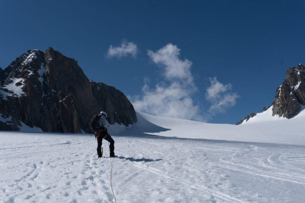
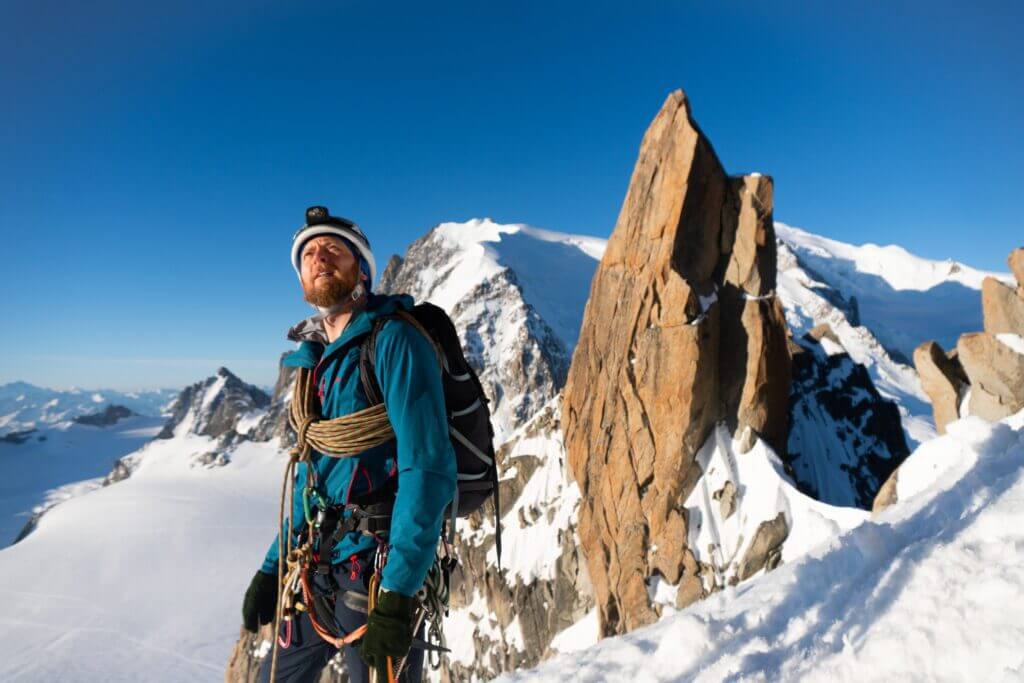
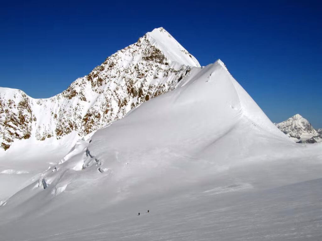
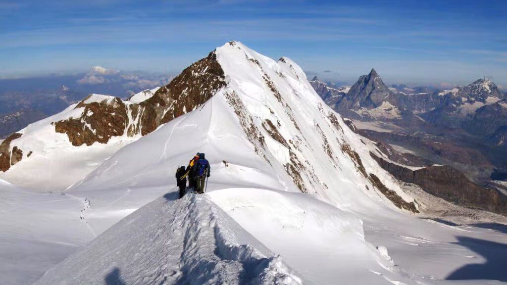
At 3 o’clock in the morning, we are the first group to wake up; we swallow something, rope up, and, after 45 minutes, we are on our way on the easy slopes of the Lys glacier. The snow is frozen hard, so far, so good, and after a couple of hours, we are starting up the east ridge of Lyskamm. There is a well-beaten track on the ridge granting an easy and quick progression, and I almost regret that.

I remember the exhilaration of tracking one or two rope lengths on the ridge of east Breithorn in deep virgin snow two years before; at every step, you had to guess whether the snow would stay or slide down, guess the distance from the cornice, and each step is a great achievement. This time it will be much easier. I said “almost regret” because with a 4Km narrow ridge to traverse, always above 4000m, there is nothing to regret about a well-beaten track. It is the fourth time I have started up this ridge, and everything looks good this time: weather, conditions and friends.

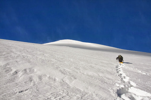
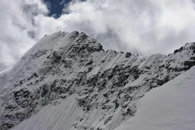
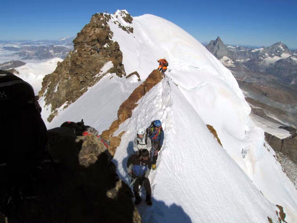
After a steep section of 150m, the east ridge levels off and becomes narrow, and the void on the north side unveils, a void that will be a companion for the next four hours or so. This traverse has few technical problems, but it is about controlling your steps, movements and focus over that void. Some short sections downhill are exciting from this point of view. Then the ridge rises for another 150m, and we get to the East summit quite soon.

Deep view of the east ridge from the summit of east Lyskamm (Photo: Carlo T.)

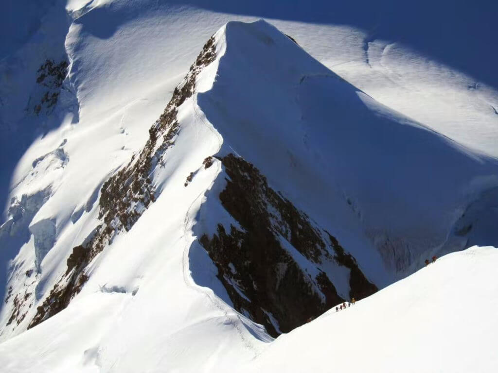
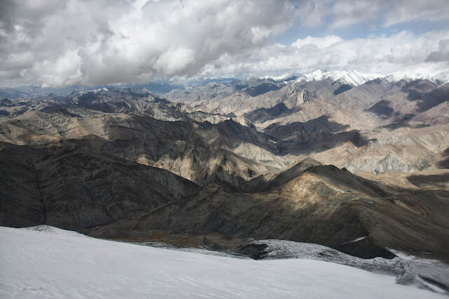
The deep view of the ridge below is one of those views for which we go to the mountains. The weather is fine, and everything looks good, but I don’t remember stopping even a minute on the summit. It is the first time on this route, and all we know is that we still have a long way to go. After an airy summit ridge, the descent to the saddle between the east and west Lyskamm is the only section where we can relax; I can walk looking at the great scene around me instead of the three meters of snow in front of my feet.

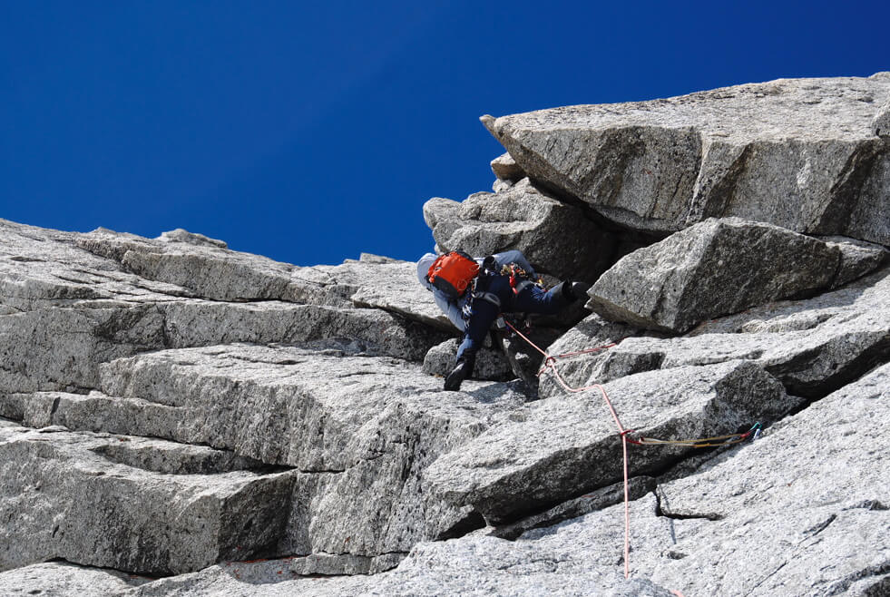
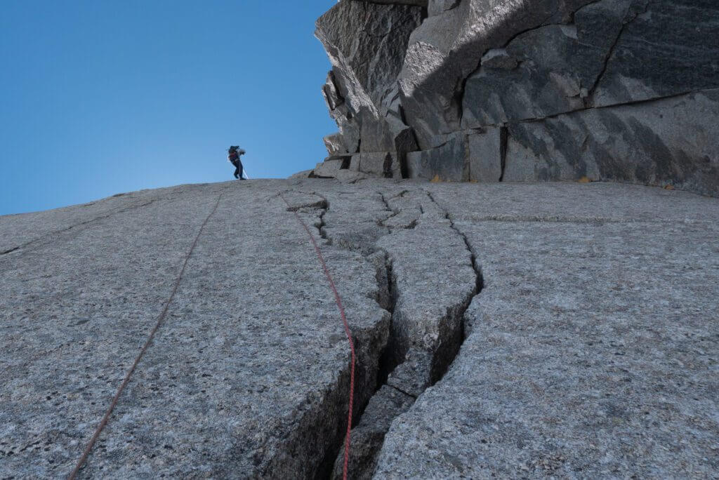
At the saddle, we encounter the first team from the opposite direction, an odd choice for this crossing; in fact, most people choose to traverse from east to west. The next section of the ridge to the west summit is steep and narrow again, and I switch focus to the three meters in front. After a false summit, there is a small notch and the terrain changes, with outcrops and short snow ridges connecting them. Time to scratch some rocks.

The ridge between the two summits.
Lyskamm traverse - void
The ridge between the two summits.

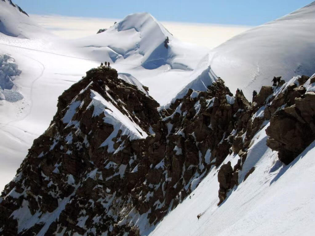
Then, in the middle of a rocky section, something happened just ahead of us, I heard yells and calls for help, but I couldn’t see what happened. A vertical wall follows a rock step – maybe 4 or 5 meters high to downclimb, landing on a narrow snow ridge. When we are at the top of this step, we realize that a team of two just fell down the north face, about 900m high at that point. A team, led by a mountain guide, is on the ridge looking down, just faint marks on the snow slope. Silence, nothing to say, nothing to do.

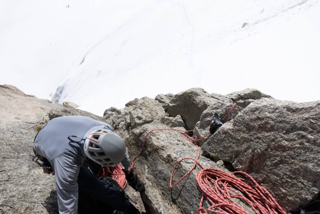
Those who realize what just happened are shocked; other parties, unaware, complain about the forced stop and want to bypass. In a few minutes, a helicopter arrives and hovers in front of us; the guide points to the slope below and the helicopter dives. Now it’s our turn to downclimb the same step where the team probably fell, most likely a false step downclimbing the wall. It is the first time I am so close to something like this, it is not easy, but we have to proceed. There is no way to make a decent belay, so I run the rope behind a small slab and let Giulio down; then it’s my turn, Giulio precariously belaying me on the ice axe in the snow.

Lyskamm traverse - views
Looking down where the team fell.

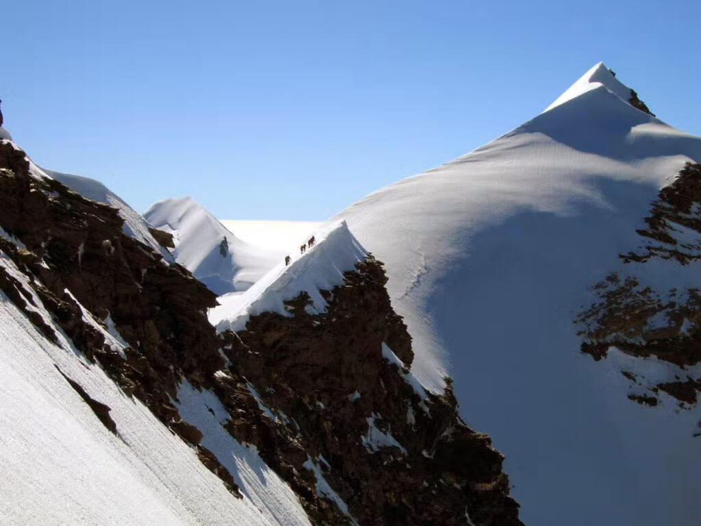
When we are down, I realize the outcrop and the downclimb could be easily avoided on the south side. We breathe and want to move away from that spot as quickly as possible. While we see the helicopter flying to Zermatt, we climb some easy rocks and reach the west summit. We descend a steep slope from the west summit, maybe 45 degrees, with some ice surfacing. Then another narrow and esthetic ridge, and we finally reach Felikjoch; from here, it is an easy walk to Quintino Sella hut.

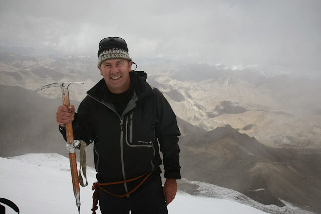
At the hut, at about noon, we meet Carlo and Anna, they were just ahead of the team that fell, and we were just behind, but none of us could see the fall. We don’t talk much about it; we know well that a fall can happen, but this time is different. Even though I always felt secure on the traverse, I perceive that it could have happened to me. This time happened to someone else, but I have to admit to myself that it is just statistics at work; there is no reason to assume that I won’t make a false step sometime. So the traverse was finally accomplished, but an unpleasant bitter feeling will be attached to it.

Lyskamm traverse - views
The final section of the ridge descending from the west summit to Felik-Joch.

Kang Yatze 2

July 19, 2022 by Christian Wilson

Ladakh. What a place. I have wanted to go there for a long time, and it did not disappoint. Some of the world’s most spectacular mountain scenery, matched by a Tibetan-flavoured culture, make it a unique place. The whole area is a high-altitude desert and has a good share of Himalayan “big peaks” to play with. And so, with a planned trek through the amazing Markha Valley, it was inevitable that I would look for another 6000m peak to climb. Of course, I do have aspirations for mountains higher than that, but after the success of Island Peak in 2010, I wanted to see if it was just a lucky break or did I have the ability to do it all again?

Two days before the climb, the sky was blue, the weather warm. Kang Yatze sat proudly among the treeless round mountains of the Nimaling area. We had left the jagged spike peaks of the Markha Valley, where we had travelled around 80km over high passes and through arid rugged terrain.

KangYatze from Nimaling

But now, the hills seemed more reminiscent of the Australian Snowy Mountains, complete with granite boulders. But, of course, Australia has no peaks that resemble the glaciated massif of Kang Yatze and its neighbours, so it was still worth being there!

On the way to Nimaling, I noticed a rainbow of ice in the blue skies. This is a strong omen of colder weather ahead. Our guide Namgyal had phoned the HQ of Overland Escape (our trekking company), and the weather was going to include some clouds and maybe snow but clear later. Again, the sky told the story.

An icy ring tells the story.

Sure enough, the day we arrived at Kang Yatze base camp (5100m), it was snowing all afternoon, apart from a clearing near sunset. Then as I prepared to sleep until my wake-up time of 12.30 am, I could hear the gritty sound of sago snow falling, sometimes as heavy as rain. My heart sank every time I woke up. More snow is falling! I had come all this way to climb a peak, and now it seemed as if it was not going to happen. We would not attempt it if it were snowing heavily.

Kang Yatze is made up of several mountains, KY 1 through 4. KY 1 is 6400m and is considered to be quite technical. Therefore, it receives a much lower number of climbers than its shoulder peak KY 2, which comes in between 6200m and 6175m, depending on what maps you refer to! KY 2 is the second point on the right-hand side of the mountain. This is the “trekking peak”, needing only basic alpine techniques to reach the top.

But at 12.30 am, the porridge was cooking, and I sat in the mess tent having an early breakfast. My Nepali climbing guide Nima was confident we were OK to go. And at 1.30 am, we set off into the night, head torches illuminating the falling snow, as we somehow found the stone cairns leading the way up the ridge.

Although I could feel the altitude making the climb harder, I think I felt well acclimatized after trekking for nine days at a high altitude. Of course, it was hard and breathless, but I only had a slight headache, which a Nurofen soon took care of. It must have been cold, as my hydration drinking hose froze, and soon I could not drink. I recall Brigitte Koch-Muir (my guide, mentor and now friend) had warned of this on the Island Peak trek. But I found that if I shoved the hose in my jacket, it thawed in a few minutes, and I soon got the precious flow of water happening again.

Drinking lots of water is crucial at high altitudes.

It seemed like an endless up and endless night, but finally, at a small strand of prayer flags, we were at the “crampon point”. I think the elevation was about 5400m. The sun began to rise amid clouded and misty dawn. Kang Yatze 1 looked down on us with a stern rocky face. Who dares come up to these heights? Its fearsome ice cliffs and broken blocks of ice as big as small buildings showed that despite its size, it could deliver destruction at any time. I now understood its bipolar character. Our side was a huge snow cone, the other side a nasty mix of crevasses, ice cliffs, steep fluted chutes and a knife-edge ridge.

Dawn breaks as we ascend

Once the crampons were on my boots, the ascent began. The snow seemed innocent enough at first. Just a big climb up the snow… Nima broke the ground, but I soon found the snow was so loose and fluffy that following steps did not amount to much ease. Every step collapsed, and the climbing began to seem very hard indeed. I had thought I would be going up hard-pack snow like on Island Peak. Usually, this route looks like that (on the YouTube clips I had seen). Hard snow, just a big hill to climb in crampons. Perhaps a bit like when my friend Steve Gottschling and I climbed up Ngaurahoe (2291m, North Island, New Zealand, in a raging blizzard) in 2011. Hard snow that crampons bite into. Not this sugary, loose junk.

Nima breaks the trail

Nima looked like he was climbing into space; the sky was a dark blue in this high atmosphere. And the cone of snow loomed higher, and slowly the slope became steeper. The mountain appeared to have no end to its heights. There were times when I had to stop short of Nima by only a few steps to regain my breath and energy. But we pressed on; his Nepalese doggedness to climb ever upward amazed me. These people really are made in the mountains! At least the views were astounding, so at any rest stop, I had time to shoot photos and take in the fantastic views.

Steeper and steep as we climb higher

Slowly, we neared what appeared to be an increase in the steep slope. Then we started following the edge of the cornice that led to the summit ridge. Nima had said that this section would be more vertical. A complete understatement!

Rising above the clouds

As we inched our way up the steep section, suddenly, I heard a surreal “whoomph!”. Deep and bassy, I had never heard such a sound before. I looked to my left and saw a 20m crack zigzagging its way toward the cornice line. Unfortunately, I didn’t think to take a photo. I just stood there wondering if anything else was going to happen. Finally, Nima calmly said, “The new snow, it causes an avalanche”.

“Good to know,” I thought…

I have since learnt that the sound I heard is a classic avalanche release sound, and upon reflection, it’s very lucky it didn’t let go that day!

Climbing with the mountain with it all to ourselves.

Time seemed to escape us. 10m seemed like 100. What looked like it would take 15 mins took 45. The altimeter now showed 5900m then creeping slowly over 6000….

I’m sure the slow progress was my fault, as Nima would just push (seemingly effortlessly) upwards. I struggled along behind him, often taking three steps before bending over my ice axe and gasping. Then with a grunt and groan, I would try and manage a few more steps. It was heartbreaking work, the snow never had any structure, and the ice axe would plunge in and not grip anything. Sometimes the snow seemed wet in appearance, and the ice axe made a metallic squeak as it went in. It would give some hold then, but mostly it was just soft and powdery. Great for skiing and snowshoeing. Not for crampons and axes.

CW on Ky2
Up to my knees in fluff

Finally, at about 11.30 am, it looked like we were near the top of the endless slope, yet I felt I had reached my energy limit. After all, I still had to make it down. We had been climbing since 1.30 am. I suggested to Nima that we were high enough. After all, the true summit of KY 1 was not our goal.

The second summit is more of a ridge point, although it still has the highest point on a rocky bluff. We were literally at the most, about 60m below that, at 6140m.

The views were fantastic. At that point, I felt happy, well above my goal of 6000m and with amazing views. I went over to look at KY1s summit, near the cornice line. Just as I approached it, about 10m away, a large section broke off and tumbled into the abyss below. I took the hint and stepped back from the cornice after that!!

My “almost summit glory” photo

We ate some lunch. Well, what I could eat of it since I was almost too exhausted to eat anything. Then photos were taken of the amazing vistas across the Markha Valley, Stok Range and Zanskar Mountains. My prayer flags meant for the summit cairn were laid to rest in the snow. The mountain had given us a pardon and allowed a climb, although Nima confirmed that “normally, people don’t climb here in such deep fresh snow”. Yep…. I had that figured for sure!

Spectacular views to the northwest

But the mountain had also given me a few signs that it held the aces. Even a “trekking peak “deserves respect once it becomes a 6000 m one.

KangYatze 1, with its formidable slopes

Our descent was uneventful but mesmerizing (perhaps it was the thin air). Snowballs of all shapes and sizes, dislodged by our boots, would hurtle down the steep slope, gaining speed, breaking into two or having erratic paths if they were oddly shaped. It kept me amused on the long walk down anyway.

Namgyal had thoughtfully sent one of the kitchen boys up with juice and biscuits, 300m above the camp (in sneakers). What a welcome sight he was, although when he offered to carry my backpack, I declined. I would rather he carried me!

By4.30 pm we were back at base camp. A 15-hour odyssey. And now I have six times two. Two peaks I have climbed over 6000m. Perhaps now it was time to think about going up a number. 7000m still remains my goal for now…

I played out the climb over and over in my mind like some mental case. Did I have enough to have kept going? Should I have rested and then gone for the summit? We did have enough time, and we could have come down with headlamps if need be. But was it too dangerous?

I am not unhappy about not summiting since I had passed the 6000m line. I just don’t deal well with ‘unfinished business’!

Our base camp the day after the climb.

But I won’t do Kang Yatze again, and There is no need.

It was a totally fun and amazing experience, and there are many other peaks yet to be climbed!

Google Earth view of our GPS tracked route. The summit of KY 2 is marked by two small icons near the end of our climb.

The East Ridge of the Pyramide du Tacul

July 12, 2022 by Ryan Colley

Pyramide du Tacul – A story told in photos.

June had just begun, and I was heading up the Midi with a new friend and climber partner. Dave Luke and I had been on a shorter trip a week or so before, but this would be our first real trip together.

About the route (taken from Jonathan Griffith/Alpine Exposures): Pyramide du Tacul is a satellite to the Mont Blanc du Tacul on its east side. The normal route is the east ridge or east arête of the Pyramide du Tacul. It has a D- grade and a not too tricky rock route on fine granite. You can find the route (number 20) in the Rébuffat book of the hundred fines routes in the Mont Blanc Massif.

Ditching boots and glacier kit at the base of the route.
Dave is questing through blocky terrain. This was the crux of the route at 5a, but key footholds were wet, so it felt a little more complicated!

We moved together for every other pitch before this, so I didn’t manage to get many photos. I was thinking about the lift down and trying to move as quickly as possible, Dave was the one who decided we pitch out the last few lengths, and I’m glad he did. While I wasn’t stoked about spending a night in the hut, the weather was beautiful, and we were in such a great part of the range. It would have been a waste to miss everything just to save an hour!

Pyramide du Tacul
On the summit at around 1 pm. The last lift down is 4.30 pm! Dave’s face says it all!
Racing down. Until we got a rope stuck anyway… Great looking crack climbs up this face with bolted belays. I can’t find it anywhere, but it made an excellent rap line.
Coming back from Pyramide du Tacul
Too late for the lift. To Cosmiques for the alpine hotel experience.
70eu for a night’s board! Damn, that’s a week living at the moment. Have to do it once, I guess. Bumped into two friends, Andy and Hilton from South Africa, who had just had a great day on the South Face of the Midi.

Took the Cosmiques Arete back to the lift station. My only other time on this route was totally underwhelming, and I didn’t really see what all of the fuss was about. However, with much less snow, perfect conditions and not another soul in sight (started at 4 am), it was all-time! The perfect end to a trip. Cheers, Dave, for a good mission!

Dún Bristé Sea Stack

July 5, 2022 by Iain Miller

Location

Found living on the wildest stretches of coastline along the western freeboard of the Republic of Ireland live a legion of ancient nautical guardians. Over many thousands of our lifetimes, the pounding heart of the Atlantic Ocean has sculptured these guardians. Standing guard at the outer edge of our distant shores these towering rock sentinels mark the boundary between the moving and the static. These sentinels are the last remains of a time and an age long forgotten.

credits: Aidan McGinley

On the north Mayo coast, approximately 80 meters out to sea north from the clifftops at Downpatrick Head resides Dún Bristé. (translates as Broken Fort) This large flat-topped sea stack is one of the most photographed and easily accessible sea stacks on the Irish coast with the clifftops at Downpatrick Head now being one of the Wild Atlantic Way signature points with ample car parking and a wee coffee shop all within a 200-metre easy stroll to the clifftop viewpoint overlooking the stack.

Alas, this is the end of the easy logistics for an ascent of Dún Bristé. As the seas surrounding the base of the stack are a law unto themselves thus making any sane nautical access very difficult to predict.

Dún Bristé History

The stack was detached from the mainland of County Mayo in 1393. Several families stranded on its summit were rescued the following day. In 1980, three scientists landed on the stacks’ summit by helicopter. They had a walkabout and measured the summit and did a bit of an archaeological dig.

The stack had been climbed once before from the sea in 1990 by Mick Fowler, Nikki Duggan and Steve Sustad. Prior to our ascent of the stack, only six people had stood on its summit in the seven hundred years the stack has been in existence. It equates to a summit visit of one person per century.

My Previous Attempts of Dún Bristé

First time

And Sho, the quest to stand on top of Dún Bristé sea stack began with a first visit to Downpatrick Head in June 2015. In attendance for some nautical action were Fionnuala Donnelly, John Mallon and Aidan McGinley. Prior to leaving Donegal, I had made all my usual wind, weather and swell predictions based on local Donegal coastal knowledge and global Synoptics.

Alas upon arrival after a four-hour drive from a flat calm northwest Donegal sea, the mighty Downpatrick Head had a different idea with the north Mayo coast bouncing at 8ft swell from the northwest. This motion was crashing white in the amphitheatre to the south around the base of the stack. All we could do was sit on the clifftops and watch whilst Neptune raged around the base of the stack and battered the coast on either side of us. After a good recce of the area, we headed to Sail Rock and had a wee play on Roaring Forties.

The second visit

The second visit to Downpatrick was in July 2016. This time on for the fray were Denise O’ Doherty and the stalwart clifftop guru Aidan McGinley. Upon arrival, we met local sea kayaker Chris McDaid in the car park and walked to the cliff edge. Alas, this time my nautical predictions were even more incorrect. The sea was bouncing up to 12ft, again from the northwest. We spent the afternoon studying the swell interactions around the base of the stack and the surrounding cliffs with a visit to the cave and channel underneath the head and a paddle around the stack. With these observations, the nautical conundrum of Downpatrick Head had become clear. I now had a very good idea why the amphitheatre around the stack was so prone to Neptune’s wrath.

My third visit to the head was a very brief outing. Having been playing out for a week on Achill Island, I was on my way home when I stopped off for a sunrise visit. On this occasion, I visited the cave under the head again. I sat and watched the movement of the sea around the stack for two hours. I was now ready to climb Dún Briste. All I needed now was a suitably calm sea, good weather, a huge amount of luck, something to calm my growing sense of dread and a climbing partner.

Dún Bristé – the Climb

Getting to the stack

Having spent the month of August with a close eye on the online sea predictions for the north Mayo coast and with great assistance from locals Chris McDaid, David Horkin and Maria Tighe the planets aligned for Saturday 27th and so, we once more set sail for Downpatrick Head.

In the house for a little nautical action on this occasion were Paulina Kaniszewska and of course, Aidan McGinley. After the four-hour drive to County Mayo on a glorious damp and overcast day, we arrived. We raced to the by now familiar clifftops. As a greeting, we had an uber flat calm sea with a subtle hint of distant blue sky on the horizon.

Word of our cunning plan had spread locally and as we inflated the dingy and packed the dry bags in the car park and a steady flow of local people arrived to watch our nautical and vertical antics on the stack. It is quite a surreal and a very unusual position to be in, embarking on a major and mildly concerning climb of this nature in such a public way.

Thankfully our PR guru/clifftop photographer Aidan took his position on the clifftops overlooking the stack and held a live press conference whilst Paulina and I descended to sea level and launched the dingy. From my previous visits finding a good exit point on mainland Mayo and the logistics of the sea crossing held no surprises and very soon we arrived at the huge non-tidal ledges below the west face of the stack, all the time being watched and cheered from the clifftop audience above.

It is only as you are paddling out to the stack in good conditions and knowing you are about to climb it, do you realise just how big the stack is and it is huge, with colossal roofs and Damocles boulders in its upper reaches.

A bad idea?

From our temporary home on the huge ledge system below the west face, we sorted the climbing gear and had a look at our intended route up the seaward face of the stack. Up to this point in time I had intended to follow Mick Fowlers 1990 route up the seaward face. Finding where this climb began was easy enough and leaving Paulina anchored into the ledge system below I made a few moves upwards to Mick’s “interesting overhang” above.

The rock at this point is regularly sea-washed and is of pretty good quality BUT it is north facing and covered in a thin green coating of sandy lichen, the overhang felt hard, greasy, scary, exposed and about another 200 excellent reasons why this was all a very bad idea. I down climbed a move or two and had a look around the corner to find a death drop overlooking the abyss, my heart sank until I saw the juggy handrail spanning across the roof of the abyss.

With a swift thuggy hand traversing over the ocean I reached the salvation of another huge ledge directly below the north face on the stack. From here I followed a series of greasy unprotected ledges to a huge undercut recess/crawl space at the western edge of another huge ledge a shade over a third of the way up the stack, built a good belay in the recess and up came Paulina. We were now 20 or so metres up the stack and above us, it all looked very steep, hard, overhanging and grim.

credits: Marion Gault

Pitch 2

The crowd

We found Mick Fowlers second pitch above us in the middle of the face and it look very hard, steep and greasy so I started up a thin groove at the far eastern edge of the ledge with a series of 4c/5a moves up to a harder and scary mantle onto a tiny stance. At this point, a few ups and downs were called for and as I was now visible from the clifftops a crowd had begun to gather.

After a moment of calm, a horrendous 5a/5b mantle was made onto the stance above followed by a very runout section of climbing to a larger stance and a thankful mini offset gear placement. The next 15 metres of climbing to the summit were on the underside of terrifying with sparse awful gear between damp greasy bulges of suspect rock to a grovel fest of a chimney and up onto the open expanse of the summit plateau and the rain.

Summiting

I arrived at the summit of the stack to a cheer from the clifftop crowds and the onset of pouring rain. I had a swift lie down on the wet grassy summit tufts to allow my vertically mangled mind to descend from the upper stratosphere to earth again. Once composed I built a grassy tuft belay and Paulina began to climb the, by now soaking wet rock below. Alas, a mini river was seeping down the groove Paulina was trying to climb. After her slipping and sliding about the groove for a while I lowered her back to the top of pitch one and she rebuilt her belay on the ledge below.

On the summit, there are the remains of several houses and livestock enclosures dating from the middle ages. Three unusual finds in the remains were a still functioning Quern Stone, an ancient livestock separation gate which allows sheep to pass from one field to another but restricts cattle from passing through. One says that this Jerusalem Gate dates from biblical times and dozens of golf balls.

Dún Bristé – the Descent

As Paulina was belayed halfway up the seaward face I rigged a grass hummock belay on the summit and began to abseil down the face taking out all the terrible gear placements on the way down. I arrived at Paulina’s stance pretty much both physically and mentally mangled but greatly relieved to be off the abseil.

After a bit of a sit down we began the return to the boat and from here it involved lowering Paulina into the sea for a swim and myself free soloing (unroped climbing) the first pitch in descent. Which took us back to the mighty vessel and the paddle back to the mainland. As the sea was so calm we returned to the mainland through the 500-metre-long sea tunnel underneath Downpatrick Head which involves paddling through the bottom of the blowhole, which is a pretty surreal way to finish an outstanding day out which returned us to the carpark and normality.

credits: Aidan McGinley

Gear

We used a small inflatable dingy to access and exit the stack sailing from the end of the tidal platforms facing out onto the landward side of the stack and returning through the channel underneath the head to the carpark. We took a standard multi-pitch rack heavy on offset nuts and huge no5 and no6 cams for the wide breaks between bulges. I opted not to take pegs as the first ascent party did not use them on their ascent, alas with hindsight this was not a great decision. We took a 20-metre static and a mailon to rig the abseil with, there are plenty of potential abseil points mid-stack for an exit down the west face.

To access the stack the sea must be peaking at less than 0.5 metre swell from the southwest to west, any north-west to north motion and the game is a bogey. The amphitheatre of cliffs at Downpatrick Head immediately around the stack are vertical to overhanging with huge shallow platforms running into the sea at their bases. The close proximity of these sea cliffs and their platforms at their bases cause a massive amount of white water with north-west to west seas running.

Dún Bristé – Route Descriptions

Doonbristy 42m MXS

Start at the landward side of the ledge system at 15m on the west face. The route follows the seaward arete of the stack, mainly on the left-hand side. The stack became disconnected from the headland in 1393 and the fort on top has been isolated since then.
Pitch 1. 18m 5a/b Climb up right-wards over an interesting overhang (on good holds) to gain a shallow groove in a band of lighter-coloured rock. Climb this to an excellent ledge on the arete.
Pitch 2. 24m 5a/b Climb onto a projecting ledge above the stance and gain a much smaller projecting ledge above. A short wall leads to a good ledge and easier (but loose) ground leading to the top.
M. Fowler, N. Duggan, S. Sustad May 1990

Chaos Theory 42m XS

There is a huge non-tidal ledge system at the base (approx 10m above the sea) of the west face.

Pitch 1: 18m 4b From the seaward end of the walkable ledge make a couple of moves up to the grim-looking overhang. After a couple of ups and downs, the hand traverse left above the void to the sanctuary of a large non-tidal ledge. Climb up and over the steps above and crawl through the birded gap above.

Pitch 2. 24m 5a/b At the far left of the huge ledge climb the well-protected groove with a hard move onto the ledge system above. Run it out forever (8mish) to a small crack in the suspect rock above. Climb grooves and ledge systems above to finish up a superb layback corner and awful chimney above.

Social media

Instagram
Pinterest
Facebook
Twitter

Categories

Adventures
Apparatus
Places
Prophets

Information

About us
Contact us

Contributors

Login

Subscribe to the Natural Dispatch, great adventures come to those receiving our news
loader

Copyright © 2023 endorfeen · Privacy Policy · Contact Us

  • Facebook
  • Twitter
  • Instagram
  • English
    • Français (French)